Good morning.
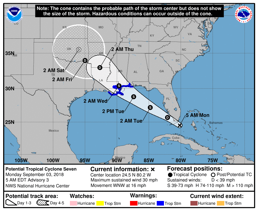
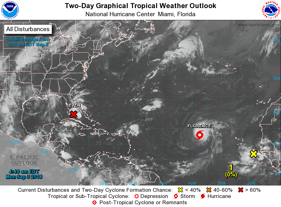
Since my last post the 2 disturbances discussed, Potential Tropical Cyclone 6 is now TS Florence and is headed toward the Central Atlantic and the area of disturbed weather north of Hispaniola is now centered 70 mile due south of Miami and is expected to become a tropical depression later today and a tropical storm late tonight or early tomorrow am. It is currently headed toward Eastern Louisiana and should make landfall just east of New Orleans as a tropical storm. Fortunately for them it has picked up speed and shouldn't have enough time to strengthen too much.
A new area of disturbed weather has recently moved off of the coast of Africa and is forecast to move WNW in a route similar to Florence. There is a wave over east-central Africa which we'll need to watch. It should emerge off the coast in about a week.
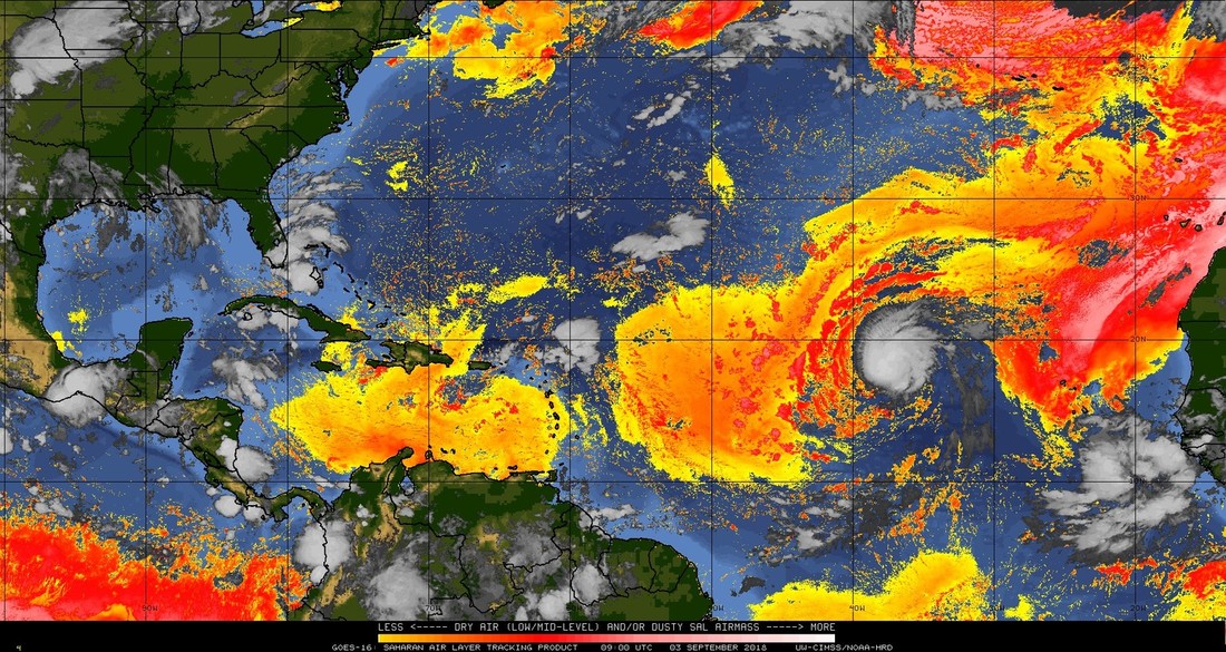
In the bottom diagram, Saharan Air Layer Analysis (SAL), you can see that the SAL persists over much of the tropical Atlantic and eastern Caribbean, however each wave will tend to slowly erode it as you can see Florence doing. (It has prevented Florence from intensifying.)
South Florida can expect a rainy day today as Potential Tropical Cyclone Seven passes to our south and south west. I do not anticipate much wind.
I'll keep you posted as things develop, or not,
Matt.
Since my last post the 2 disturbances discussed, Potential Tropical Cyclone 6 is now TS Florence and is headed toward the Central Atlantic and the area of disturbed weather north of Hispaniola is now centered 70 mile due south of Miami and is expected to become a tropical depression later today and a tropical storm late tonight or early tomorrow am. It is currently headed toward Eastern Louisiana and should make landfall just east of New Orleans as a tropical storm. Fortunately for them it has picked up speed and shouldn't have enough time to strengthen too much.
A new area of disturbed weather has recently moved off of the coast of Africa and is forecast to move WNW in a route similar to Florence. There is a wave over east-central Africa which we'll need to watch. It should emerge off the coast in about a week.
In the bottom diagram, Saharan Air Layer Analysis (SAL), you can see that the SAL persists over much of the tropical Atlantic and eastern Caribbean, however each wave will tend to slowly erode it as you can see Florence doing. (It has prevented Florence from intensifying.)
South Florida can expect a rainy day today as Potential Tropical Cyclone Seven passes to our south and south west. I do not anticipate much wind.
I'll keep you posted as things develop, or not,
Matt.