Good morning.
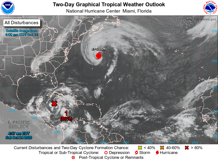
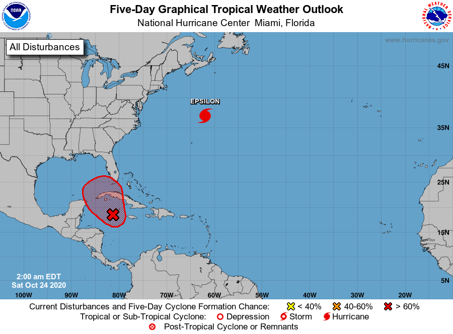
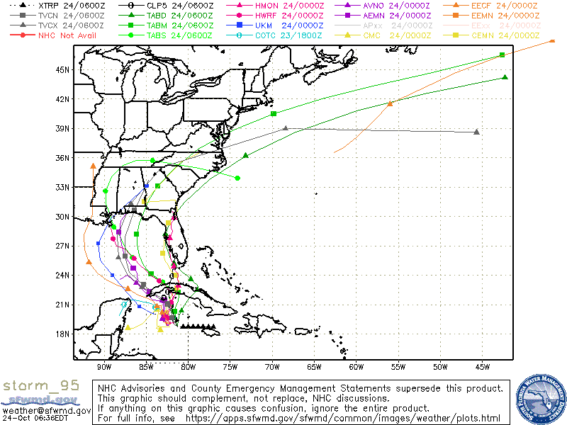
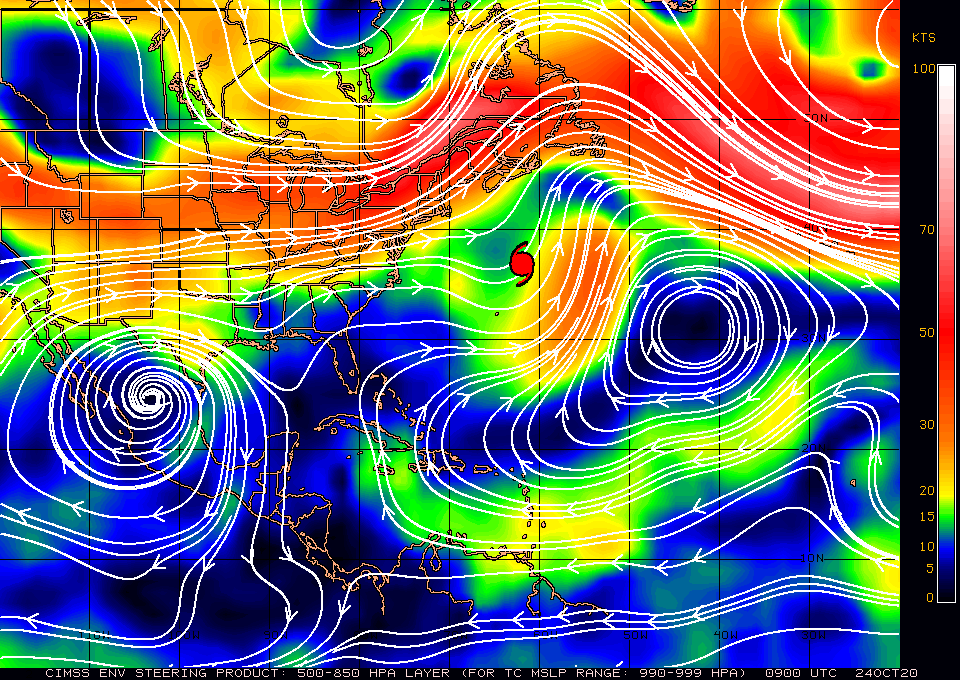
The area in the Western Caribbean which I spoke about yesterday (Invest 95) still has not developed into a tropical depression. Since yesterday the models have shifted westward however there is huge uncertainty in the forecast as steering forces over Florida and the Eastern Gulf of Mexico are very weak, see surface map below. There is also a huge spread in the models. Also if you look at the water vapor loop below you will see the high amount of shear, strong upper level winds streaming the cloud tops east to west over the Eastern Gulf of Mexico. Note the high pressure east of Florida is forecast to drift slowly westward, which is why the models are shifting, it hasn't happened yet.
The NHC is currently forecasting this area to slowly drift NW or N for the next few days. Development is likely in the next day or two. It should bring rains to the state of Florida.
Until it actually forms and a center of circulation is defined it will be very difficult to forecast just where it will go. Due to weak steering forces it is not likely to move very quickly.
I'll continue to watch it and will write again tomorrow, sooner if needed.
Until next time,
Matt.
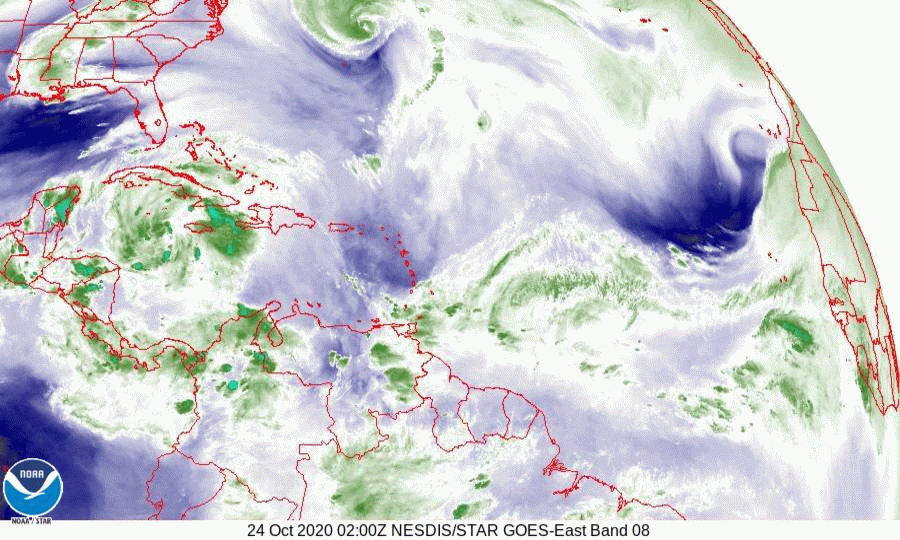