Good morning.
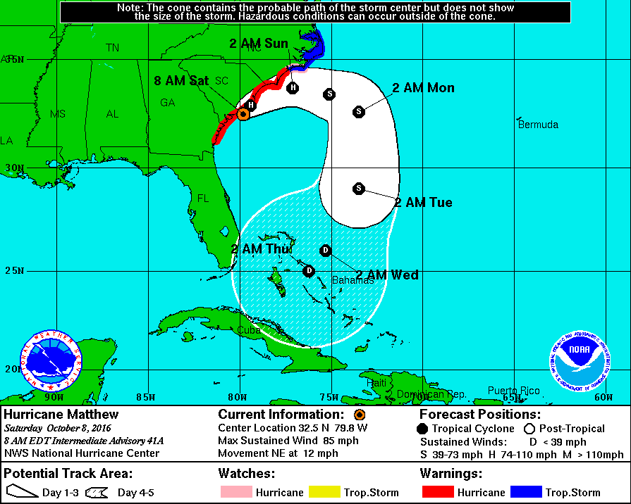
At 8 am Hurricane Matthew was located @ 32.5 N and 79.8 W and was moving NNE with peak winds of 85 mph. Earlier this am the center of its eye made its first US landfall along coastal South Carolina. In looking at radar this morning it is currently centered over Charleston, SC. The eye now measures 40 miles across which will expand the Hurricane force wind field. Heavy rains are affecting Georgia and South Carolina and will spread into Coastal North Carolina later today. The extent of Matthew effects have been remarkable and historic.
After tomorrow it will move out to sea and is expected to weaken significantly under heavy shear. We'll have to reassess around Tuesday to see what is left and whether we will have to deal with it again!
Until the next time, Matt.

