Good morning.
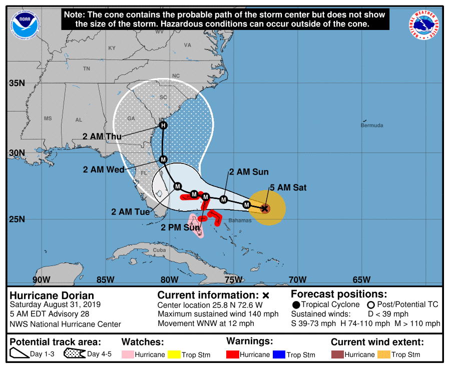
We have some good new with regards to Dorian this morning. The models are continuing to trend further east. In the first diagram below you can see NHC's current track.
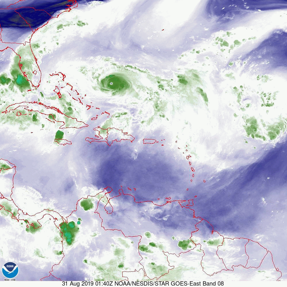
In the second image, the water vapor loop, you'll notice the upper-level low, which has been influencing Dorian on its present track and shearing it to the east, is now over Andros Island and moving into the Florida Straits. You'll also notice southwest flow associated with the stationary front located over north-central Florida. Also notice that most of the weather is on the east side of the storm. That should continue and, if it stays offshore, would lead to less weather for the state of Florida.
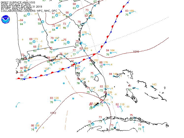
As Dorian approaches Florida and continues to slow, the lack of strong steering forces to its north, combined with the Coriolis Effect, will allow the storm to start drifting generally northward. Notice in the third diagram, the stationary front across north-central Florida. This will become the next factor steering Dorian. On the surface map (fourth diagram), Notice the isobar north of Dorian, which suggests that the storm could be steered toward the Outer Banks of North Carolina.
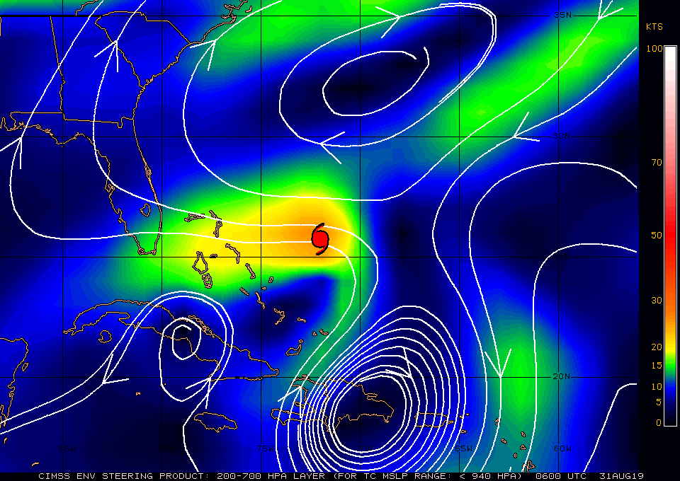
Finally, if you look at the computer models you will notice that most are even further east than the NHC's track. If this trend continues, Florida will probably only experience tropical storm conditions with the main risk of hurricane conditions being the Outer Banks, though they too could be spared. As a note of caution, note that the model tracks have shifted every day. Though they have trended east yesterday and today, until it is past us things could change.
I'll be writing again this afternoon and tomorrow morning, with additional updates if needed if anything significant changes. Note Miami-Dade County is no longer in the cone.
Until next time,
Matt and Cassie.