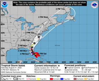
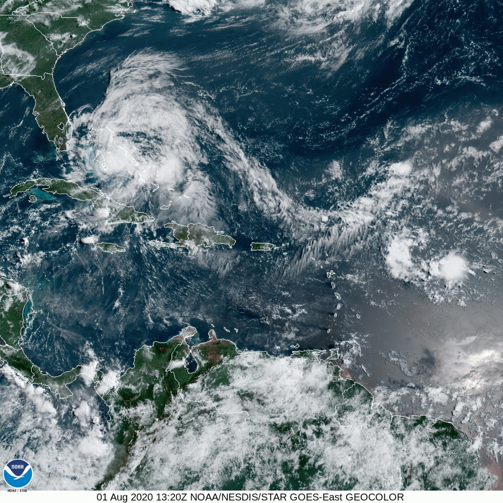
Good evening. This morning now tropical storm Isiais was moving Northwest on the east side of Andros Island and was approaching Nassau. Late this morning and this afternoon, it took an unexpected jog/wobble 60-70 miles Westward along the North coast of Andros Island. It has now resumed its Northwest motion, however in light of this, the models and NHC track have shifted back Westward. It appears it will either come ashore or just barely skirt the East central coast of Florida, possibly making landfall in the Jupiter area. Most of its weather remains on the East side of the storm. It is forecast to regain minimal Cat 1 status tonight. It should be at its closest approach to the Miami area at approximately 10 pm tonight and should be approximately 80 miles off shore. I would not anticipate much weather for Miami-Dade County however Stuart and North will probably experience strong Tropical Storm conditions.
I'll write again tomorrow. Until next time, Matt
I'll write again tomorrow. Until next time, Matt