Good morning.
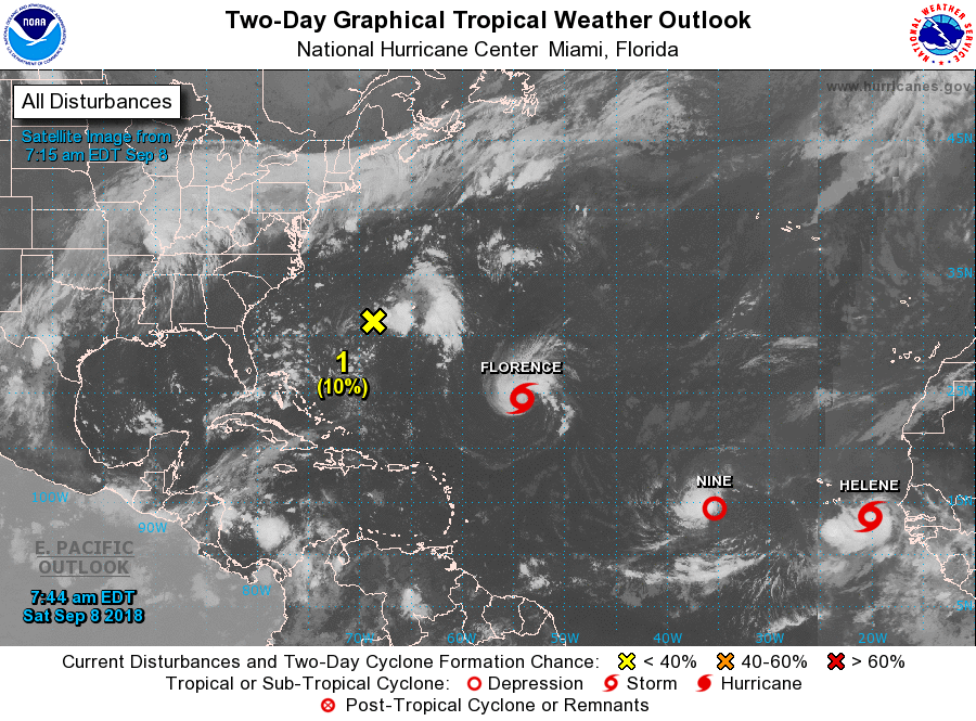
We have several area of interest this am.
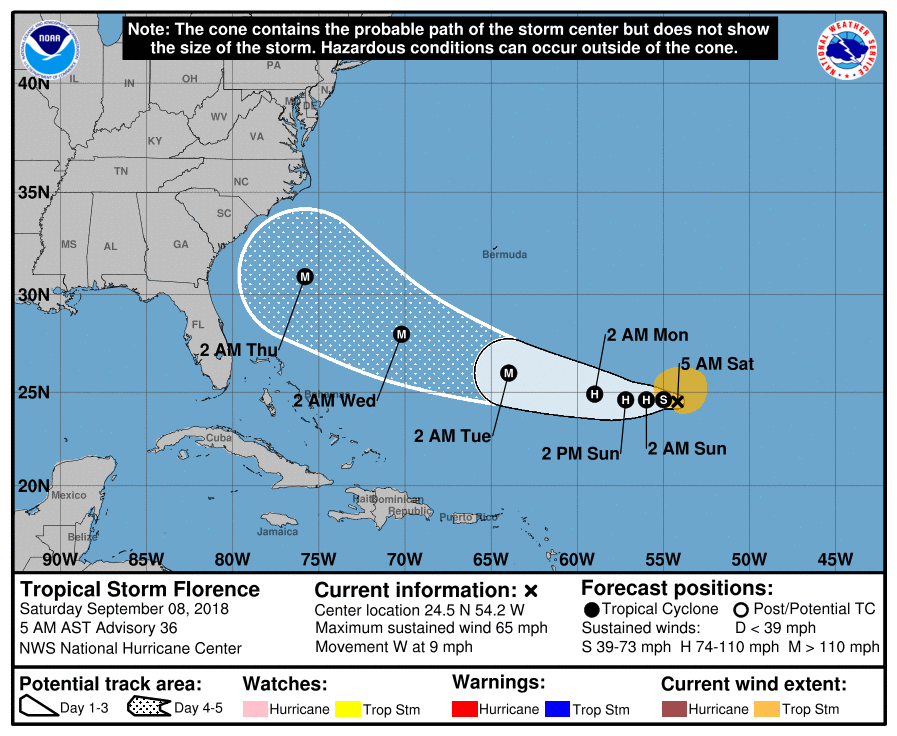
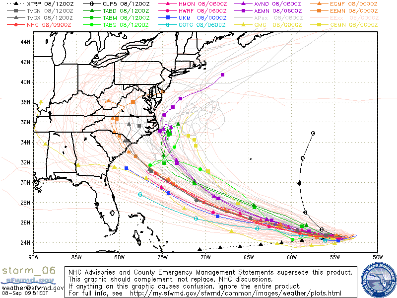
First is TS Florence. Overnight it has been moving just south of W around the periphery of high pressure to its north. The NHC has shifted its track southward however this will probably be temporary. The Coastal Carolinas, particularly the Outer Banks of NC appear to be at risk. It is going to be a close call and they will need to prepare for possible major hurricane conditions. My suspicion is that it will turn away 20-50 miles off the coast but it will be too close to not be ready. Expect the models to continue to change. We'll just have to wait and see how things evolve.
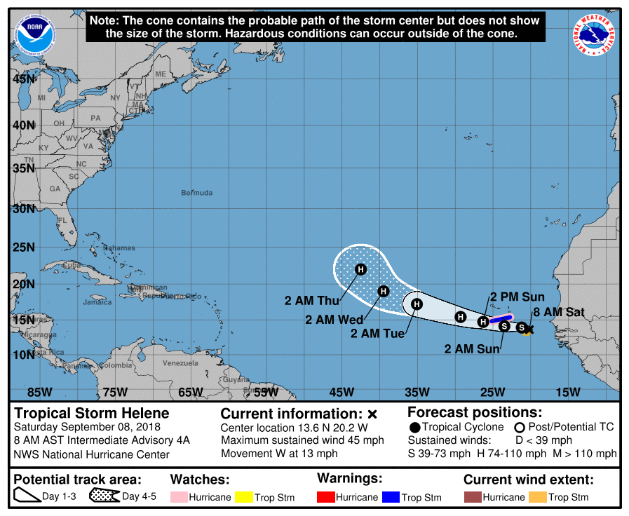
Second is TS Helene, just off the coast of Africa. It is moving just north of W and the NHC is forecasting it to move WNW and eventually NW into the mid-Atlantic Trough. That would be great news for the US.
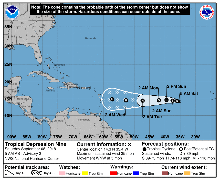
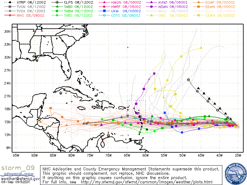
Third is TD #9, soon to become TS Isaac. This will become the one to watch. Fortunately it has numerous obstacles in front of it. First is a lot of Saharan dust and dry air. (See SAL bottom diagram). It is in an area of modest shear, in a few days it will enter an area of low shear where it should strengthen however when it enters the Caribbean shear will increase significantly. (See Wind Shear Analysis below.) There is high shear currently over the entire Caribbean most likely thanks to a developing El Nino as discussed in my Preseason forecast in April. Building high pressure to its north should steer it into the Caribbean and hopefully south of Florida as well. It is still a long ways out and conditions as always will be changing. As long as storms are to our south we need to continue to watch them.
Elsewhere of note is that there are currently no other significant disturbances over Africa and it will likely be at least a week before we see anything else in the Eastern Atlantic.
Until tomorrow,
Matt.
We have several area of interest this am.
First is TS Florence. Overnight it has been moving just south of W around the periphery of high pressure to its north. The NHC has shifted its track southward however this will probably be temporary. The Coastal Carolinas, particularly the Outer Banks of NC appear to be at risk. It is going to be a close call and they will need to prepare for possible major hurricane conditions. My suspicion is that it will turn away 20-50 miles off the coast but it will be too close to not be ready. Expect the models to continue to change. We'll just have to wait and see how things evolve.
Second is TS Helene, just off the coast of Africa. It is moving just north of W and the NHC is forecasting it to move WNW and eventually NW into the mid-Atlantic Trough. That would be great news for the US.
Third is TD #9, soon to become TS Isaac. This will become the one to watch. Fortunately it has numerous obstacles in front of it. First is a lot of Saharan dust and dry air. (See SAL bottom diagram). It is in an area of modest shear, in a few days it will enter an area of low shear where it should strengthen however when it enters the Caribbean shear will increase significantly. (See Wind Shear Analysis below.) There is high shear currently over the entire Caribbean most likely thanks to a developing El Nino as discussed in my Preseason forecast in April. Building high pressure to its north should steer it into the Caribbean and hopefully south of Florida as well. It is still a long ways out and conditions as always will be changing. As long as storms are to our south we need to continue to watch them.
Elsewhere of note is that there are currently no other significant disturbances over Africa and it will likely be at least a week before we see anything else in the Eastern Atlantic.
Until tomorrow,
Matt.