Good morning.
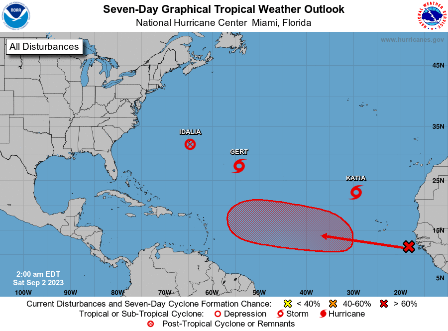
There are a few systems currently in the Atlantic though none pose a threat to to he US at this time.
If you look at the surface map below you can see that high pressure has moved over the SE US and Florida. This should shield Florida and the US East Coast. It is forecast to remain roughly in place for the next week. In fact the only areas in the Continental US currently potentially vulnerable are Louisiana and Texas, and there is nothing out there threatening them.
If you look at the bottom diagram, Sea Surface Temperatures, you can once again see that the area to watch remains the Gulf of Mexico. We will likely see at least one more system there later in the season.
The climatological peak of hurricane season is September 10th with a second small peak in early October.
We should have a breather for a week, ? +, until things change.
Until next time,
Matt.