Good morning.
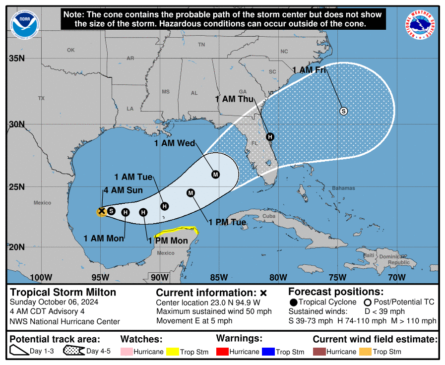
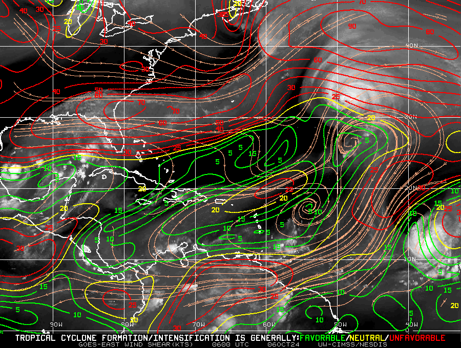
Since yesterday a couple of things have changed with regards to TS Milton's forecast. The biggest is the increasing uncertainty as to its projected intensity at landfall. If you look at the Wind Shear Analysis below you can see that Milton is currently in a low shear environment however once it starts to move more to the north it will encounter significant shear. Since yesterday Milton has moved little. If formed yesterday shortly after my forecast about 2 d prior to when the NHC had originally anticipated it to. This is going to give it more time over water. Unlike Helene, Milton is a very small system, this makes it potentially more susceptible to shear, however, rapidly strengthening small systems can sometimes overcome the affects of shear due to the rapid outflow above them while they are intensifying.
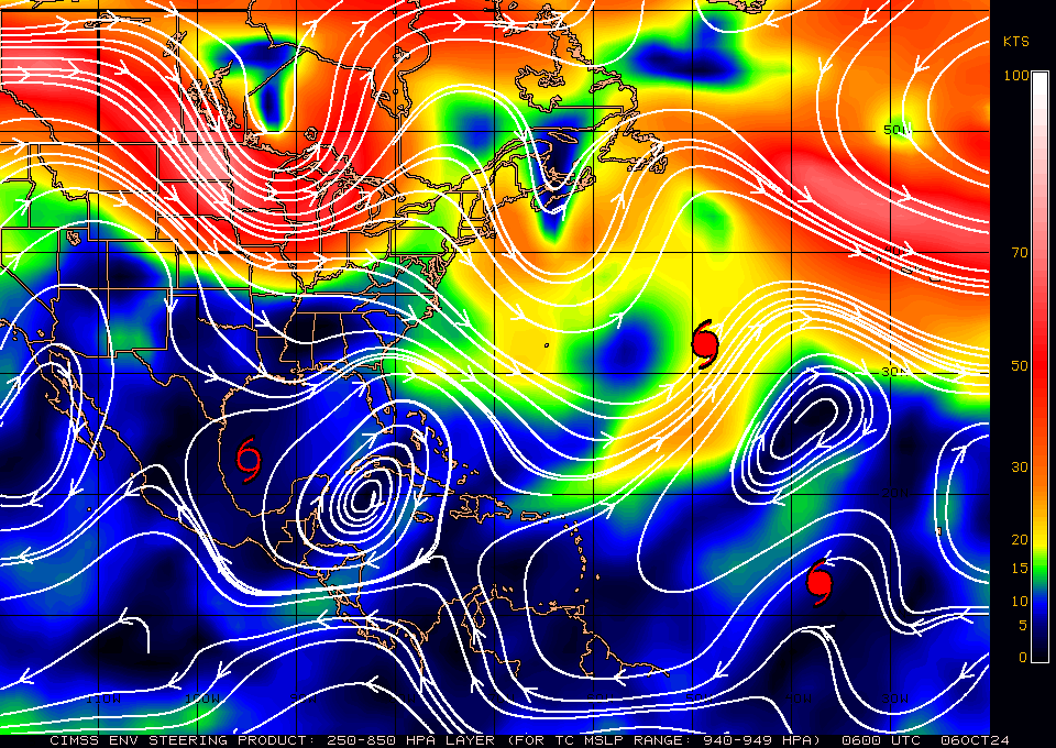
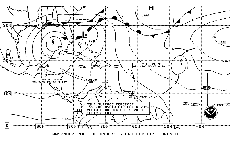
Milton is currently moving slowly eastward towards a stationary front across South Florida. A cold front over the SE US is forecast to move southward to over North Florida as Milton approaches Florida and the weaker stationary front is forecast to dissipate, this will allow Milton to be drawn further north. How much time it has in the low shear environment, before it turns NE will be key in how strong it becomes. The NHC expects it to become a major hurricane on Tuesday however it may rapidly weaken prior to landfall, or as noted above it may not. The intensity models vary from Cat 1 to Cat 5 with mean currently forecasting a 110-120 mph hurricane. It will be a tough call. It will start to accelerate to the NE as it approaches Florida.
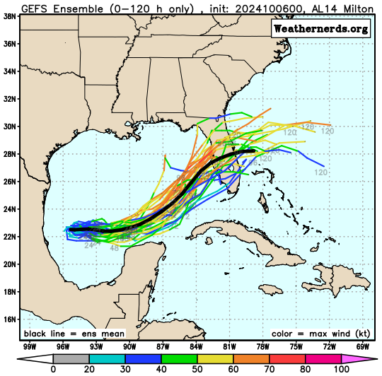
The models as you can see are all over the place and vary as to when Milton starts to perceive the northern front, for Florida the sooner the better as the intensity will likely level off or decline once it gets north of around 25 degrees.
I will be writing at least daily until Milton passes. Areas from Ft Myers to the Southern Big Bend need to prepare for possible hurricane conditions.
Until next time,
Matt.
