Good afternoon.
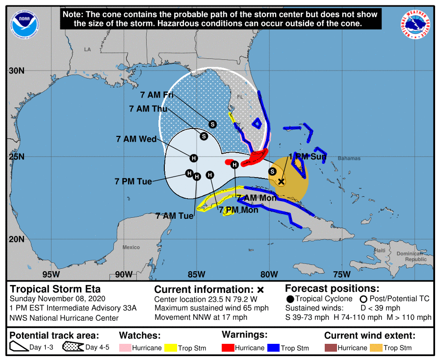
At 1 pm TS Eta was located just north of Central Cuba and was moving NNW, a turn to the NW and W should occur soon.
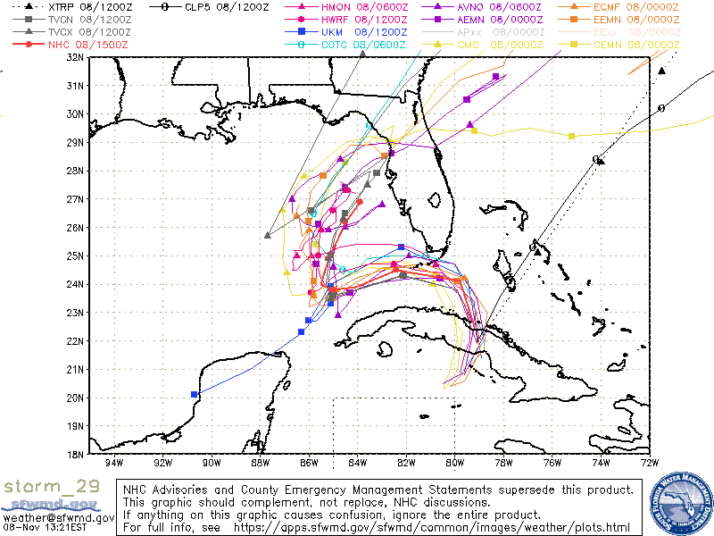
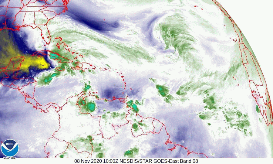
The NHC has shifted its track south and it is now in line with the model consensus and my original track, passing just south of the Lower Keys. Shear is expected to subside in the next 12-36 hours and the NHC is forecasting a possible Cat 1 hurricane for the Florida Keys, with the Lower Keys at greatest risk. Dry air intruding from the SW, evident on the water vapor loop below, may prevent this from happening until it is past them, but to be safe the NHC has placed the Florida Keys under a hurricane warning.
It should be at its closest approach to the Miami area around 11 pm tonight with windy weather for South Florida starting around 7 pm, by 7 am tomorrow morning it is forecast to be in the vicinity of the Dry Tortugas and the weather should start to improve in the Miami area around that time. The exact timing may vary depending on the amount of convection that occurs overnight.
With the more southerly track the wind projections from this morning still hold, except possibly to 70-80 mph in the Keys.
I'll write again this evening right after the 8 pm NHC advisory comes out.
Until then,
Matt.
At 1 pm TS Eta was located just north of Central Cuba and was moving NNW, a turn to the NW and W should occur soon.
The NHC has shifted its track south and it is now in line with the model consensus and my original track, passing just south of the Lower Keys. Shear is expected to subside in the next 12-36 hours and the NHC is forecasting a possible Cat 1 hurricane for the Florida Keys, with the Lower Keys at greatest risk. Dry air intruding from the SW, evident on the water vapor loop below, may prevent this from happening until it is past them, but to be safe the NHC has placed the Florida Keys under a hurricane warning.
It should be at its closest approach to the Miami area around 11 pm tonight with windy weather for South Florida starting around 7 pm, by 7 am tomorrow morning it is forecast to be in the vicinity of the Dry Tortugas and the weather should start to improve in the Miami area around that time. The exact timing may vary depending on the amount of convection that occurs overnight.
With the more southerly track the wind projections from this morning still hold, except possibly to 70-80 mph in the Keys.
I'll write again this evening right after the 8 pm NHC advisory comes out.
Until then,
Matt.