Good morning.
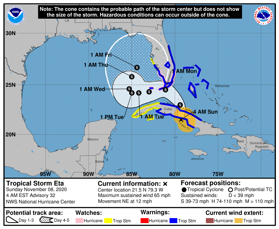
At 5 am TS Eta was about to cross Central Cuba. Overnight it has been moving NNE and is slowing down. If you look at the water vapor loop below you can see the convection weakening some as it interacts with Cuba with dry (yellow) air moving into its SW quadrant. You can also see the upper level low which I'v been talking about is just north of the western tip of Cuba.
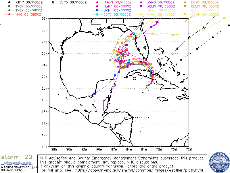
The models have continued to shift southward and the NHC has adjusted their track slightly southward though it is still north of the model consensus which is currently in alignment with my track, bringing Eta just south of the Lower Florida Keys. Due to its further than anticipated eastward location, it should pass 80-100 miles south of Miami at its closest approach, if this track holds.
Strong storm force winds, 60+ are currently forecast to extend 40-60 miles to the north of the center when it passes Florida with weak storm force winds extending 150-240 miles north of the center. In light of this The Miami area should experience winds in the 40s with gusts to 50s. The southern parts of Miami - Dade could experience winds 40-60 mph on this track. 60s in the Keys with higher gusts.
Most of the weather will occur late tonight and Monday morning with strongest winds out of the NE, E and SE.
I'll write again this afternoon and again this evening.
Until next time,
Matt.
At 5 am TS Eta was about to cross Central Cuba. Overnight it has been moving NNE and is slowing down. If you look at the water vapor loop below you can see the convection weakening some as it interacts with Cuba with dry (yellow) air moving into its SW quadrant. You can also see the upper level low which I'v been talking about is just north of the western tip of Cuba.
The models have continued to shift southward and the NHC has adjusted their track slightly southward though it is still north of the model consensus which is currently in alignment with my track, bringing Eta just south of the Lower Florida Keys. Due to its further than anticipated eastward location, it should pass 80-100 miles south of Miami at its closest approach, if this track holds.
Strong storm force winds, 60+ are currently forecast to extend 40-60 miles to the north of the center when it passes Florida with weak storm force winds extending 150-240 miles north of the center. In light of this The Miami area should experience winds in the 40s with gusts to 50s. The southern parts of Miami - Dade could experience winds 40-60 mph on this track. 60s in the Keys with higher gusts.
Most of the weather will occur late tonight and Monday morning with strongest winds out of the NE, E and SE.
I'll write again this afternoon and again this evening.
Until next time,
Matt.