Good morning.
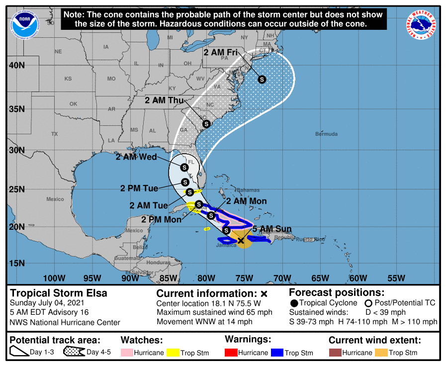
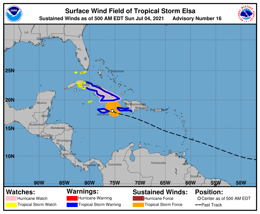
With regards to Elsa there has been an interesting development overnight. When the Hurricane Hunters were in it early this morning they discovered that a new center had formed under the area of deepest convection well east of the previous center. The old center basically uncoupled and ran away from it. The net effect of this is Elsa is now centered south and east of the prior projections and is currently right along the NE coast of Jamaica. Because of this it is now better organized and moving slower and it could temporarily regain hurricane strength later today. Due to its more southerly location a track across eastern Cuba is much less likely and confidence is increasing in the current NHC track. After it crosses Central Cuba it should weaken, and increased shear north of Cuba will hamper re-intensification. The NHC is currently calling for it to be a 50-60 mph storm when it passes just west of Key West and at its closest approach to SE Florida. On the current track it would bring it around 150 miles west of the Miami area. Tropical storm force winds are projected to extend only 90-100 miles to the NE of the center that time. If the current track hold SE Florida would not experience storm conditions. Probably peak winds in the 30s in a few squalls and showers.
I'll write again tomorrow morning sooner if things should change,
Matt.