Good morning.
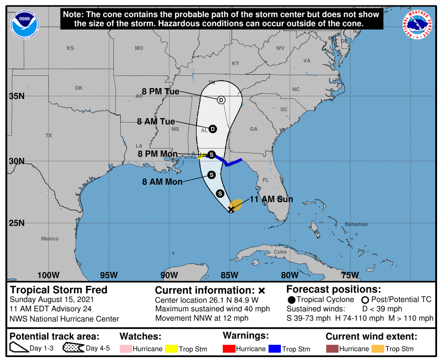
He's back ! Hurricane Hunters this morning found a new center of circulation well north of where they had projected the old one to be and TS Fred is back. Due to shear Fred is only anticipated to be a 45-50 mph TS when it makes landfall tomorrow along the Florida Panhandle. The primary impact will be rainfall.
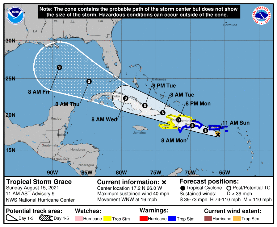
Meanwhile Grace remains poorly organized and in looking at Puerto Rico radar a clear center of circulation is not evident. It remains a minimal TS and is about to cross Hispaniola and Cuba. No significant weather is anticipated for Florida though some enhancement of our normal summer thunderstorms can be expected with the increase in tropical moisture when it passes south of Florida.
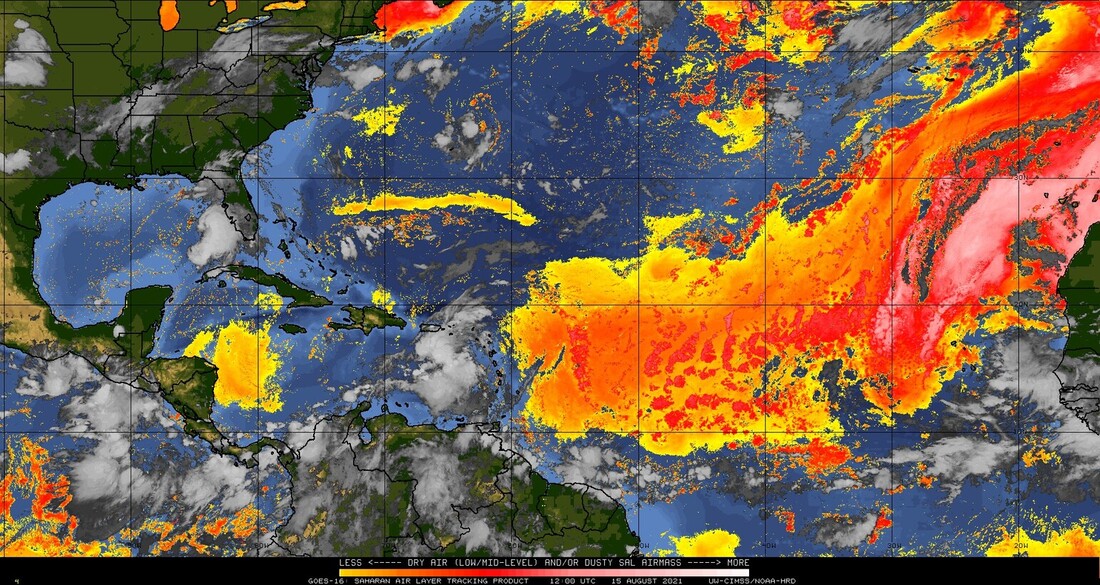
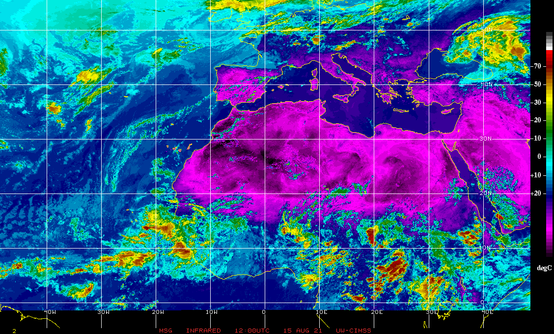
If you look at the Saharan Air Layer Analysis and the IR Satellite image of Africa below you see what I talked about yesterday evening. We should be ok for a while.
Until next time,
Matt.
He's back ! Hurricane Hunters this morning found a new center of circulation well north of where they had projected the old one to be and TS Fred is back. Due to shear Fred is only anticipated to be a 45-50 mph TS when it makes landfall tomorrow along the Florida Panhandle. The primary impact will be rainfall.
Meanwhile Grace remains poorly organized and in looking at Puerto Rico radar a clear center of circulation is not evident. It remains a minimal TS and is about to cross Hispaniola and Cuba. No significant weather is anticipated for Florida though some enhancement of our normal summer thunderstorms can be expected with the increase in tropical moisture when it passes south of Florida.
If you look at the Saharan Air Layer Analysis and the IR Satellite image of Africa below you see what I talked about yesterday evening. We should be ok for a while.
Until next time,
Matt.