Good evening.
Hurricane Harvey made landfall late Friday night on southern Matagorda Island, Texas near the town of Rockport, TX. Peak wind gust recorded was 132 mph in Aransas, just west of Matagorda Island. Peak wind in Rockport was 108 mph. Fortunately for Corpus Christie, Harvey passed 31 miles to its north (north of the NHC's forecast track) and as hurricane force winds only extended 20 miles to the south of the center they did not experience hurricane conditions. Peak wind gust recorded in Corpus Christie was 69 mph. Harvey is currently a minimal Tropical Storm with peak winds of 40 mph. Peak wind gust in Texas in the past hour has been 41 mph. Almost all of its weather is currently north of the center which is now just west of Victoria, Texas.
The biggest effect of Harvey will be rainfall. Houston has already received 25" of rain and it is still raining heavily. Many major roads are currently flooded and the NWS is predicting total accumulations of up to 50-60" possible !!!
Closer to home the low pressure system near the SW Florida coast on Friday is now off the coast of Georgia and South Carolina. We have received about 5 and a half inches of rain so far since Thursday from this system Some development is possible as it moves along the South and North Carolina coastal regions on its way out to sea. It would likely not be more than a Tropical Storm for them, if it should form and if it were to make landfall or a close enough approach.
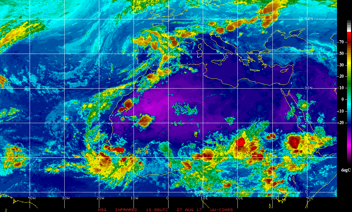
Elsewhere in the tropics there is not much at present. There are a couple of large thunderstorm complexes over tropical Africa which will bear watching for development after they emerge off the coast in about 5-7 days. (See Infra Red image of Africa below.)
Until next time, Matt.
Hurricane Harvey made landfall late Friday night on southern Matagorda Island, Texas near the town of Rockport, TX. Peak wind gust recorded was 132 mph in Aransas, just west of Matagorda Island. Peak wind in Rockport was 108 mph. Fortunately for Corpus Christie, Harvey passed 31 miles to its north (north of the NHC's forecast track) and as hurricane force winds only extended 20 miles to the south of the center they did not experience hurricane conditions. Peak wind gust recorded in Corpus Christie was 69 mph. Harvey is currently a minimal Tropical Storm with peak winds of 40 mph. Peak wind gust in Texas in the past hour has been 41 mph. Almost all of its weather is currently north of the center which is now just west of Victoria, Texas.
The biggest effect of Harvey will be rainfall. Houston has already received 25" of rain and it is still raining heavily. Many major roads are currently flooded and the NWS is predicting total accumulations of up to 50-60" possible !!!
Closer to home the low pressure system near the SW Florida coast on Friday is now off the coast of Georgia and South Carolina. We have received about 5 and a half inches of rain so far since Thursday from this system Some development is possible as it moves along the South and North Carolina coastal regions on its way out to sea. It would likely not be more than a Tropical Storm for them, if it should form and if it were to make landfall or a close enough approach.
Elsewhere in the tropics there is not much at present. There are a couple of large thunderstorm complexes over tropical Africa which will bear watching for development after they emerge off the coast in about 5-7 days. (See Infra Red image of Africa below.)
Until next time, Matt.