Good morning.
Just a quick update on Hurricane Ida. At 5 am Ida was approaching the SE Louisiana coastline.
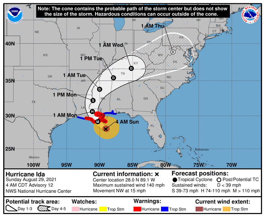
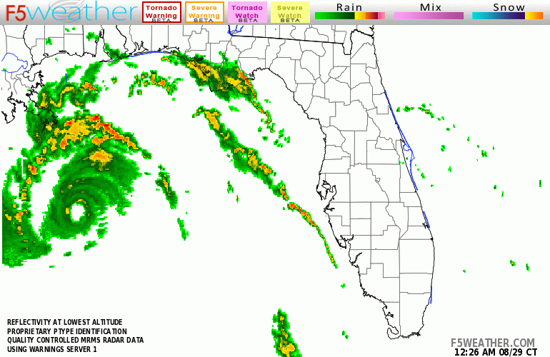
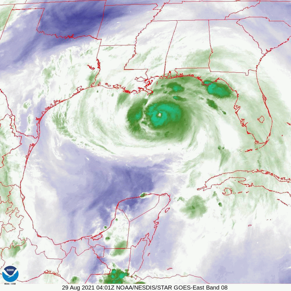
The current NHC track has shifted slightly westward. Of note is that if you look at the water vapor loop below you will notice that Ida took a decided westward wobble between 1 and 4 am. This has placed it a little further west than previously forecast. The result of this is that the eye wall will probably miss New Orleans. They will still however likely experience hurricane conditions. Note a western wobble is often followed by an northern wobble in a NW moving system. When storms are far out they don't make much difference however as they get close to shore they can have a significant impact on just where it makes landfall. The eye is currently 15 nm wide. You can see it on radar. Ida has been steadily intensifying and will likely reach winds of 150-160 mph before landfall. The NHC currently projects peak winds to 145. Ida currently appears to be headed towards Houma, LA. As noted wobbles become significant as storms approach land and Ida has been wobbling a lot so a precise location will be difficult to ascertain. They eye is small so it will have to pass within 12 miles of you to get eye wall. The area most affected will be narrow but extreme.
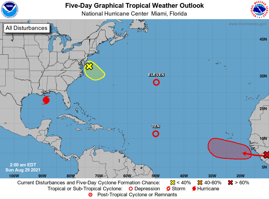
The wave over Africa that I spoke about a few days ago is forecast to come off the coast tomorrow and will likely move out to sea.
Best wishes to all.
Until next time,
Matt.
PS. Just a note. H. Katrina made landfall on 8-29-05. 16 years ago to the date.
Just a quick update on Hurricane Ida. At 5 am Ida was approaching the SE Louisiana coastline.
The current NHC track has shifted slightly westward. Of note is that if you look at the water vapor loop below you will notice that Ida took a decided westward wobble between 1 and 4 am. This has placed it a little further west than previously forecast. The result of this is that the eye wall will probably miss New Orleans. They will still however likely experience hurricane conditions. Note a western wobble is often followed by an northern wobble in a NW moving system. When storms are far out they don't make much difference however as they get close to shore they can have a significant impact on just where it makes landfall. The eye is currently 15 nm wide. You can see it on radar. Ida has been steadily intensifying and will likely reach winds of 150-160 mph before landfall. The NHC currently projects peak winds to 145. Ida currently appears to be headed towards Houma, LA. As noted wobbles become significant as storms approach land and Ida has been wobbling a lot so a precise location will be difficult to ascertain. They eye is small so it will have to pass within 12 miles of you to get eye wall. The area most affected will be narrow but extreme.
The wave over Africa that I spoke about a few days ago is forecast to come off the coast tomorrow and will likely move out to sea.
Best wishes to all.
Until next time,
Matt.
PS. Just a note. H. Katrina made landfall on 8-29-05. 16 years ago to the date.