Good morning.
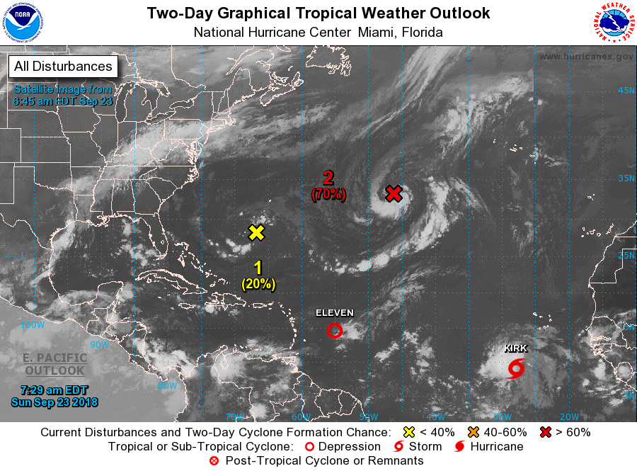
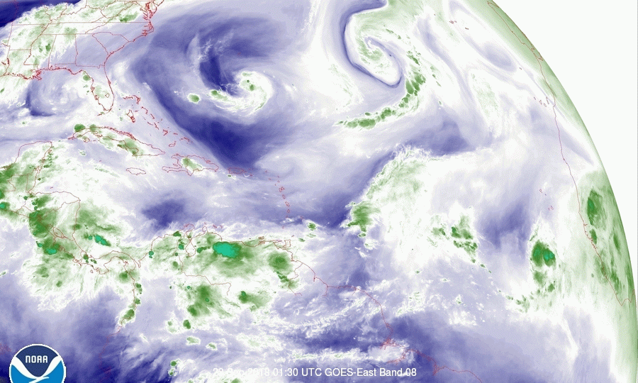
There are several new features in the Tropics this morning though none appear to be of great concern at this time. If you look at the Water Vapor Loop, second graphic, you will see several things.
First an upper level low spinning over the Gulf of Mexico, with a frontal system moving north of it over the Central US, next an upper level low east of Florida, labeled #1 on 1st diagram , a large stronger upper level low labeled #2 in red, spinning over the central Atlantic, next a whisp of clouds being heavily sheared in the southern central tropical Atlantic east of the Lesser Antilles (this is TD #11) and last a spin of convection in the far south eastern Atlantic (this is TS Kirk).
Briefly, the NHC is giving #1 a 30% chance of development in the next 5 days. It may approach the Carolinas however the front across the Central US moving east should keep it offshore as well as shear it preventing significant development.
#2 is expected to move off to the NE away from land.
TD #11 is undergoing significant shear and is about to enter an area of even greater shear. (See Wind Shear Analysis below). It will likely dissipate in the next 1-2 days.
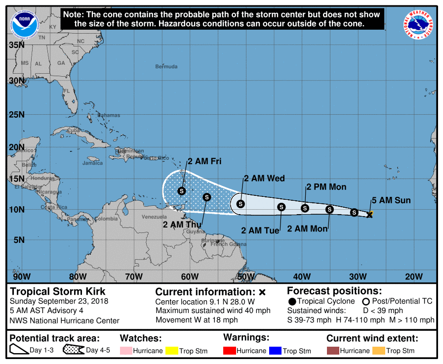
TS Kirk is currently in an area of low shear however it is being limited by dry air to its north and west,(see Saharan Air Layer Analysis, SAL, last diagram). In looking at the Surface map it is being steered quickly west by high pressure to its north. It is currently moving west at 18 mph however that speed is expected to increase to 25 mph or more. This is good news because it will even further enhance shear over it once it reaches the south central Atlantic just south of where TD #11 is now. Both the GFS and European models are forecasting dissipation in 5-7 days after it enters that area of high shear which is extensive. (See Wind Shear Analysis below.)
I'll be watching if things should change however I anticipate that the high shear over the Caribbean and southwestern Atlantic (likely due to a developing El Nino) should keep a damper on southern systems.
Until next time, Matt.
There are several new features in the Tropics this morning though none appear to be of great concern at this time. If you look at the Water Vapor Loop, second graphic, you will see several things.
First an upper level low spinning over the Gulf of Mexico, with a frontal system moving north of it over the Central US, next an upper level low east of Florida, labeled #1 on 1st diagram , a large stronger upper level low labeled #2 in red, spinning over the central Atlantic, next a whisp of clouds being heavily sheared in the southern central tropical Atlantic east of the Lesser Antilles (this is TD #11) and last a spin of convection in the far south eastern Atlantic (this is TS Kirk).
Briefly, the NHC is giving #1 a 30% chance of development in the next 5 days. It may approach the Carolinas however the front across the Central US moving east should keep it offshore as well as shear it preventing significant development.
#2 is expected to move off to the NE away from land.
TD #11 is undergoing significant shear and is about to enter an area of even greater shear. (See Wind Shear Analysis below). It will likely dissipate in the next 1-2 days.
TS Kirk is currently in an area of low shear however it is being limited by dry air to its north and west,(see Saharan Air Layer Analysis, SAL, last diagram). In looking at the Surface map it is being steered quickly west by high pressure to its north. It is currently moving west at 18 mph however that speed is expected to increase to 25 mph or more. This is good news because it will even further enhance shear over it once it reaches the south central Atlantic just south of where TD #11 is now. Both the GFS and European models are forecasting dissipation in 5-7 days after it enters that area of high shear which is extensive. (See Wind Shear Analysis below.)
I'll be watching if things should change however I anticipate that the high shear over the Caribbean and southwestern Atlantic (likely due to a developing El Nino) should keep a damper on southern systems.
Until next time, Matt.