Good afternoon.
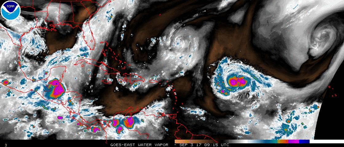
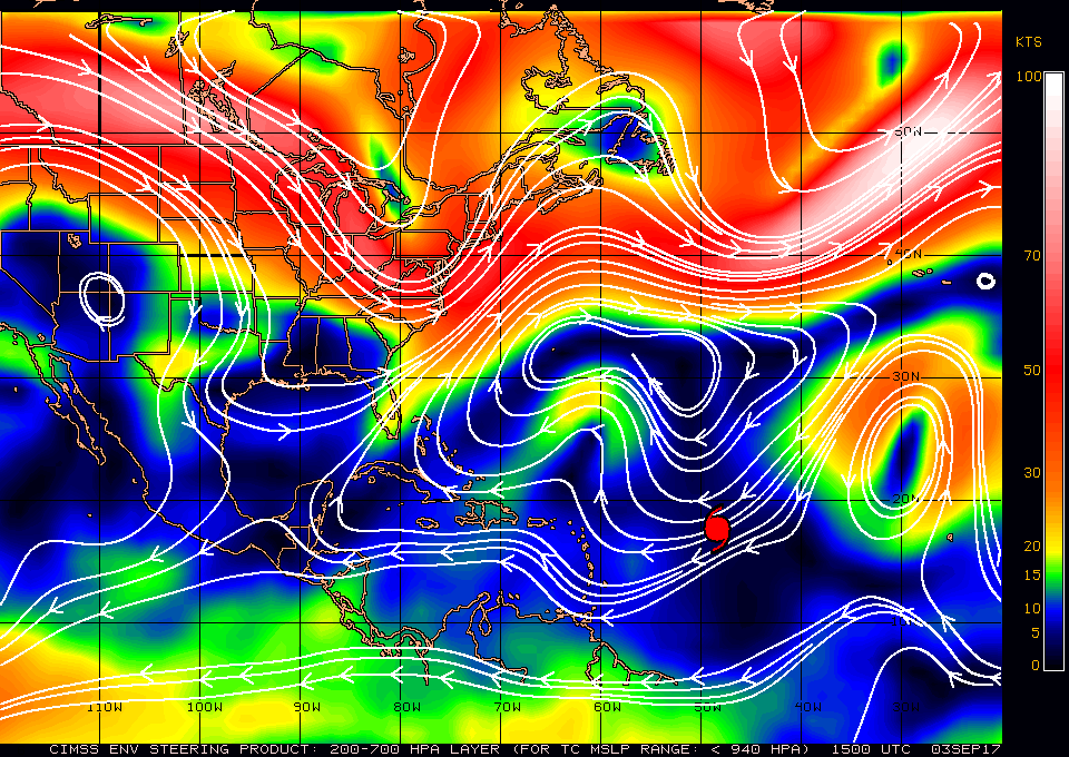
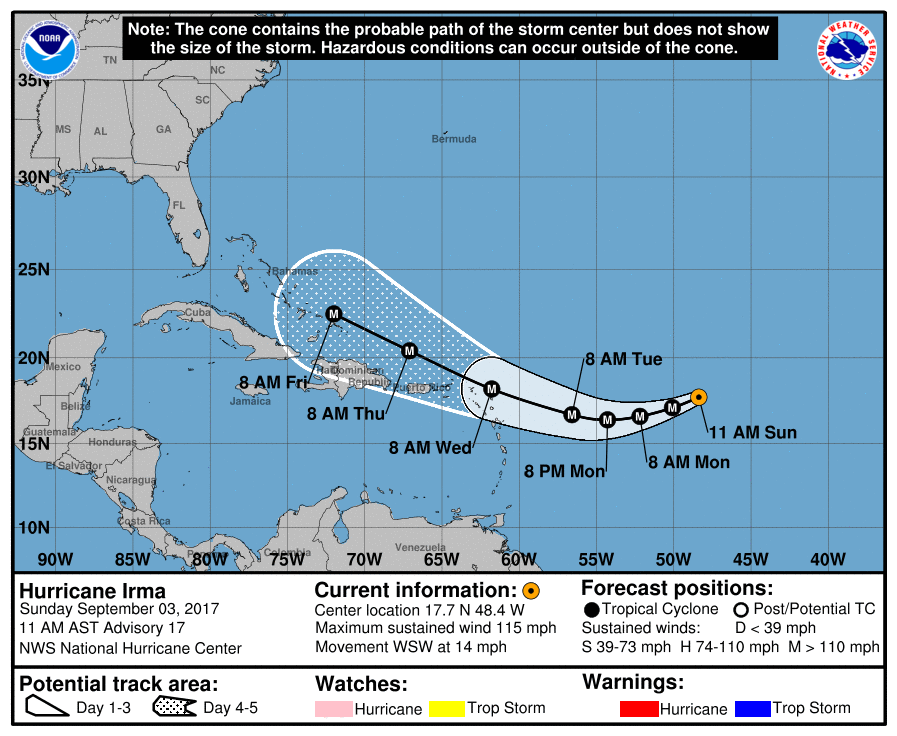
At 11 am Hurricane Irma was located at 17.7 N & 48.4 W and was moving WSW @ 14 mph. Since yesterday a few things have happened with Irma. Most notably its WSW move has begun and it has already moved south 1.3 degrees from its northern most location so far of 19.0 N. Tomorrow night it is expected to reach its southern most point before beginning its WNW move. Just how far south it goes will be key in determining its ultimate location(s) of landfall. In general the further south it goes the greater the risk for Florida and the East Coast of the US. It is forecast to get to around 16.5 N. If it is much further south than that expect the models to shift to the south and west. (They have already shifted a little to the south today.) The converse if it turns earlier. If it were to enter the Caribbean South Florida could be at risk. On water vapor loop notice that the front across Florida has moved a little further east. This would be good as long as it stays to our east. If it should get south of South Florida it could draw it towards it. (see surface map below). We should know by Tuesday morning.
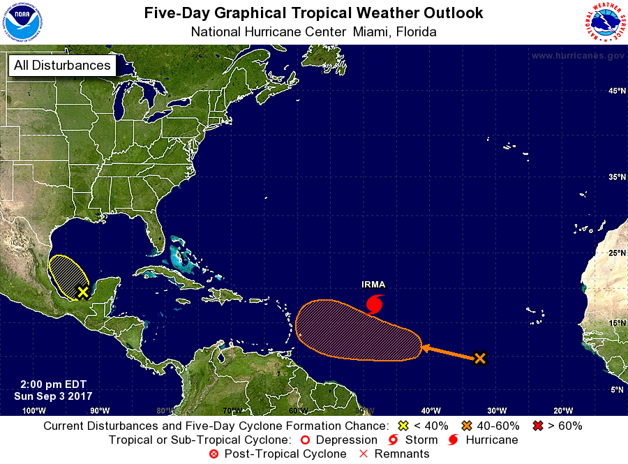
Elsewhere in the tropics the wave SE of Irma remains poorly organized however the NHC has given it a medium chance of developing in the next 5 days (see bottom chart).
*** Note the NHC tracks over 48 hours out have a high degree of uncertainty. Don't let them psyche you out. They are just lines on a graph and have no influence on the storms themselves. They will certainly change and fluctuate going forward.
Until tomorrow, Matt.
At 11 am Hurricane Irma was located at 17.7 N & 48.4 W and was moving WSW @ 14 mph. Since yesterday a few things have happened with Irma. Most notably its WSW move has begun and it has already moved south 1.3 degrees from its northern most location so far of 19.0 N. Tomorrow night it is expected to reach its southern most point before beginning its WNW move. Just how far south it goes will be key in determining its ultimate location(s) of landfall. In general the further south it goes the greater the risk for Florida and the East Coast of the US. It is forecast to get to around 16.5 N. If it is much further south than that expect the models to shift to the south and west. (They have already shifted a little to the south today.) The converse if it turns earlier. If it were to enter the Caribbean South Florida could be at risk. On water vapor loop notice that the front across Florida has moved a little further east. This would be good as long as it stays to our east. If it should get south of South Florida it could draw it towards it. (see surface map below). We should know by Tuesday morning.
Elsewhere in the tropics the wave SE of Irma remains poorly organized however the NHC has given it a medium chance of developing in the next 5 days (see bottom chart).
*** Note the NHC tracks over 48 hours out have a high degree of uncertainty. Don't let them psyche you out. They are just lines on a graph and have no influence on the storms themselves. They will certainly change and fluctuate going forward.
Until tomorrow, Matt.