Good afternoon.
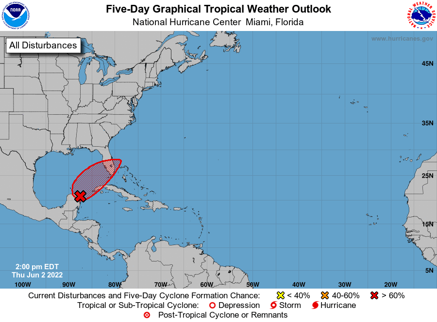
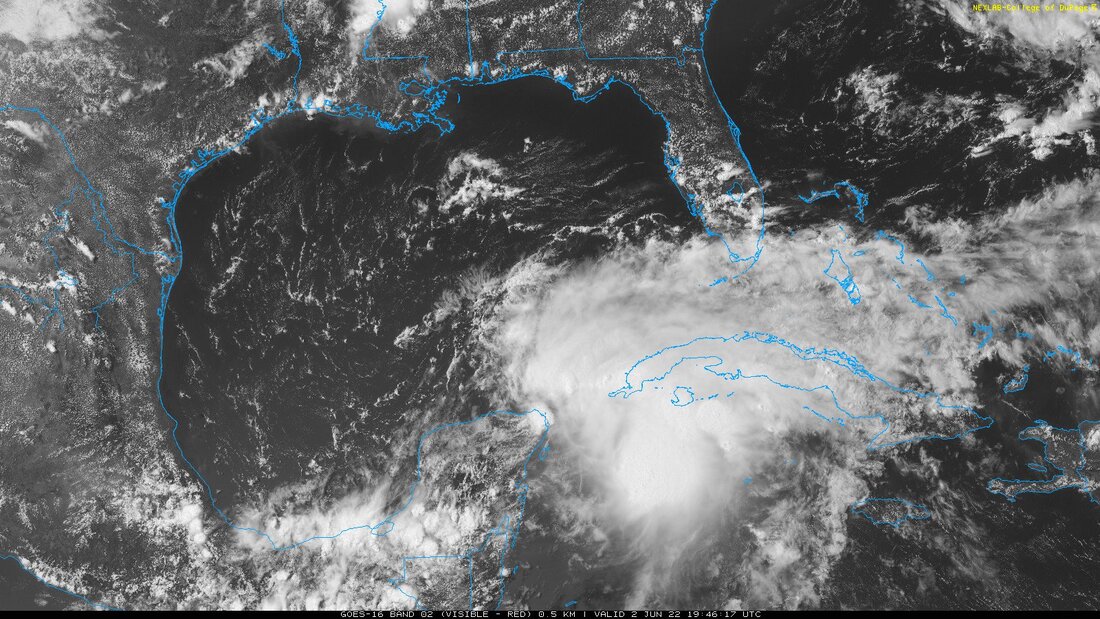
Since yesterday's forecast nothing has changed. The NHC is giving the low pressure system currently over the NW Yucatan Peninsula an 80% chance of tropical development over the next 2 days. Due to high shear over the system all of the associated weather is displaced to the east of the low. This should help to slow development and should prevent it from becoming too strong.
The Ft. Myers area remains at highest risk though due to an anticipated weak system the weather should be fairly diffuse. For SE Florida winds in the 20s with gusts to 30s with 5-10+ inches of rain are anticipated. SW FL should have similar rainfall with higher winds.
I'll probably post again tomorrow afternoon. South Florida should expect a blustery and rainy Friday and Saturday.
Until next time,
Matt.