Good morning.
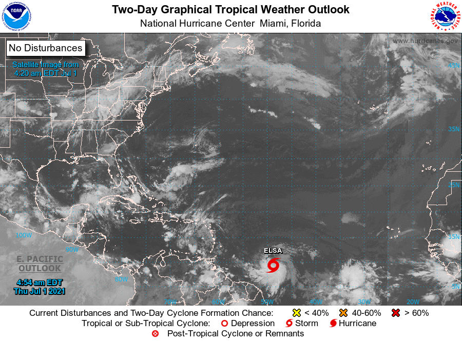
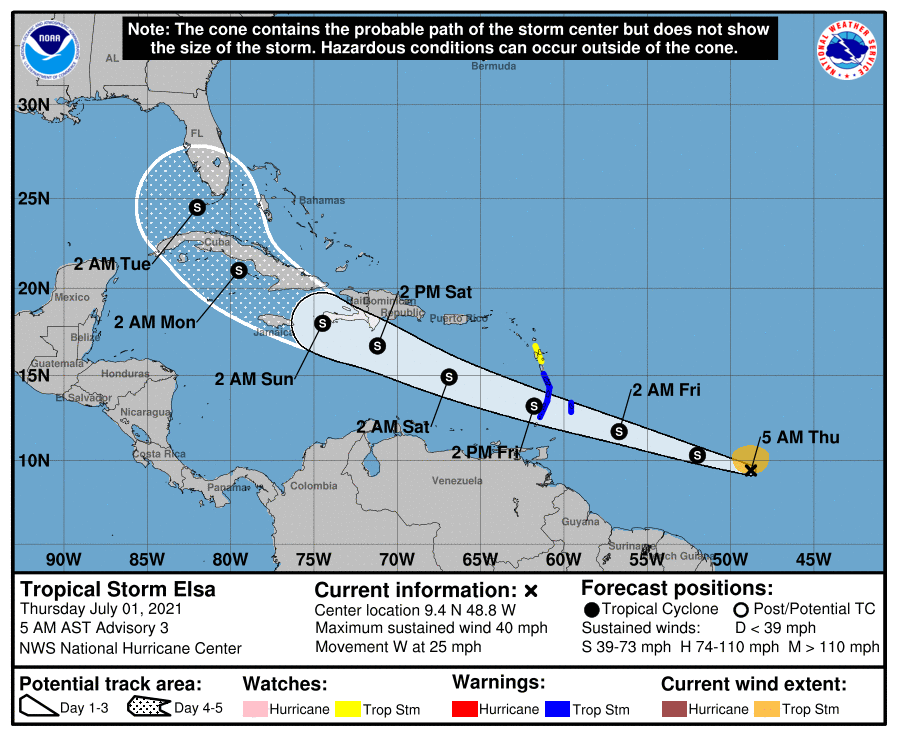
Early this morning Potential Tropical Cyclone #5 became better organized and the NHC located a center of circulation and named it Tropical Storm Elsa. If you look at the Surface Map below you will see that the isobar that it is on takes it to the northern Yucatan Peninsula. This is not likely where it will go.
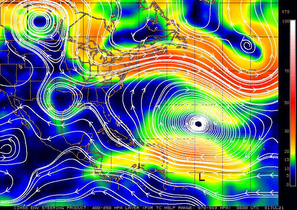
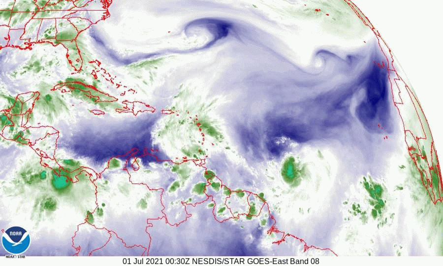
If you look at the water vapor loop below you will notice a couple of interesting features. First Elsa is south and west of where they anticipated it to be yesterday and it appears to be moving just south of west, not along the current NHC track. Next note an upper level low spinning counter clockwise over the central Gulf of Mexico. IF this feature should persist it would tend to turn Elsa to the NW as it approaches the Western Caribbean. My current track is south and west of the NHC's and takes Elsa either through the eastern Yucatan Channel or into the Isle of Pines and the western tip of Cuba. Louisiana or Mississippi appear to be at highest risk at present, however it is still very early in the forecast track and some changes are likely.
I'll be watching and will write another post early tomorrow morning. Sooner if needed.
Until then,
Matt.
Early this morning Potential Tropical Cyclone #5 became better organized and the NHC located a center of circulation and named it Tropical Storm Elsa. If you look at the Surface Map below you will see that the isobar that it is on takes it to the northern Yucatan Peninsula. This is not likely where it will go.
If you look at the water vapor loop below you will notice a couple of interesting features. First Elsa is south and west of where they anticipated it to be yesterday and it appears to be moving just south of west, not along the current NHC track. Next note an upper level low spinning counter clockwise over the central Gulf of Mexico. IF this feature should persist it would tend to turn Elsa to the NW as it approaches the Western Caribbean. My current track is south and west of the NHC's and takes Elsa either through the eastern Yucatan Channel or into the Isle of Pines and the western tip of Cuba. Louisiana or Mississippi appear to be at highest risk at present, however it is still very early in the forecast track and some changes are likely.
I'll be watching and will write another post early tomorrow morning. Sooner if needed.
Until then,
Matt.