Good afternoon.
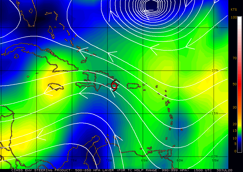
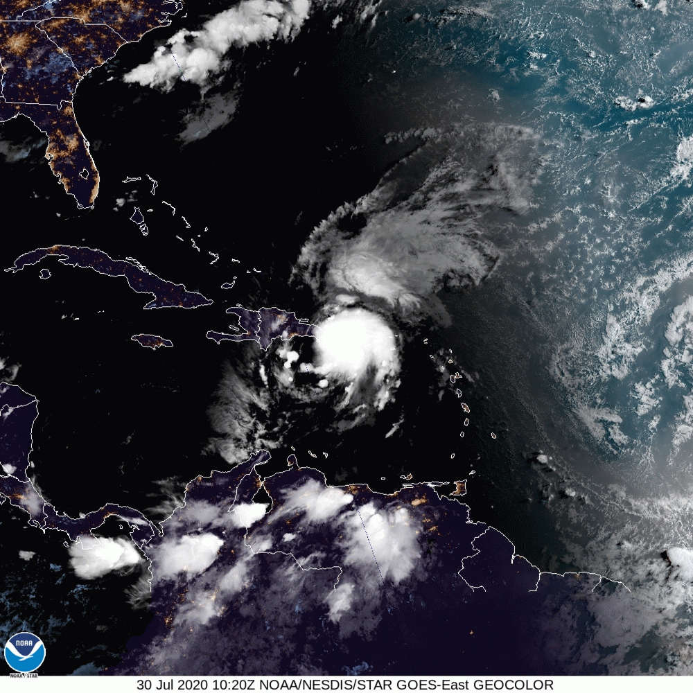
An interesting phenomenon appears to have occurred with Isaias. Due to its interaction with the mountainous terrain of Hispaniola a new center appears to have formed along the northern coast of Hispaniola. You can see it if you look closely at the current satellite loop below. Local radar shows the prior center along the SE coast of Hispaniola, it will probably dissipate in the mountains. The result of this is that Isaias has taken a jog to the NW which should result in a slightly more easterly track. If you look at the surface map below you can see a gap in the high pressure ridges to its north centered around Grand Bahama, this is currently the area of greatest risk.
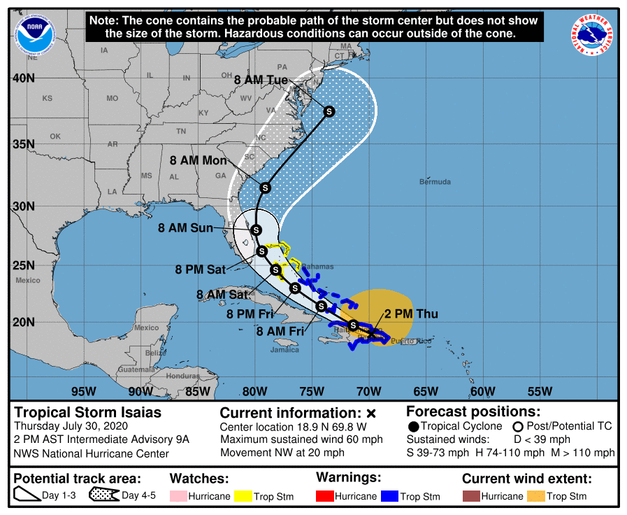
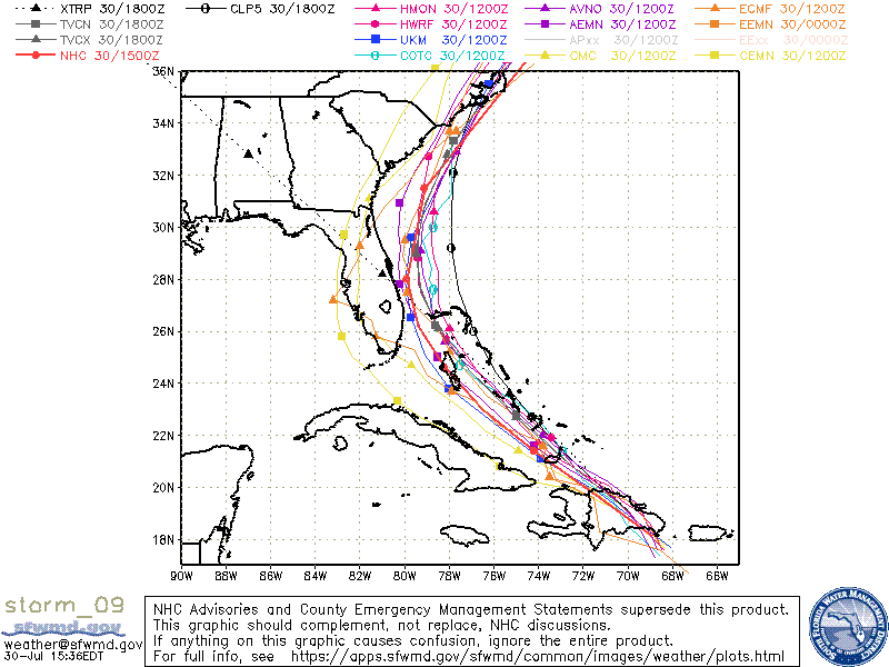
My current track is a little east of the NHC's centered over Grand Bahama.
Due to SW shear over Florida, the Florida Straits and the northern Caribbean most of its weather is NE of the center. If the current track hold South Florida could expect winds in the 20s with gusts into the 40s with a few passing squalls. I would not anticipate much rainfall, ?1-2 inches or less??
I'll write again tomorrow however the overall risk to Florida currently appears fairly low.
Matt.
An interesting phenomenon appears to have occurred with Isaias. Due to its interaction with the mountainous terrain of Hispaniola a new center appears to have formed along the northern coast of Hispaniola. You can see it if you look closely at the current satellite loop below. Local radar shows the prior center along the SE coast of Hispaniola, it will probably dissipate in the mountains. The result of this is that Isaias has taken a jog to the NW which should result in a slightly more easterly track. If you look at the surface map below you can see a gap in the high pressure ridges to its north centered around Grand Bahama, this is currently the area of greatest risk.
My current track is a little east of the NHC's centered over Grand Bahama.
Due to SW shear over Florida, the Florida Straits and the northern Caribbean most of its weather is NE of the center. If the current track hold South Florida could expect winds in the 20s with gusts into the 40s with a few passing squalls. I would not anticipate much rainfall, ?1-2 inches or less??
I'll write again tomorrow however the overall risk to Florida currently appears fairly low.
Matt.