Good afternoon.
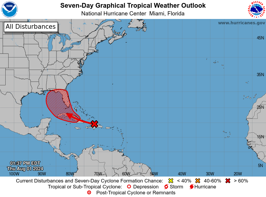
Since Tuesday a few things have changed with regards to the tropical wave in the Western Atlantic. Most importantly it has been moving westward instead of WNW as previously forecast and as a result is further south than originally anticipated. This has resulted in a shift in the NHC's track to the west. It remains poorly organized however it has succeeded in moistening the air around it and as a result the associated shower activity has increased. The NHC is now giving it a 70% chance of tropical development over the next 7 days.
If you look at the surface map below you can see that the window remains open over the Bahamas, however if it should form far enough south of the window it could miss it, run down the spine of Cuba and end up in the Eastern Gulf of Mexico where it would then turn NW and northward and threaten the West Coast of Florida. Water temperatures are extremely warm in the Eastern Gulf of Mexico, see Sea Surface Temp diagram below.
If it does pass directly over Hispaniola and Cuba it would not likely develop until it enters the Gulf.
I'll continue to keep an eye on it and probably post again tomorrow afternoon or evening.
Until next time,
Matt.