Good afternoon,
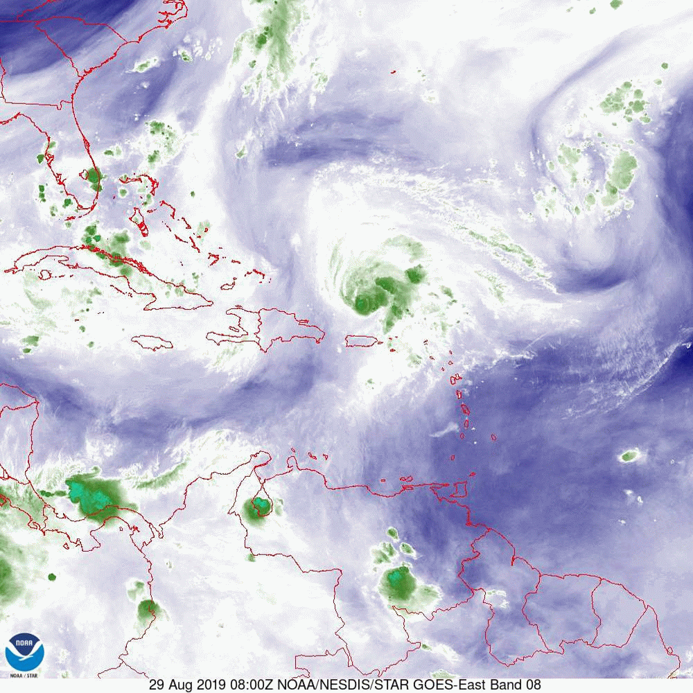
In looking at the data on Dorian today there are a few interesting features. First, it has continued to move north and east of yesterday's NHC forecast. Next, and most important, if you look at the water vapor loop below you'll see that the upper-level low, which had been between Erin and Dorian yesterday, is now moving west towards Florida. The main impact of this should be 1) it should not have a significant effect on weakening Dorian, and 2) it should support the storm's northwest movement--probably until the storm is north of South Florida.
The other important feature is that the NHC is forecasting Dorian to slow and possibly not approach the coast until late Monday/early Tuesday.
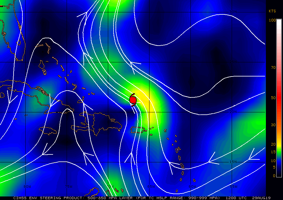
If you look at the surface map below you will again see a broad area between isobars, this denotes an area of weak steering currents which will add to slowing motion and uncertainty in the forecast. One of the impacts of the slowing is that it will allow the frontal system (the blue area you can now see right along the SE coast) to proceed even further south. This could become the "White Knight." One distinct possibility is that Dorian could stall just off the coast of Central or North Florida and then move NE avoiding a Florida landfall all together potentially threatening the outer banks of NC or even missing the US entirely. The latest Global models are starting to reflect this possibility.
The European model, due to projection of a stronger western Atlantic high pressure ridge, is currently forecasting landfall in the area of Vero Beach. The GFS or American model, which only projects a weak high pressure ridge, currently centers closer to the Florida/Georgia border. Since this morning, the model trends are starting to shift northward. This could be temporary.
Dorian is projected to be an asymmetric storm when it approaches Florida, with most of the weather on the eastern side of the storm. If it were to make landfall in central Florida, Miami-Dade County would only experience winds in the 20s and only a few passing showers. It is still too early to say and the weak steering forces will probably continue to lead to low probability forecasts for everyone. This is why the NHC has such a wide cone.
I'll write again tomorrow morning.
Until next time,
Matt
In looking at the data on Dorian today there are a few interesting features. First, it has continued to move north and east of yesterday's NHC forecast. Next, and most important, if you look at the water vapor loop below you'll see that the upper-level low, which had been between Erin and Dorian yesterday, is now moving west towards Florida. The main impact of this should be 1) it should not have a significant effect on weakening Dorian, and 2) it should support the storm's northwest movement--probably until the storm is north of South Florida.
The other important feature is that the NHC is forecasting Dorian to slow and possibly not approach the coast until late Monday/early Tuesday.
If you look at the surface map below you will again see a broad area between isobars, this denotes an area of weak steering currents which will add to slowing motion and uncertainty in the forecast. One of the impacts of the slowing is that it will allow the frontal system (the blue area you can now see right along the SE coast) to proceed even further south. This could become the "White Knight." One distinct possibility is that Dorian could stall just off the coast of Central or North Florida and then move NE avoiding a Florida landfall all together potentially threatening the outer banks of NC or even missing the US entirely. The latest Global models are starting to reflect this possibility.
The European model, due to projection of a stronger western Atlantic high pressure ridge, is currently forecasting landfall in the area of Vero Beach. The GFS or American model, which only projects a weak high pressure ridge, currently centers closer to the Florida/Georgia border. Since this morning, the model trends are starting to shift northward. This could be temporary.
Dorian is projected to be an asymmetric storm when it approaches Florida, with most of the weather on the eastern side of the storm. If it were to make landfall in central Florida, Miami-Dade County would only experience winds in the 20s and only a few passing showers. It is still too early to say and the weak steering forces will probably continue to lead to low probability forecasts for everyone. This is why the NHC has such a wide cone.
I'll write again tomorrow morning.
Until next time,
Matt