Good morning.
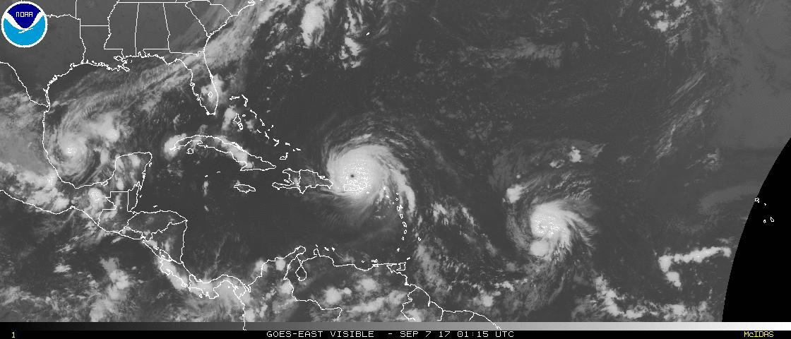
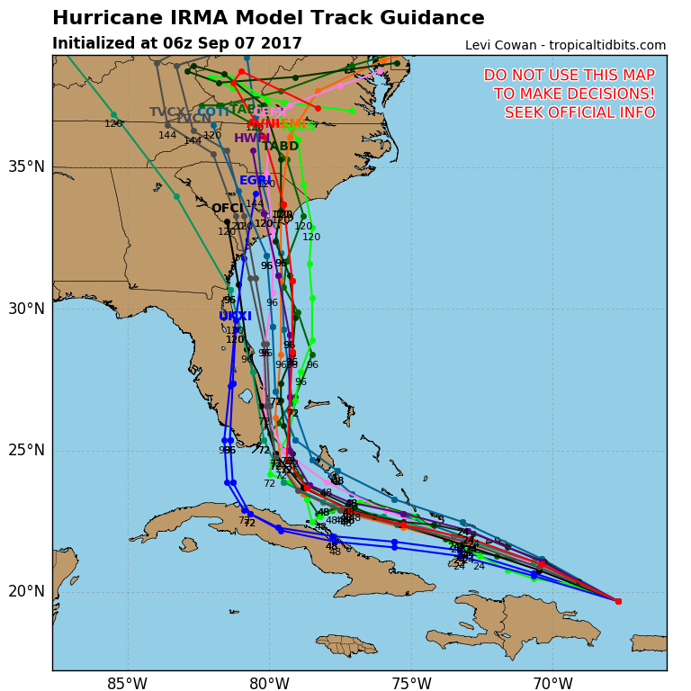
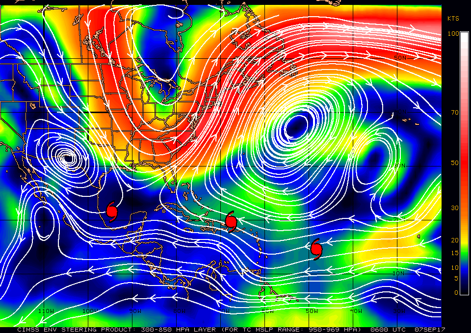
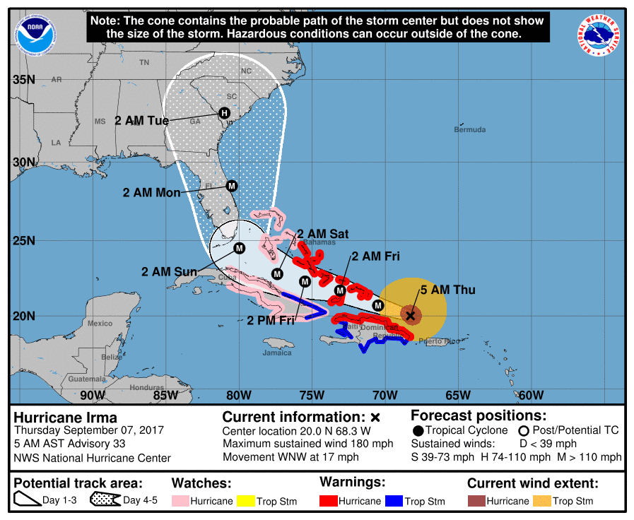
At 5 am Hurricane Irma was located at 20.0 N & 68.3 W and was moving WNW @ 16 mph. Since last night not much has changed with Irma. It continues to head WNW toward South Florida and the Bahamas. It should remain over warm water in a low shear environment until it is in our area and the NHC is currently calling for it to be a strong Cat 4 with 150 mph winds when it is in our vicinity, The Global Models have shifted slightly to the E however the NHC has not changed its forecast track as they could shift back to the W. My track has not changed significantly from yesterday and still brings Irma over or just west of Andros Island and Grand Bahama Island. It is going to be a close call for South Florida and we are not going to know just how much weather we are going to receive until late in the forecast period ( ?Saturday am? ). We will probably receive at least tropical storm conditions, possibly much more and we all need to prepare. A few miles either way could make a big difference for us in South Florida.
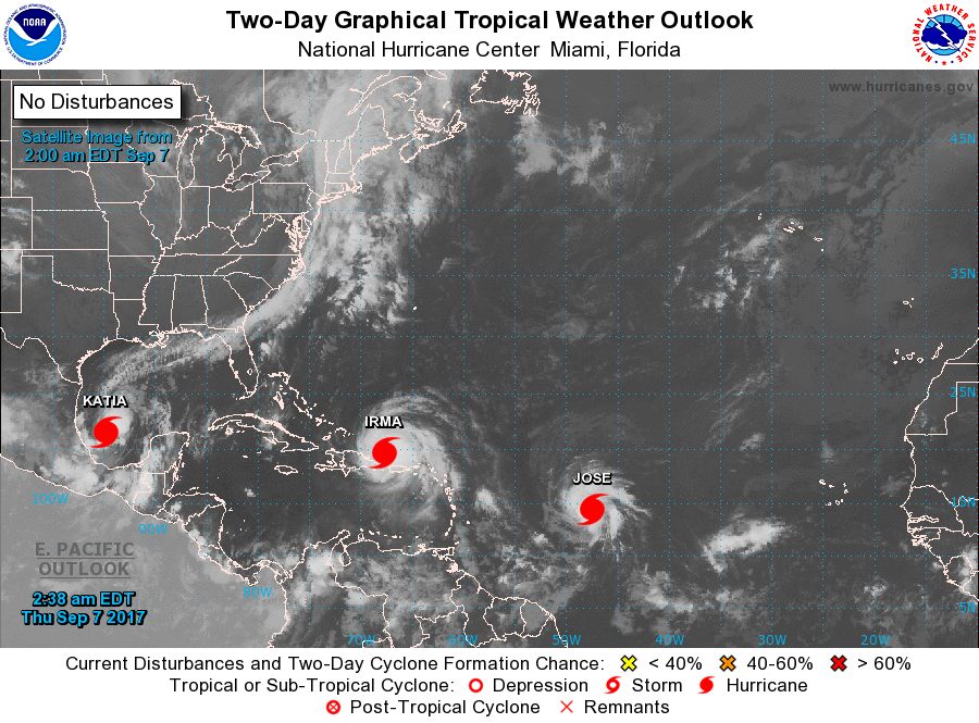
Elsewhere Jose and Katia are now both Hurricanes, but fortunately are not threatening the US at this time.
I will write again this evening and will probably post frequently Friday, Saturday and Sunday as things develop and will let you know just what to expect as things get clearer.
Until later, Matt.
At 5 am Hurricane Irma was located at 20.0 N & 68.3 W and was moving WNW @ 16 mph. Since last night not much has changed with Irma. It continues to head WNW toward South Florida and the Bahamas. It should remain over warm water in a low shear environment until it is in our area and the NHC is currently calling for it to be a strong Cat 4 with 150 mph winds when it is in our vicinity, The Global Models have shifted slightly to the E however the NHC has not changed its forecast track as they could shift back to the W. My track has not changed significantly from yesterday and still brings Irma over or just west of Andros Island and Grand Bahama Island. It is going to be a close call for South Florida and we are not going to know just how much weather we are going to receive until late in the forecast period ( ?Saturday am? ). We will probably receive at least tropical storm conditions, possibly much more and we all need to prepare. A few miles either way could make a big difference for us in South Florida.
Elsewhere Jose and Katia are now both Hurricanes, but fortunately are not threatening the US at this time.
I will write again this evening and will probably post frequently Friday, Saturday and Sunday as things develop and will let you know just what to expect as things get clearer.
Until later, Matt.