Good morning.
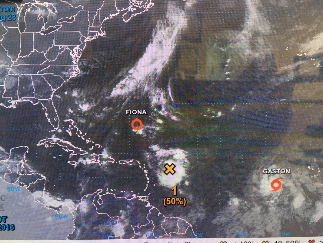
I am writing about a tropical disturbance which could potentially threaten S Florida in 5-6 days. It is currently labeled Invest 99L by the NHC. It currently is in a moderate shear environment and development will be slow to occur however once it reaches an area north of Hispaniola shear will slacken and development is quite possible. TD Fiona and TS Gaston will move off into the central Atlantic and not threaten us however Gaston's presence may limit this disturbance's ability to move further north. It is way too early to say whether it will develop or where it will eventually go however this will be one which we will need to watch. I've included the NHC's latest advisory about this system, a current satellite image and the NWS's current projected track. Note these will all change and should be taken with a grain of salt at this time.
I am writing about a tropical disturbance which could potentially threaten S Florida in 5-6 days. It is currently labeled Invest 99L by the NHC. It currently is in a moderate shear environment and development will be slow to occur however once it reaches an area north of Hispaniola shear will slacken and development is quite possible. TD Fiona and TS Gaston will move off into the central Atlantic and not threaten us however Gaston's presence may limit this disturbance's ability to move further north. It is way too early to say whether it will develop or where it will eventually go however this will be one which we will need to watch. I've included the NHC's latest advisory about this system, a current satellite image and the NWS's current projected track. Note these will all change and should be taken with a grain of salt at this time.
" A large area of disorganized showers and thunderstorms located a few
hundred miles east of the Leeward Islands is associated with a
tropical wave. Environmental conditions are somewhat conducive for
development of this system during the next couple of days while
it moves west-northwestward at 15 to 20 mph near the northern
Leeward Island and the Greater Antilles. Large-scale conditions
could become more conducive later this week while the system moves
near Hispaniola and then the southeastern and central Bahamas. An
Air Force Reserve Hurricane Hunter aircraft is scheduled to
investigate this disturbance later this morning. Interests from the
islands of the northeastern Caribbean Sea to the Bahamas should
monitor the progress of this system. Gusty winds, heavy rains, and
possible flash floods and mud slides could occur over these areas
regardless of tropical cyclone formation. Please consult products
issued by your local meteorological offices for further details.
* Formation chance through 48 hours...medium...50 percent
* Formation chance through 5 days...medium...60 percent "

