Good morning.
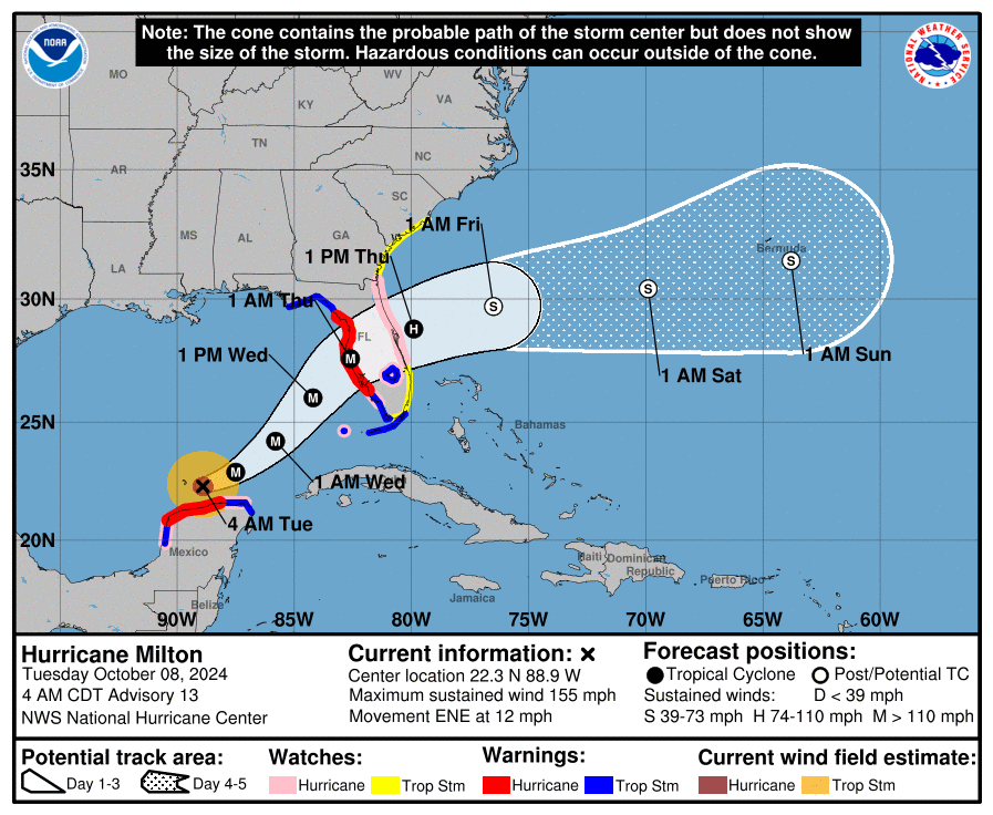
If you look at the water vapor loop below you will notice a few things. Most obvious is that Milton is starting to become more asymmetric and wobbling more, its eye is fluctuating and larger. It is also gaining latitude. It is starting to feel the affects of the shear to its north. It has weakened some and is currently a strong Cat 4 hurricane. Further weakening is anticipated and the NHC is currently forecasting a 125 mph Cat 3 at landfall, which is currently at the high end of their guidance. That would be a very strong hurricane and everyone in its path should be making preparations and plans.
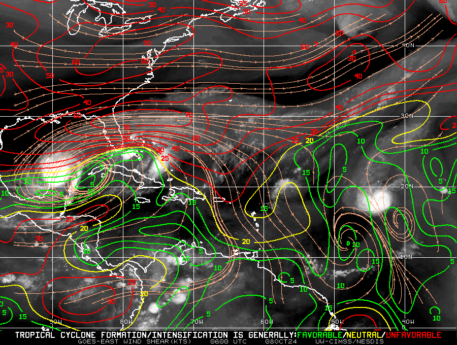
My track has not changed since yesterday. If you look at the wind shear analysis below you can see that Milton will be steadily encountering increasing shear as it gains latitude. We can only hope that it weakens as much as possible. We'll know more about intensity tomorrow.
I will write tonight about what specific regions can expect.
Until next time,
Matt.


