Good morning.
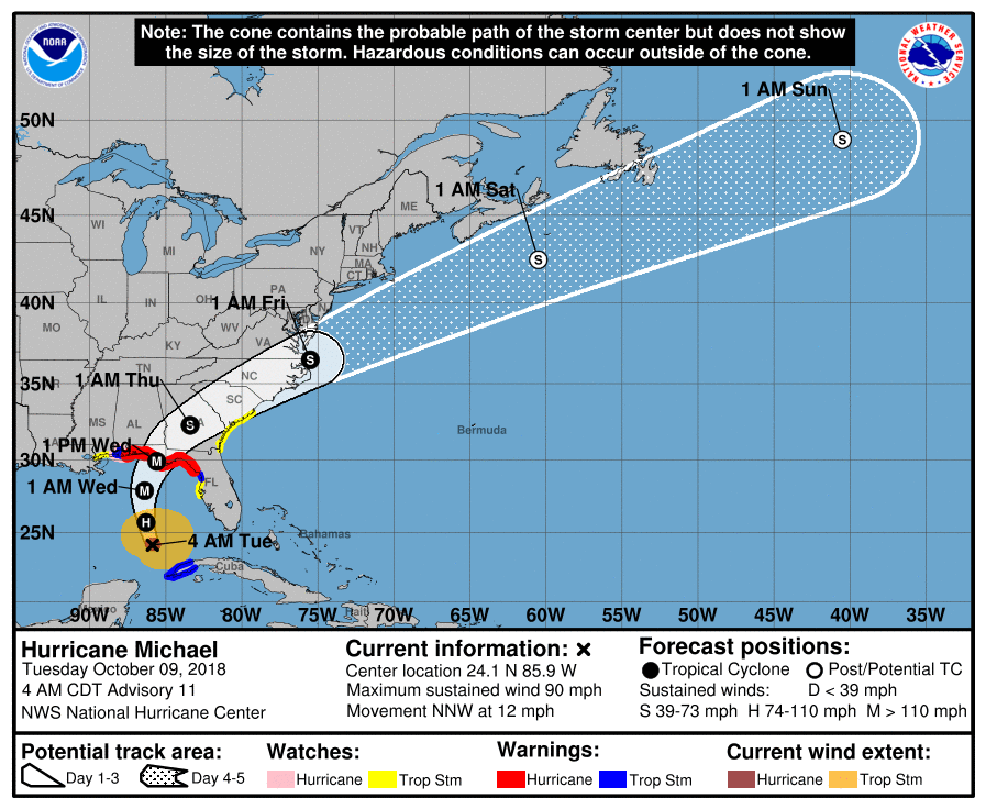
Hurricane Michael at 05:00 this morning was moving NNW @ 12 mph with peak winds of 90 mph. Overnight pressure have stabilized at around 973 mbs. Shear is anticipated to decrease some today and Michael is expected to become a Cat 2 storm later today. The NHC is currently forecasting a 120 mph Cat 3 storm at landfall around noon tomorrow along the Florida Panhandle. The NHC's track has not changed since yesterday afternoon and the models are in very tight agreement. The eye remains cloud filled however a distinct eye should form later today as peak sustained winds reach around 100 mph.
Note Florida has received very little rainfall so far from Michael. This is due to it becoming a stronger system than expected which has drawn the moisture closer to its center.
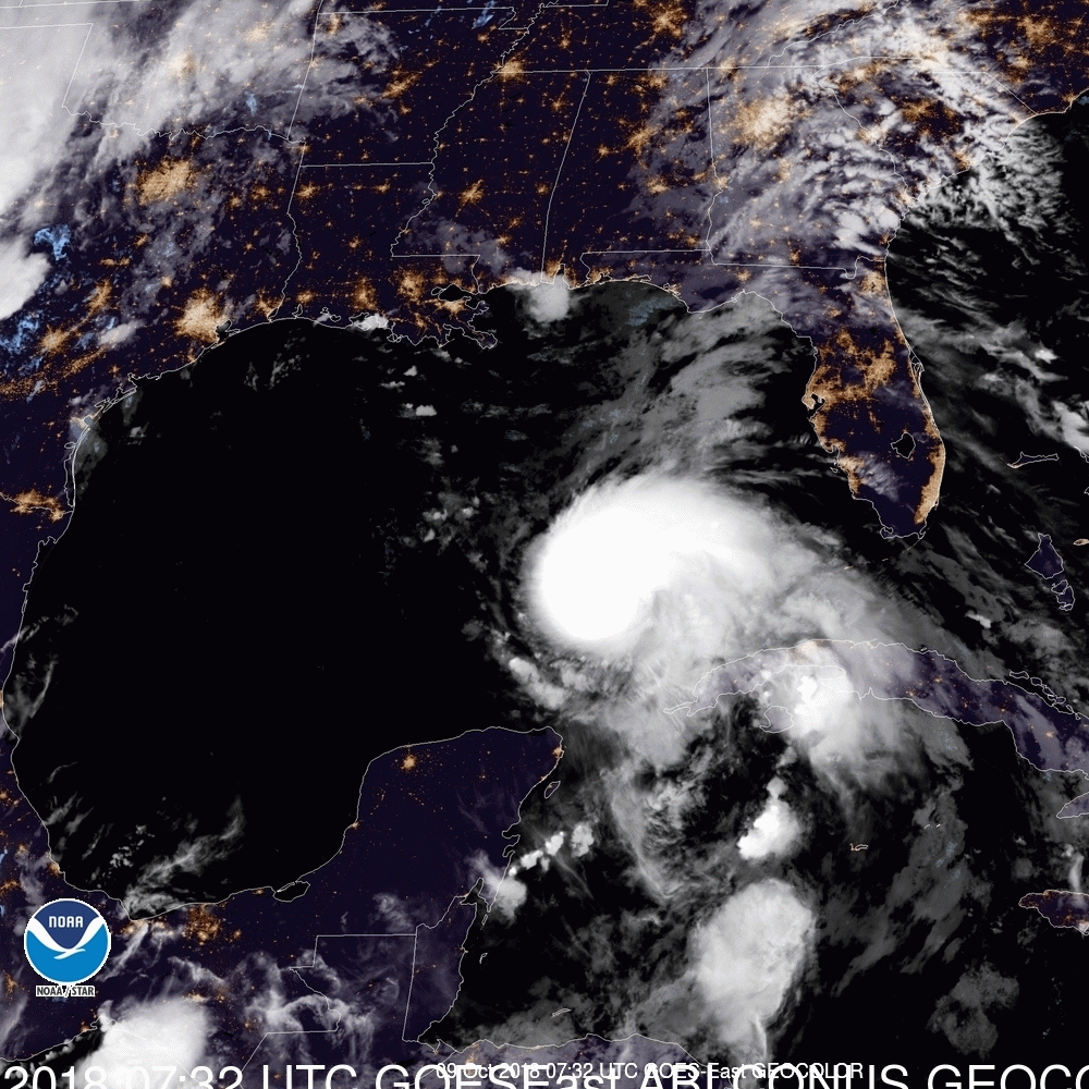
Note the bottom graphic is the currently color satellite loop looking at the SE US and the Gulf of Mexico prior to sunrise. Notice the city lights. My track has not changed since yesterday am and still centers around the Panama City area.
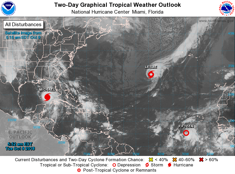
Elsewhere, Leslie is moving out to sea and TD #15 has formed. It is forecast to remain a weak system, probably becoming Tropical Storm Nadine later today or tomorrow. Dissipation is forecast in a few days.
Until next time, Matt.
Hurricane Michael at 05:00 this morning was moving NNW @ 12 mph with peak winds of 90 mph. Overnight pressure have stabilized at around 973 mbs. Shear is anticipated to decrease some today and Michael is expected to become a Cat 2 storm later today. The NHC is currently forecasting a 120 mph Cat 3 storm at landfall around noon tomorrow along the Florida Panhandle. The NHC's track has not changed since yesterday afternoon and the models are in very tight agreement. The eye remains cloud filled however a distinct eye should form later today as peak sustained winds reach around 100 mph.
Note Florida has received very little rainfall so far from Michael. This is due to it becoming a stronger system than expected which has drawn the moisture closer to its center.
Note the bottom graphic is the currently color satellite loop looking at the SE US and the Gulf of Mexico prior to sunrise. Notice the city lights. My track has not changed since yesterday am and still centers around the Panama City area.
Elsewhere, Leslie is moving out to sea and TD #15 has formed. It is forecast to remain a weak system, probably becoming Tropical Storm Nadine later today or tomorrow. Dissipation is forecast in a few days.
Until next time, Matt.