Good morning.
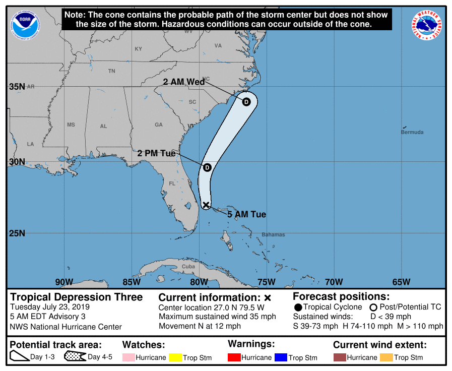
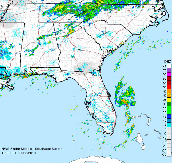
TD #3 formed this morning just off the coast of Central Florida. It may become a minimal tropical storm later today before dissipating tomorrow as shear from an approaching front to the north and west will disrupt it. The NHC says it is moving N @ 12 however if you look at radar images below you can see that a NE move has already started. In light of this it will probably miss the Carolinas. Even if it should brush them there won't be much left of it. Elsewhere a stalled frontal system along the northern Gulf of Mexico will likely bring rain and thunderstorms and possibly even a TD to the Florida Panhandle. There should not be enough time for anything significant to develop.
Until next time,
Matt.