Good morning.
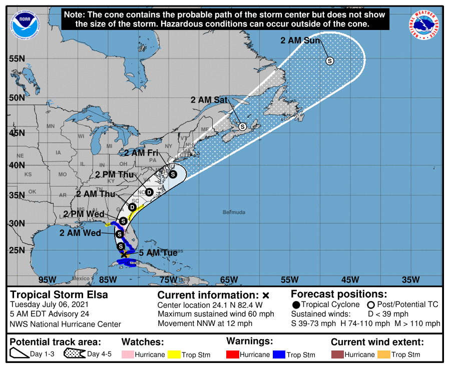
At 5 am TS Elsa was located in the vicinity of the Dry Tortugas and was moving NNW @ 12 mph. It is currently located about 20 miles to the east of where the NHC had anticipated it to be at this time. As a result the models and their track have shifted eastward. The NHC is now forecasting landfall about 40 miles to the east of where they had it yesterday and it is currently pretty much in line with my track from yesterday. My track has not changed.
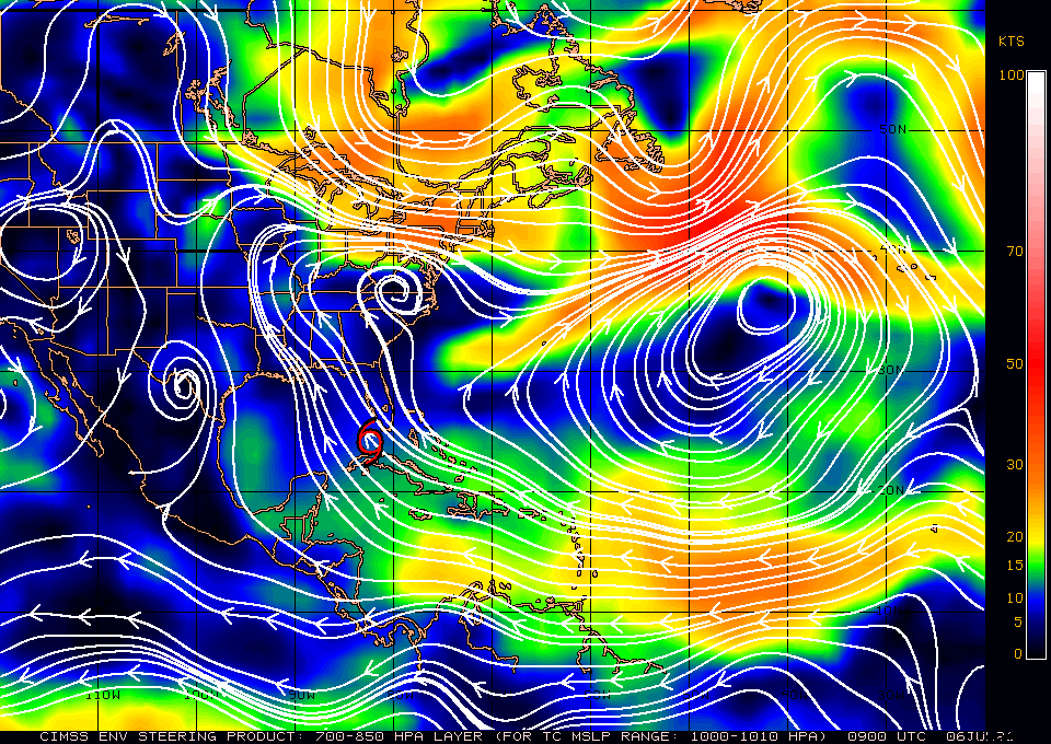
If you look at the wind shear analysis below you can see that Elsa has around 25-30 knots of shear over it. This will slow development though there is a possibility that it could have winds near 75 mph at landfall tomorrow.
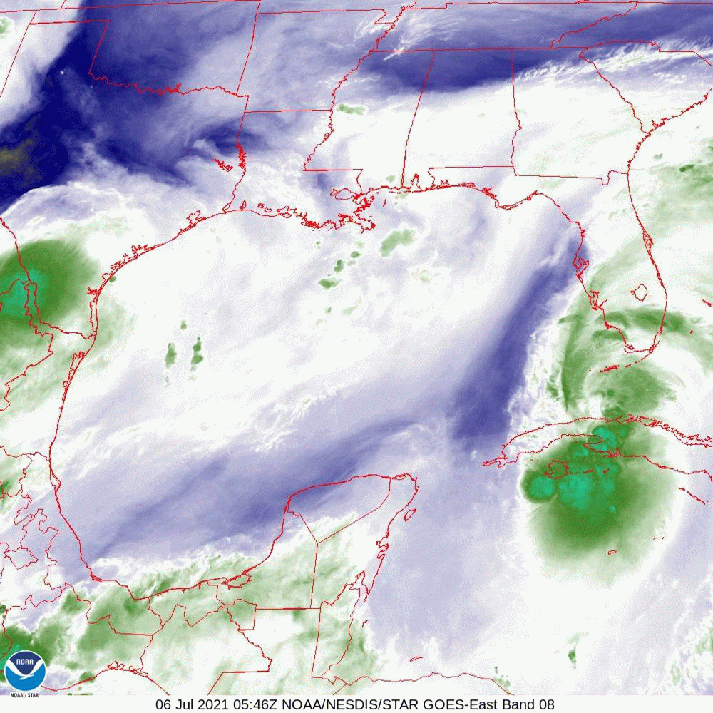
If you look at the water vapor loop below you will see that Elsa appears very ragged, having been disrupted by its course across Cuba with little weather near its center of circulation. The upper level low remains, now over Louisiana. If you look at the Florida radar below you can see it starting to move up through the Florida Straits. Its center is on the west side of the rain mass which is currently spreading across the Lower and Middle Florida Keys.
Overall not much has changed and my forecast from yesterday still holds. With a moist S to SW flow over South Florida expect scattered rain showers today, especially this afternoon.
My best to all.
Until next time,
Matt.
At 5 am TS Elsa was located in the vicinity of the Dry Tortugas and was moving NNW @ 12 mph. It is currently located about 20 miles to the east of where the NHC had anticipated it to be at this time. As a result the models and their track have shifted eastward. The NHC is now forecasting landfall about 40 miles to the east of where they had it yesterday and it is currently pretty much in line with my track from yesterday. My track has not changed.
If you look at the wind shear analysis below you can see that Elsa has around 25-30 knots of shear over it. This will slow development though there is a possibility that it could have winds near 75 mph at landfall tomorrow.
If you look at the water vapor loop below you will see that Elsa appears very ragged, having been disrupted by its course across Cuba with little weather near its center of circulation. The upper level low remains, now over Louisiana. If you look at the Florida radar below you can see it starting to move up through the Florida Straits. Its center is on the west side of the rain mass which is currently spreading across the Lower and Middle Florida Keys.
Overall not much has changed and my forecast from yesterday still holds. With a moist S to SW flow over South Florida expect scattered rain showers today, especially this afternoon.
My best to all.
Until next time,
Matt.