Good morning.
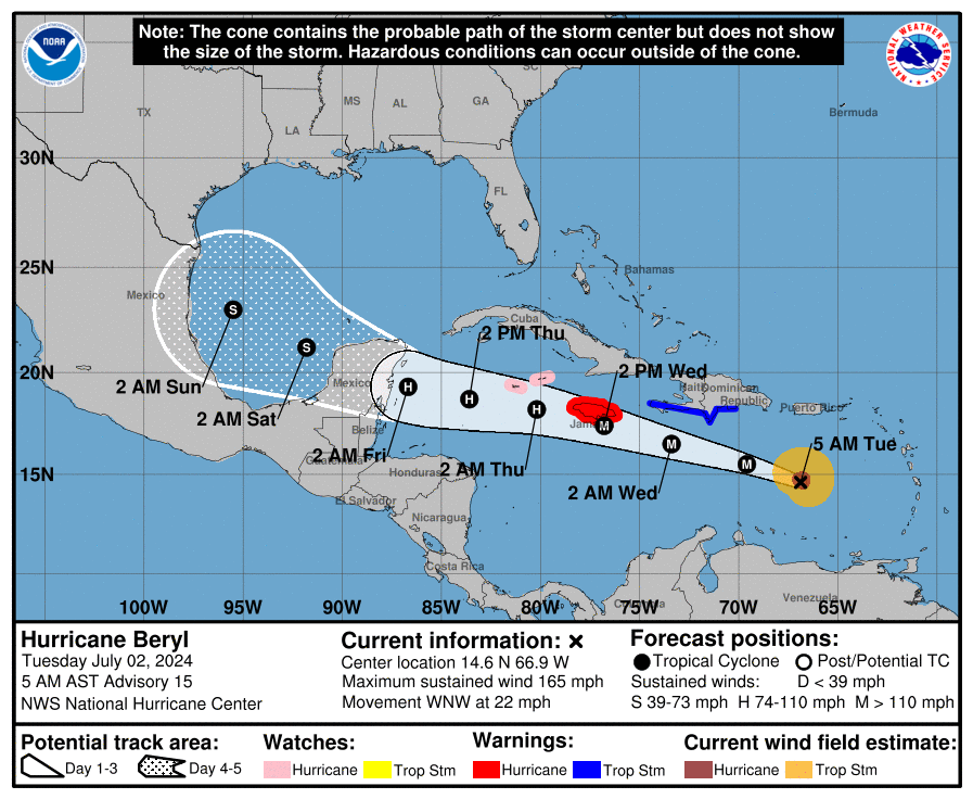
Overnight Beryl has intensified to a Cat 5 storm, see below. If you look at the water vapor loop below you will see that Beryl has taken a decided wobble/ move to the north and it is well north of where the NHC had forecast it to be at this time yesterday. In light of this their track has shifted a little north. If you look at the models below they have aslo shifted northward and now bring it close to southern Texas as a strong tropical storm on Sunday.
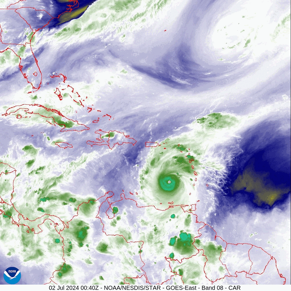
When it gets south of Hispaniola and Jamaica it will encounter significant shear out of the S and SW, you can see it on the water vapor loop. It is currently forecast to be a 120 mph Cat 3 storm as it approaches the south side of Jamaica. Due to the southerly shear and Jamaica's mountainous terrain, Jamaica will see a huge amount of rainfall. The hurricane force wind field is small with hurricane force winds forecast to extend only 20-25 miles to the north of the center when it is near Jamaica. It will be. close call for them tomorrow afternoon. Note the eye is only around 10 miles wide currently. Also note peak winds in a hurricane are at around 1500' above the ground. Those at or near this elevation will see enhanced winds.
Until next time,
Matt.
Overnight Beryl has intensified to a Cat 5 storm, see below. If you look at the water vapor loop below you will see that Beryl has taken a decided wobble/ move to the north and it is well north of where the NHC had forecast it to be at this time yesterday. In light of this their track has shifted a little north. If you look at the models below they have aslo shifted northward and now bring it close to southern Texas as a strong tropical storm on Sunday.
When it gets south of Hispaniola and Jamaica it will encounter significant shear out of the S and SW, you can see it on the water vapor loop. It is currently forecast to be a 120 mph Cat 3 storm as it approaches the south side of Jamaica. Due to the southerly shear and Jamaica's mountainous terrain, Jamaica will see a huge amount of rainfall. The hurricane force wind field is small with hurricane force winds forecast to extend only 20-25 miles to the north of the center when it is near Jamaica. It will be. close call for them tomorrow afternoon. Note the eye is only around 10 miles wide currently. Also note peak winds in a hurricane are at around 1500' above the ground. Those at or near this elevation will see enhanced winds.
Until next time,
Matt.