Good morning.
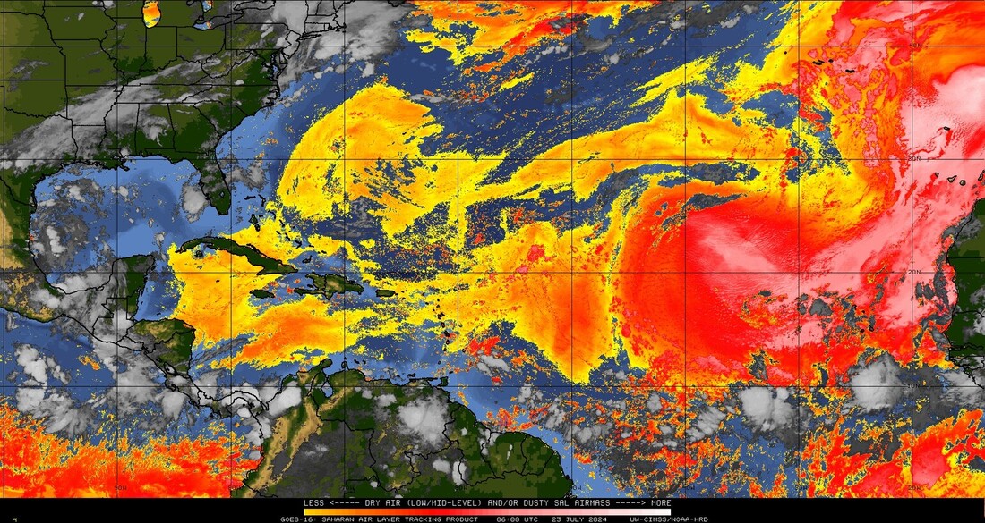
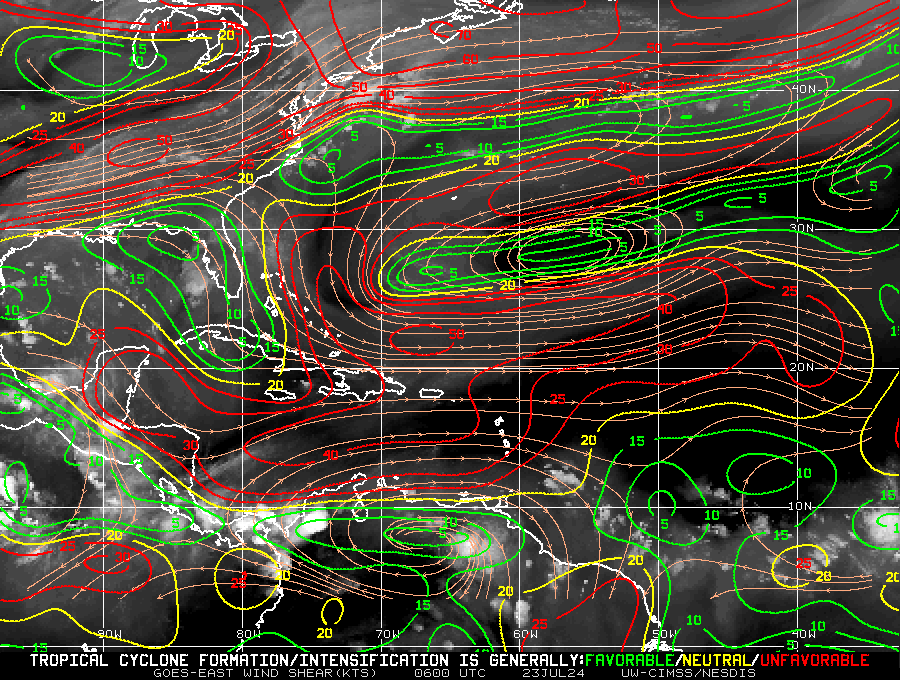
Just a quick update. The tropics have been quiet since Beryl made landfall in Texas. This has been due to large dust storms in North Africa providing abundant Saharan dust and dry air which has been pushed into the Tropical Atlantic by strong high pressure over the Atlantic. This has effectively shut down the Tropical Atlantic to tropical development. In addition if you look at the second diagram there is currently abundant wind shear over the Caribbean and Western Atlantic, (areas in red).
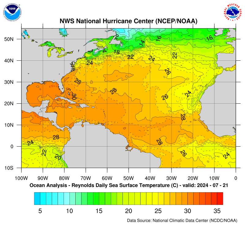
Also of note is the the forecast La Nina is likely to be late. Instead of arriving around now it will likely not develop until September. (Why we still have so much shear.) If that does occur, and the Saharan dust dissipates in time we should have a busy end of the season, September/October, however we may not see as many storms as originally forecast. However its not the absolute number that counts. Its where they go. If you look at the bottom diagram, Sea Surface Temperatures, you can see that the warmest waters are in the Gulf of Mexico, Western Caribbean and Bahamas. We'll need to watch these areas closely as they could support stronger storms.
Until next time,
Matt.
Just a quick update. The tropics have been quiet since Beryl made landfall in Texas. This has been due to large dust storms in North Africa providing abundant Saharan dust and dry air which has been pushed into the Tropical Atlantic by strong high pressure over the Atlantic. This has effectively shut down the Tropical Atlantic to tropical development. In addition if you look at the second diagram there is currently abundant wind shear over the Caribbean and Western Atlantic, (areas in red).
Also of note is the the forecast La Nina is likely to be late. Instead of arriving around now it will likely not develop until September. (Why we still have so much shear.) If that does occur, and the Saharan dust dissipates in time we should have a busy end of the season, September/October, however we may not see as many storms as originally forecast. However its not the absolute number that counts. Its where they go. If you look at the bottom diagram, Sea Surface Temperatures, you can see that the warmest waters are in the Gulf of Mexico, Western Caribbean and Bahamas. We'll need to watch these areas closely as they could support stronger storms.
Until next time,
Matt.