Good evening.
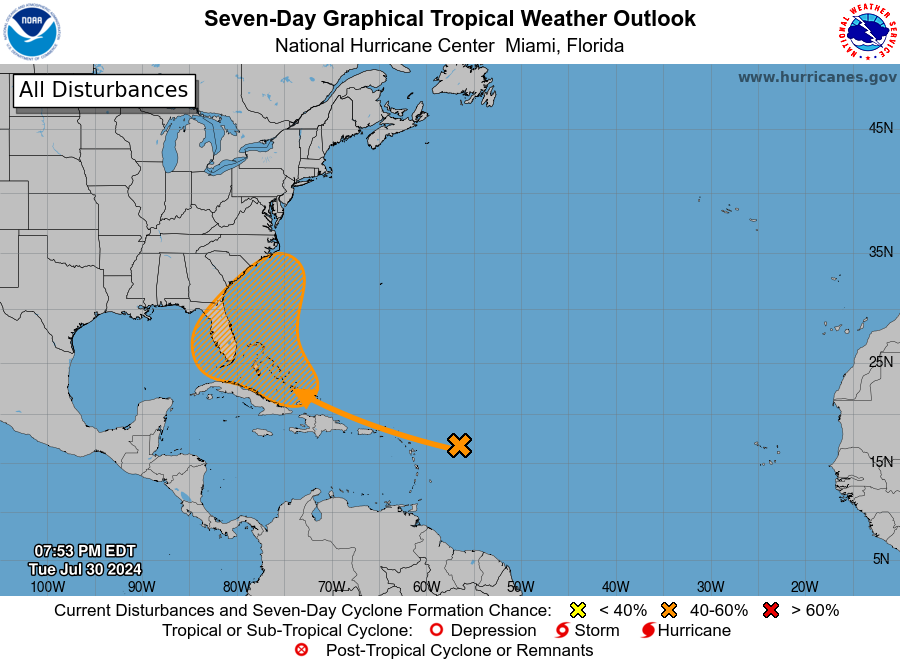
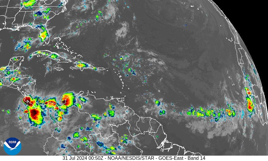
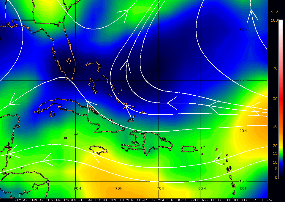
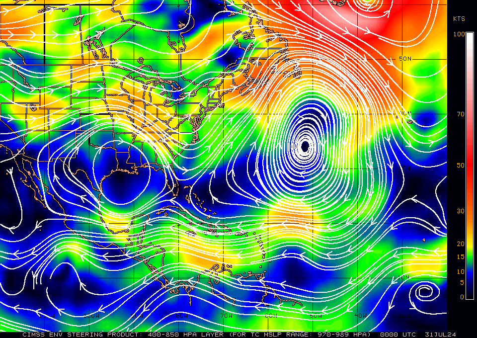
I'm writing about a potential system which currently does NOT exist. The NHC is giving an area of minimally disturbed weather a 50-60% chance of tropical development over the next 7 days. The NHC currently has the Bahamas, the whole state of Florida, the SE US coast and the northern coast of Cuba in its cone. In reality currently only the Bahamas appear to be at risk, however presently a storm does not exist. If you look at the Infra Red Satellite image below, second diagram, you can see just a few small showers. The third diagram, Saharan Air Layer Analysis, shows dry air and dust which surrounds the area in question. This is why it hasn't developed, however you will notice that once it gets into the region of the Bahamas the dry air lessens. In other words, it will be slow to develop as it will have to erode and moisten all of that dry air. Next if you look at the Surface map, 4th and 5th diagrams, you can see that if it does make it to the Bahamas, and were to develop, the steering forces would take it near the Bahamas and then N and NE away from the US.
Note the high pressures over the Gulf of Mexico and the Western Atlantic are not static and tend to move back and forth. Timing will be key with regards to the location of the window currently over the Bahamas. As it hasn't formed it is very difficult to make a precise forecast at this point in time.
However currently this is a low probability event. Even if it should develop it would be late in the forecast period and there's a good chance that it would miss Florida, and likely the US entirely. I'll be keeping an eye on it but currently am not overly concerned.
Until next time,
Matt.