Good morning.
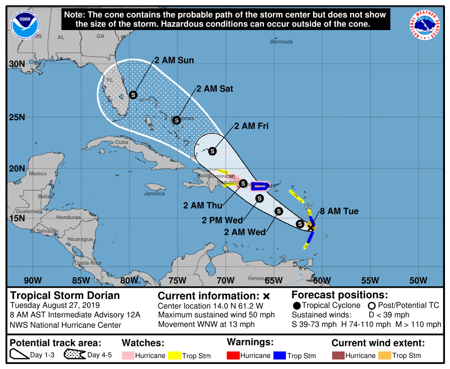
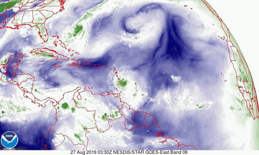
In reviewing the data on TS Dorian this morning a few things are to be noticed. First it is N and E of where the NHC had forecast it to be yesterday at this time. This is good news. This makes a move into the central Caribbean unlikely and reduces the risk of a South Florida landfall. In addition it has weakened. If you look at the second diagram, Saharan Air layer, you can see that it continues to be surrounded by dry air. This will limit development until it gets into the Bahamas. If you look at the wind Shear Analysis, 3rd diagram, you will see that other than a small window just north of Puerto Rico, there is a lot of hostile environment in front of it.
Lastly if you look at the water vapor loop, bottom diagram you will notice several features. First is TD #6 under going significant NE shear east of Florida (it will move out to sea), Dorian entering the NE Caribbean starting to encounter SW shear, the small blue window of low shear just north of Puerto Rico and lastly a cold front approaching the SE US. We currently have high pressure centered over South Florida, this should help to protect the southern 1/2 of the state. The approaching frontal system would tend to deflect the storm to the NE however high pressure is forecast to build over the Atlantic which could push Dorian toward central-north Florida or the Carolinas. It is still way too early to say. Steering forces remain weak over the Bahamas which will lead to greater uncertainty in the overall forecast.
Right now the risk to South Florida is low.
Dorian remains a small system and will be vulnerable to the adverse conditions in front of it. The NHC is currently not forecasting it to become a hurricane, though that could change. This is unlikely to become a major hurricane for anyone.
I will write again tomorrow. The possibility of further weakening or even dissipation are also possible so I would not get too hyped up about this one at this time.
Matt.