Good morning.
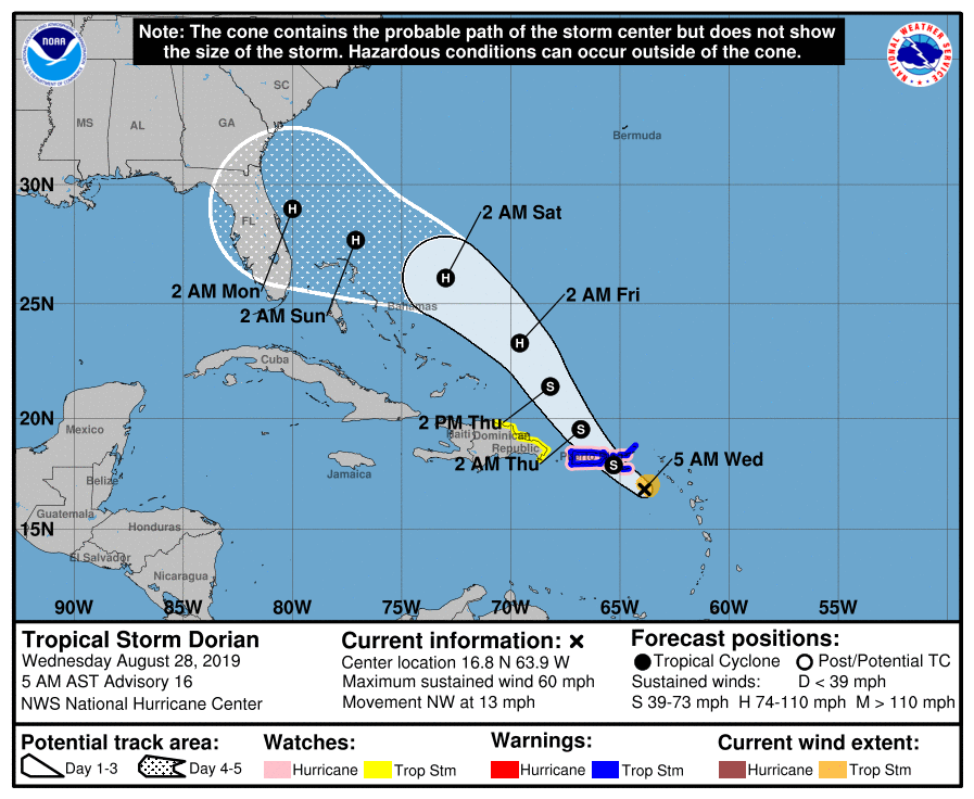
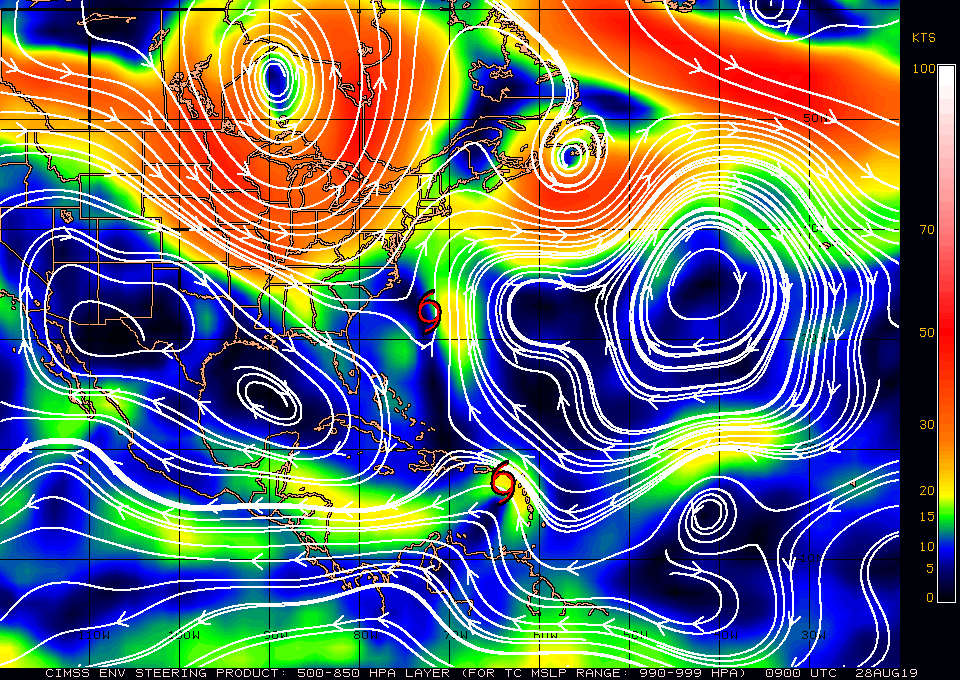
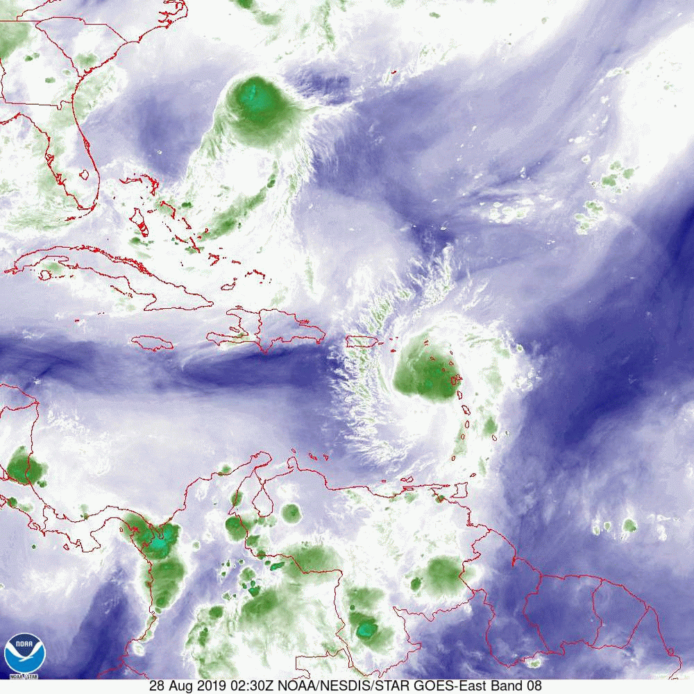
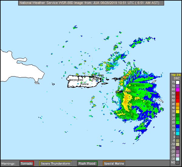
With regards to Dorian several things have changed since yesterday. First and most important is that it continues to track N and E of the NHC's forecast track. If you look below I have attached several graphics. First the current NHC forecast track, second a current surface map, third the current water vapor loop, fourth current live Puerto Rico Radar and lastly the numerous Ensemble Models. If you look at the water vapor loop you will notice several features. First is Erin spinning off the SE US coast, it is forecast to move out to sea, second is Dorian in the extreme NE Caribbean Sea. Notice it continues to be moving east of the NHC's track and will likely pass just east of Puerto Rico today. The next thing to notice is an upper level low right between Erin and Dorian. This is the wild card and will likely influence just where Dorian goes. The SW upper level flow on Dorian's side of it is what is drawing Dorian further east. Conversely once it gets to the other side of it it will tend to push it further west. Right now it appears fairly stationary though that is likely to change. If Dorian moves directly over it it would likely weaken it significantly, if it moves to the NE it could actually enhance it. The behavior of upper level lows can be very hard to predict, thus it being the wild card. We'll have to see. If you look at the Surface Map you will notice a large open area between isobars north of Hispaniola bordered to its north by the area between roughly Daytona and southern South Carolina. This is currently the window at which Dorian is heading. This will likely change some but the risk to South Florida continues to lessen. Note due to the more eastern track it will take longer for Dorian to approach the US and the NHC is currently forecasting it to a Cat 2 with landfall Monday. Once it gets to the other side of the upper level low shear will decrease and further intensification will be possible. In addition the longer it takes the more likely that conditions will change and there is still the possibility of it staying just off shore and tracking NE. If you look at the models there is huge divergence however with the continuing eastward trend the more northern tracks will become more likely.
Interests from Titusville to the Carolinas need to keep a close eye on this one as a longer course over warm water and the lack of significant land interaction with Puerto Rico or Hispaniola, could lead to an even stronger system.
I or possibly my daughter Cassie, who is brilliant and apprenticing with me, will write again tomorrow morning.
Matt.