Good morning.
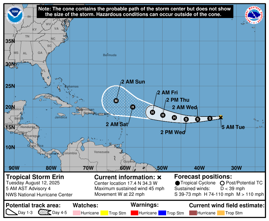
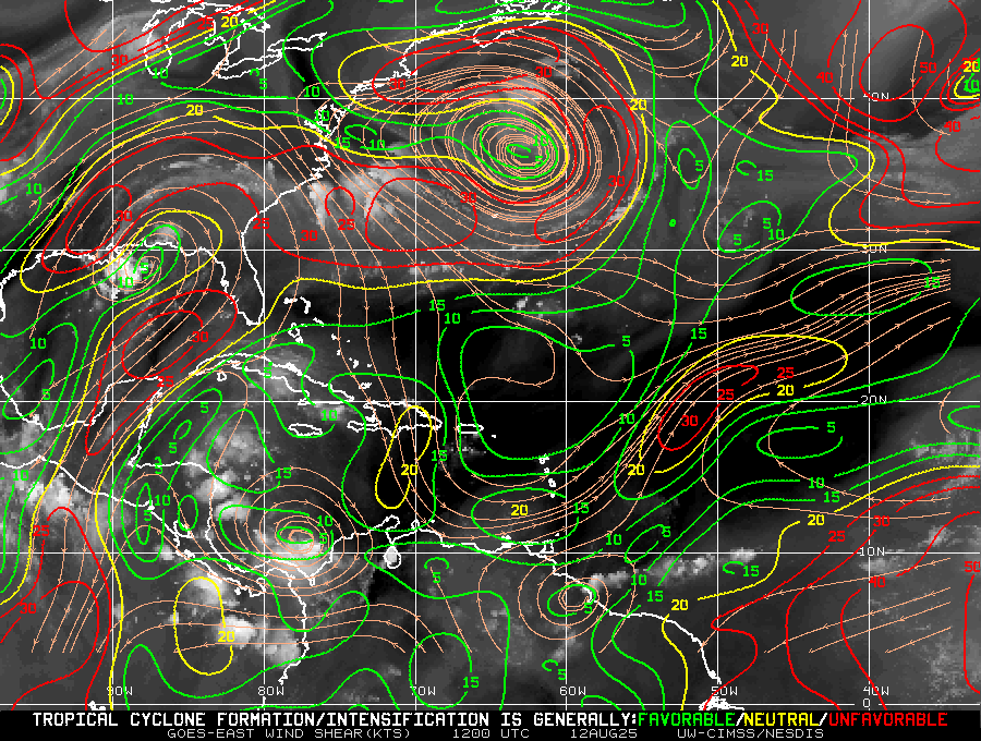
Just a quick update. Tropical storm Erin is currently headed generally toward Florida however it is not likely to hit the state nor the US. If you look at the SAL diagram 3 below you can see that is encountering a lot of dry air and has a lot more to pass through. Next notice the forecast surface map for 4 days out as it approaches the Bahamas. It will likely turn north before reaching the Bahamas and then NE towards a stalled frontal boundary extending from the Carolinas out into the Atlantic.
I'll be watching it however it is not likely to threaten the US. After it passes through the dry air it should intensify and hopefully pull a lot of heat out of the ocean in the process.
Until next time,
Matt.