Good afternoon.
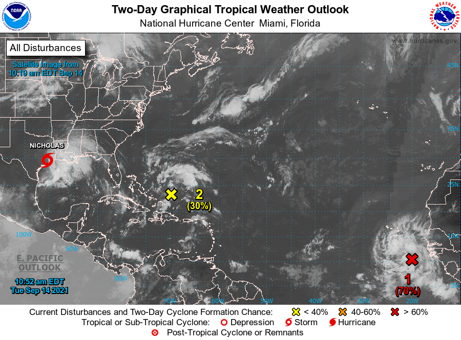
Just a quick note. The tropical wave over Africa that I spoke about last week has emerged off the coast and the NHC is giving it a 70% chance of development. Almost all of the current models take it out to sea, missing the US. It is however early and its pretty far south, around 10.5 degrees N, so until it forms and actually starts moving to the WNW we'll need to keep an eye on it. Saharan dust and dry air to its west should help to slow development.
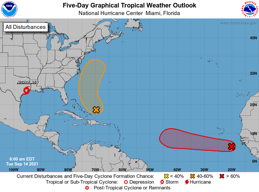
On the good news front if you look at the IR of Africa below, it appears that the Cape Verde season is winding down over Africa and the Inter-Tropical Convergence Zone is starting to drift southward. Once it gets south of around 8 degrees the Cape Verde season usually ends and we'll need to shift our attention to the Western Caribbean Sea and the Gulf of Mexico. If you look at the Wind Shear Analysis below you will notice high shear, almost 60 knots, over the entire state of Florida. This should protect the state for at least the next several days, hopefully longer.
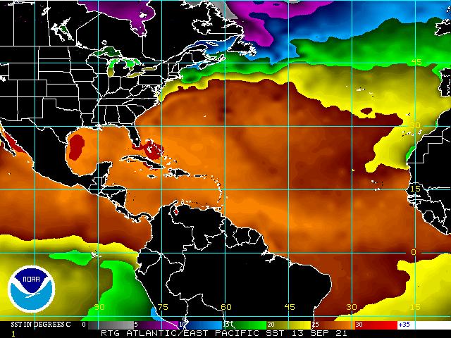
If you look at Sea Surface Temps, bottom diagram you will see 2 pockets of hot water left. One in the Western Gulf of Mexico which Nicholas has taped into and will hopefully remove and one over the Bahamas where a disturbance is currently located which should drift north and hopefully take some of that heat with it. It's amazing how these system will find the warm water.
Looking okay for now.
Until next time,
Matt.
Just a quick note. The tropical wave over Africa that I spoke about last week has emerged off the coast and the NHC is giving it a 70% chance of development. Almost all of the current models take it out to sea, missing the US. It is however early and its pretty far south, around 10.5 degrees N, so until it forms and actually starts moving to the WNW we'll need to keep an eye on it. Saharan dust and dry air to its west should help to slow development.
On the good news front if you look at the IR of Africa below, it appears that the Cape Verde season is winding down over Africa and the Inter-Tropical Convergence Zone is starting to drift southward. Once it gets south of around 8 degrees the Cape Verde season usually ends and we'll need to shift our attention to the Western Caribbean Sea and the Gulf of Mexico. If you look at the Wind Shear Analysis below you will notice high shear, almost 60 knots, over the entire state of Florida. This should protect the state for at least the next several days, hopefully longer.
If you look at Sea Surface Temps, bottom diagram you will see 2 pockets of hot water left. One in the Western Gulf of Mexico which Nicholas has taped into and will hopefully remove and one over the Bahamas where a disturbance is currently located which should drift north and hopefully take some of that heat with it. It's amazing how these system will find the warm water.
Looking okay for now.
Until next time,
Matt.