Good morning.
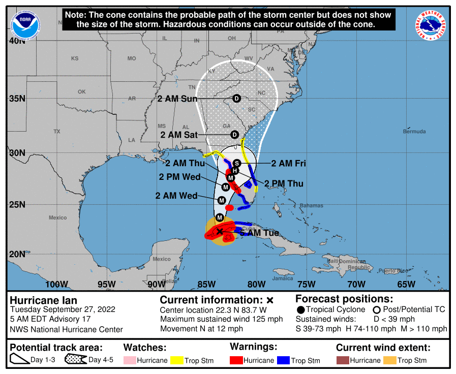
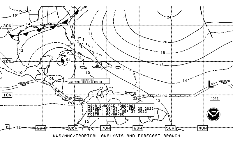
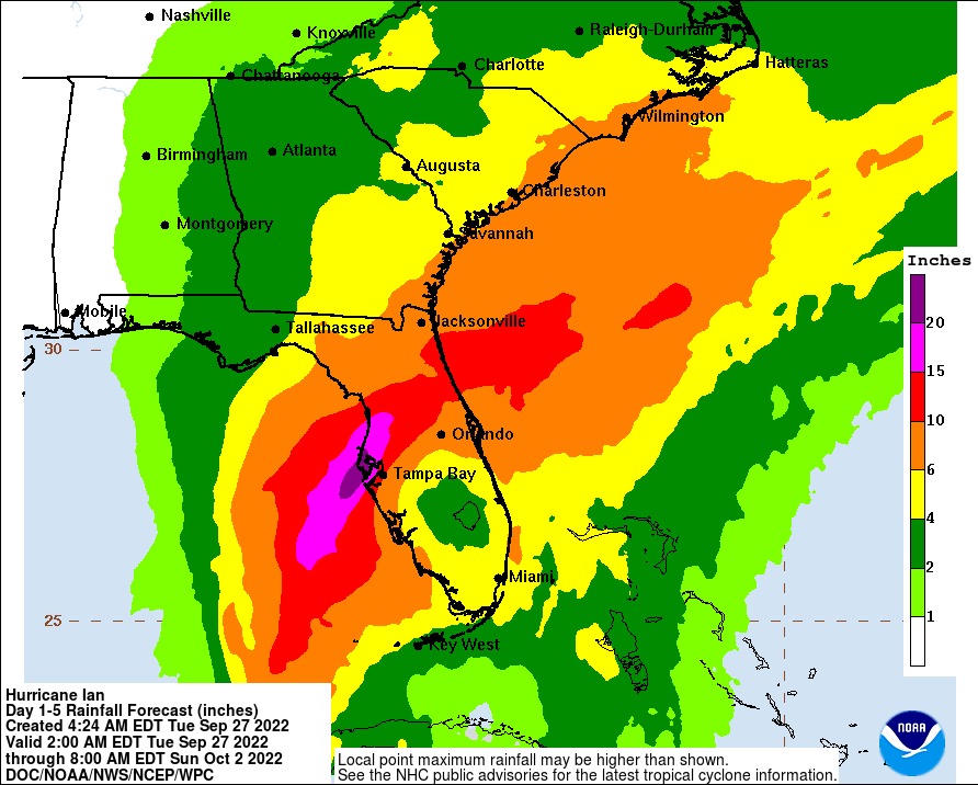
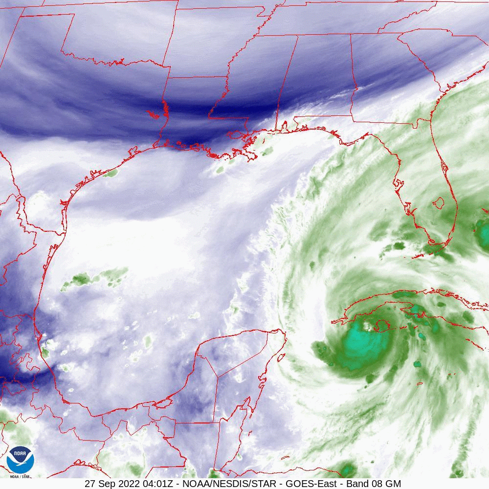
At 5 am Hurricane Ian was making landfall over Western Cuba, see WVL below. You will also notice the cold front slowly pushing south towards North Florida. It is currently forecast to be in the Tampa Bay region on Thursday morning as Ian approaches the West Coast of Florida. Ian is currently moving just slightly west of due north and may not make it to 84.0 degrees west. It is already starting to slow down and should markedly slow down Wednesday and Thursday. This will lead to a prolonged rain event for the Florida Peninsula and wind event for the affected areas of the West Coast. It is currently forecast to be a 115-120 mph Cat 3 Hurricane at landfall in the Tampa Bay region. Hurricane force winds are forecast to extend 40 miles to the east of the center with Major Hurricane force winds extending 15-20 miles from the center. Storm surge will be significant with the slow approach to the coast. This will be a severe event.
With its slow motion wobbles will become very significant and could lead to landfalls north or south of the current forecast, areas from Ft Myers to the Big Bend should continue to prepare, Tampa Bay remains at highest risk.
I will post again this evening after we see how it progresses today.
Until then,
Matt.