Good morning.
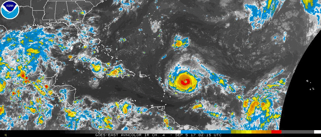
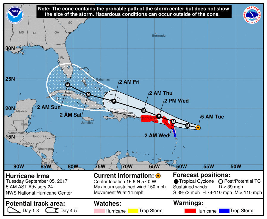
At 5 am Hurricane Irma was located at 16.6 N and 57.0 W and was moving W @ 14 mph. Irma is a large and powerful hurricane now with peak winds of 150 mph. It's wind field is much larger than Harvey's was at this time. Irma remains south of where the NHC anticipated it to be yesterday and so far today as well. I anticipate models will continue to shift a little southward.
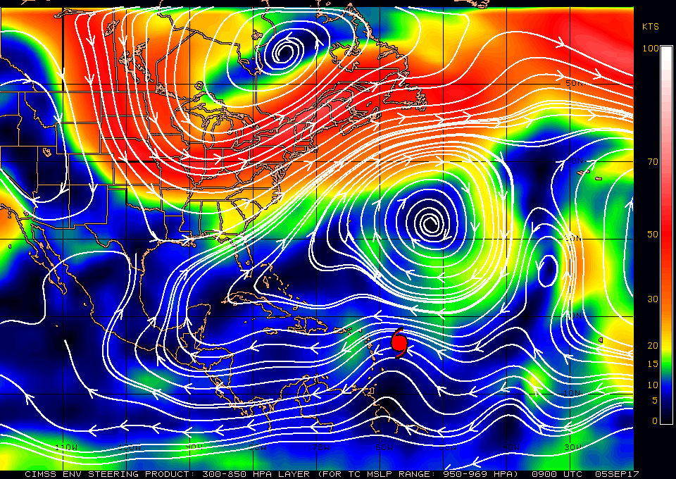
My current track, south of the NHC's, takes Irma into the extreme NE Caribbean, over Puerto Rico, over the north coast of the Dominican Republic and along or over the north coast of Cuba. Due to weakness of the southern end of the frontal trough over Florida a recurve to the east of Florida is becoming unlikely. In looking at the Surface Map below the problem for Florida and the US will be when the recurve to the N and NE occurs. Currently the west coast of Florida appears to be at greatest risk. ? Ft Myers to Tampa? If it hits the DR and Cuba it would be a much weaker system, The high pressure north of it is expected to shift a little to the west, which could bring it further west before it recurves. It will recurve and a Florida landfall appears likely. It is still early and things could change. If it tracks down Cuba and slows a turn further east is possible. On the current NHC track, and mine, South Florida would receive peak winds in the 40s-50s. If it recurved earlier and came in over Naples or Florida Bay, South Florida would receive hurricane conditions.
We're just going to have to wait and see. For now we should all make preparations for at least a tropical storm. Because it will be fairly close to us when the recurve occurs and we may be in weather when it occurs, we should probably prepare for a hurricane as well, though hopefully South Florida won't experience one.
I'll write again this evening and will probably go to twice daily reports until it is past us.
Matt
At 5 am Hurricane Irma was located at 16.6 N and 57.0 W and was moving W @ 14 mph. Irma is a large and powerful hurricane now with peak winds of 150 mph. It's wind field is much larger than Harvey's was at this time. Irma remains south of where the NHC anticipated it to be yesterday and so far today as well. I anticipate models will continue to shift a little southward.
My current track, south of the NHC's, takes Irma into the extreme NE Caribbean, over Puerto Rico, over the north coast of the Dominican Republic and along or over the north coast of Cuba. Due to weakness of the southern end of the frontal trough over Florida a recurve to the east of Florida is becoming unlikely. In looking at the Surface Map below the problem for Florida and the US will be when the recurve to the N and NE occurs. Currently the west coast of Florida appears to be at greatest risk. ? Ft Myers to Tampa? If it hits the DR and Cuba it would be a much weaker system, The high pressure north of it is expected to shift a little to the west, which could bring it further west before it recurves. It will recurve and a Florida landfall appears likely. It is still early and things could change. If it tracks down Cuba and slows a turn further east is possible. On the current NHC track, and mine, South Florida would receive peak winds in the 40s-50s. If it recurved earlier and came in over Naples or Florida Bay, South Florida would receive hurricane conditions.
We're just going to have to wait and see. For now we should all make preparations for at least a tropical storm. Because it will be fairly close to us when the recurve occurs and we may be in weather when it occurs, we should probably prepare for a hurricane as well, though hopefully South Florida won't experience one.
I'll write again this evening and will probably go to twice daily reports until it is past us.
Matt