Good morning.
Just a quick update. Things continue to look good in the tropics. An area of low pressure in the extreme SW Gulf of Mexico is forecast to drift NE and eventually east. The NHC is currently giving it a 40% chance of tropical development over the next 5 days. If you look at the Surface Map below you can see that the steering forces will head it generally toward the Big Bend area of Florida. High wind shear over the northern Gulf of Mexico however should prevent any significant development.
Sea surface temperatures, bottom diagram, fortunately are continuing to moderate.
Until next time, Matt.
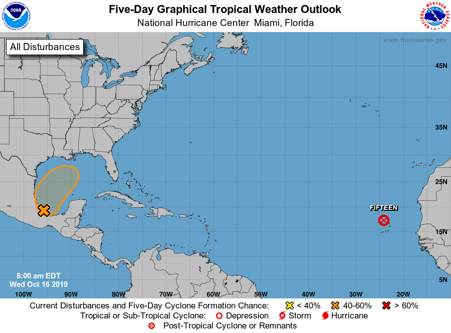