Good morning.
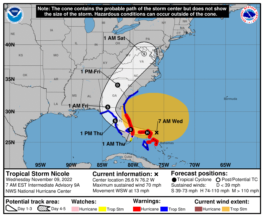
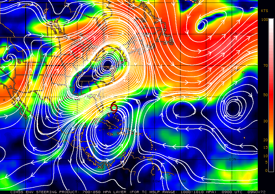
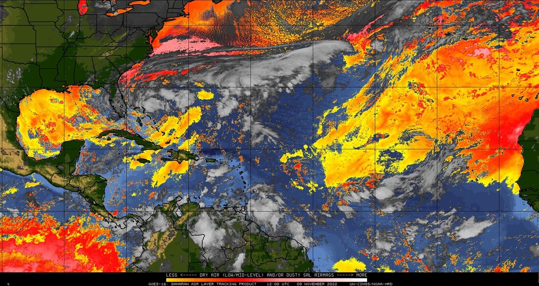
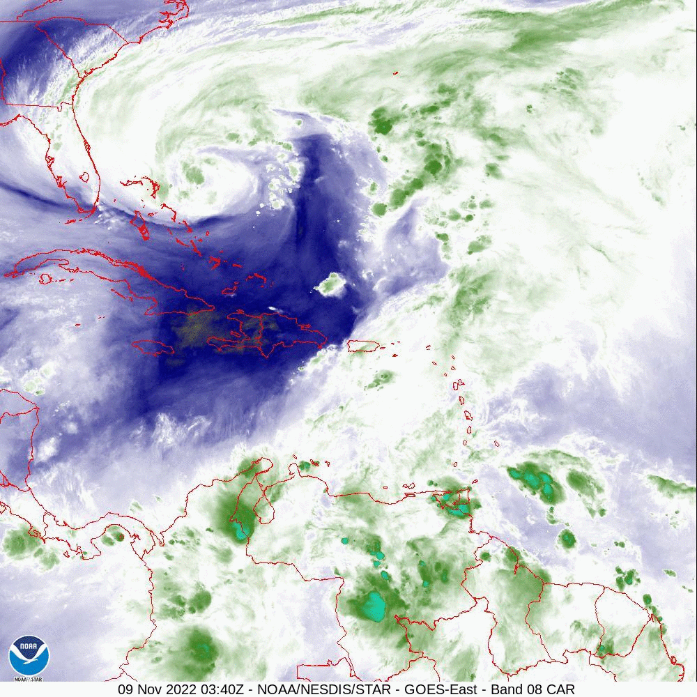
TS Nicole has changed little since yesterday. If you look at the Water Vapor Loop (WVL) and the Surface Map below you will notice a few things. First it has moved a little south of where it was forecast to be at this time yesterday. Next the upper level low that it was embedded in has now moved to the south and Nicole is now moving along it's northern periphery. Next on the WVL notice there is not a lot of green (convection) associated with it at present, mostly just white which is water vapor. The latest convection, near the center now appears to be moving to the west. There is not a lot of weather to the south of the center. On its current track it should make landfall in the Jupiter area with greatest wind and surge from Jupiter to Melbourne. Tropical storms conditions will be likely along the Florida East Coast from Palm Beach County northward. Peak winds are forecast to be in the 70-75 mph range, (Jupiter to Melbourne) with 40-60 mph elsewhere. Miami-Dade County should see winds in the 20s with passing showers. Areas north of the center could see a fair amount of rainfall. Its tropical storm wind field should arrive around 5 pm this evening for areas closest to its path with landfall anticipated around 1 am tomorrow morning.
Dry air and shear have continued to hamper Nicole and the NHC is not forecasting much if any further strengthening.
Best wishes to those in its path, though this should not be an extreme event like Ian.
Until next time,
Matt.