Good morning.
Today marks the first day of the Atlantic hurricane season, which will run until November 30. Long-term averages for the number of named storms, hurricanes, and major hurricanes are 14, 7, and 3, respectively. The list of names for 2022 is as follows:
Alex, Bonnie, Colin, Danielle, Earl, Fiona, Gaston, Hermine, Ian, Julia, Karl, Lisa, Martin, Nicole, Owen Paula, Richard, Shary, Tobias, Virginie and Walter .
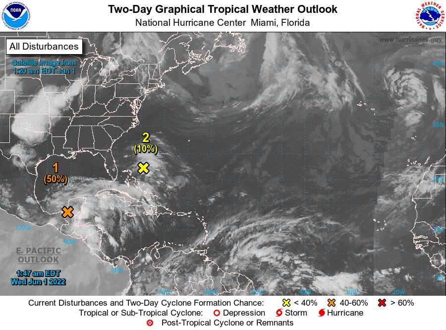
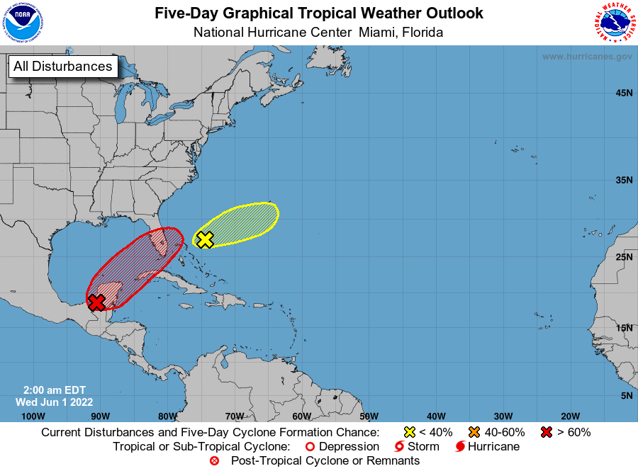
I am writing about an area of disturbed weather over the Yucatan Peninsula and the NW Caribbean Sea. The NHC is currently giving it a 70% chance for a tropical depression to form within the next 5 days. There is currently an old frontal boundary in the region of lake Okeechobee which would tend to draw whatever weather that does develop towards SW Florida. Fortunately wind shear is very high over the Gulf of Mexico and even if it should develop it is unlikely to become more than a weak to medium strength tropical storm. Hurricane conditions would be very unlikely. As no center of circulation currently exists it would be very difficult to predict exactly where it would go at this time however the Ft Myers area currently appears to be at greatest risk. Whether or not tropical development occurs anticipate rain across South Florida the next few days greatest on Friday and Saturday.
I'll be following it and will keep you posted.
Until next time,
Matt.
Today marks the first day of the Atlantic hurricane season, which will run until November 30. Long-term averages for the number of named storms, hurricanes, and major hurricanes are 14, 7, and 3, respectively. The list of names for 2022 is as follows:
Alex, Bonnie, Colin, Danielle, Earl, Fiona, Gaston, Hermine, Ian, Julia, Karl, Lisa, Martin, Nicole, Owen Paula, Richard, Shary, Tobias, Virginie and Walter .
I am writing about an area of disturbed weather over the Yucatan Peninsula and the NW Caribbean Sea. The NHC is currently giving it a 70% chance for a tropical depression to form within the next 5 days. There is currently an old frontal boundary in the region of lake Okeechobee which would tend to draw whatever weather that does develop towards SW Florida. Fortunately wind shear is very high over the Gulf of Mexico and even if it should develop it is unlikely to become more than a weak to medium strength tropical storm. Hurricane conditions would be very unlikely. As no center of circulation currently exists it would be very difficult to predict exactly where it would go at this time however the Ft Myers area currently appears to be at greatest risk. Whether or not tropical development occurs anticipate rain across South Florida the next few days greatest on Friday and Saturday.
I'll be following it and will keep you posted.
Until next time,
Matt.