Good morning.
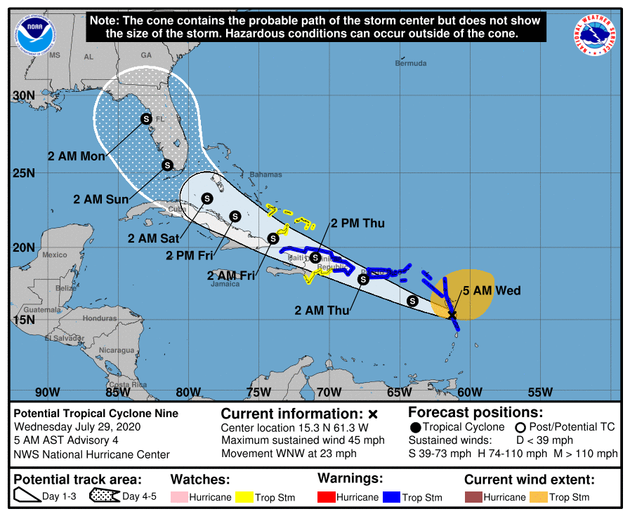
At 5 am the approximated center of Potential Tropical Cyclone #9 was located in the region of Dominica. A defined center of circulation still does not exist. Yesterday there were two areas of spin, one to the SW and one to the NE along the elongated trough of low pressure. Yesterday afternoon the NE one appeared as if it would dominate, and highest winds are in that region; however overnight deep convection over the SW center is now prevailing and it looks like this will become the center of circulation and this is the area that the NHC is now focusing on. Note until a defined center exists the forecasts have a high degree of uncertainty. If the NE one should reestablish a track east of the Bahamas could occur, however this appears unlikely now.
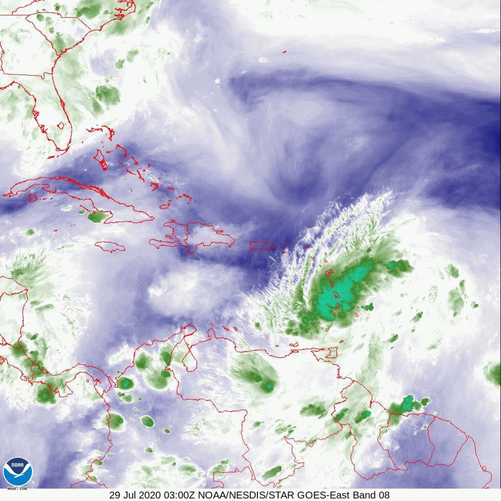
If you look at the Water Vapor Loop below you will notice that most of the convection has moved into the Caribbean and is SW of where the NHC track currently lies. Note my first forecast on this system, when the models were taking it towards Bermuda, I stated that Florida should be ok UNLESS it got into the Caribbean south of us. This appears to be occurring. High pressure remains over South Florida and for now doesn't appear to be moving. In light of this and its apparent more southerly track my current track, which is south and west of the NHC's takes it over Hispaniola, into Cuba then into the west coast of Florida with the area between Tampa and Cedar Key being at greatest risk. Fortunately there is a lot of shear, dry air and land between it and Florida and it is likely to be only a tropical storm or Cat 1 hurricane. Again it is still too early to say and the forecast is likely to continue to change. Hopefully it will be significantly disrupted.
I'll write again tomorrow, sooner if significant changes should occur.
Matt.
At 5 am the approximated center of Potential Tropical Cyclone #9 was located in the region of Dominica. A defined center of circulation still does not exist. Yesterday there were two areas of spin, one to the SW and one to the NE along the elongated trough of low pressure. Yesterday afternoon the NE one appeared as if it would dominate, and highest winds are in that region; however overnight deep convection over the SW center is now prevailing and it looks like this will become the center of circulation and this is the area that the NHC is now focusing on. Note until a defined center exists the forecasts have a high degree of uncertainty. If the NE one should reestablish a track east of the Bahamas could occur, however this appears unlikely now.
If you look at the Water Vapor Loop below you will notice that most of the convection has moved into the Caribbean and is SW of where the NHC track currently lies. Note my first forecast on this system, when the models were taking it towards Bermuda, I stated that Florida should be ok UNLESS it got into the Caribbean south of us. This appears to be occurring. High pressure remains over South Florida and for now doesn't appear to be moving. In light of this and its apparent more southerly track my current track, which is south and west of the NHC's takes it over Hispaniola, into Cuba then into the west coast of Florida with the area between Tampa and Cedar Key being at greatest risk. Fortunately there is a lot of shear, dry air and land between it and Florida and it is likely to be only a tropical storm or Cat 1 hurricane. Again it is still too early to say and the forecast is likely to continue to change. Hopefully it will be significantly disrupted.
I'll write again tomorrow, sooner if significant changes should occur.
Matt.