Good morning.
I wasn't going to write about Bertha because it poses little threat to anyone, however yesterday afternoon I was watching one of the news stations on TV and the headline read,
" 116 million people may be affected by huge Tropical Storm Bertha."
What a bunch of hooey !
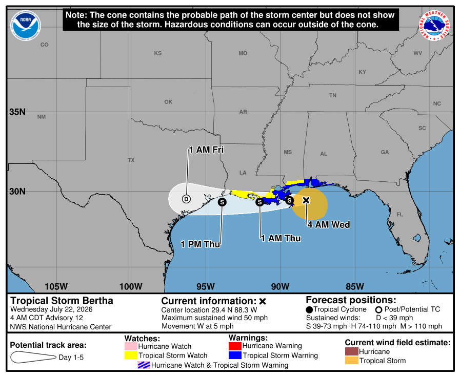
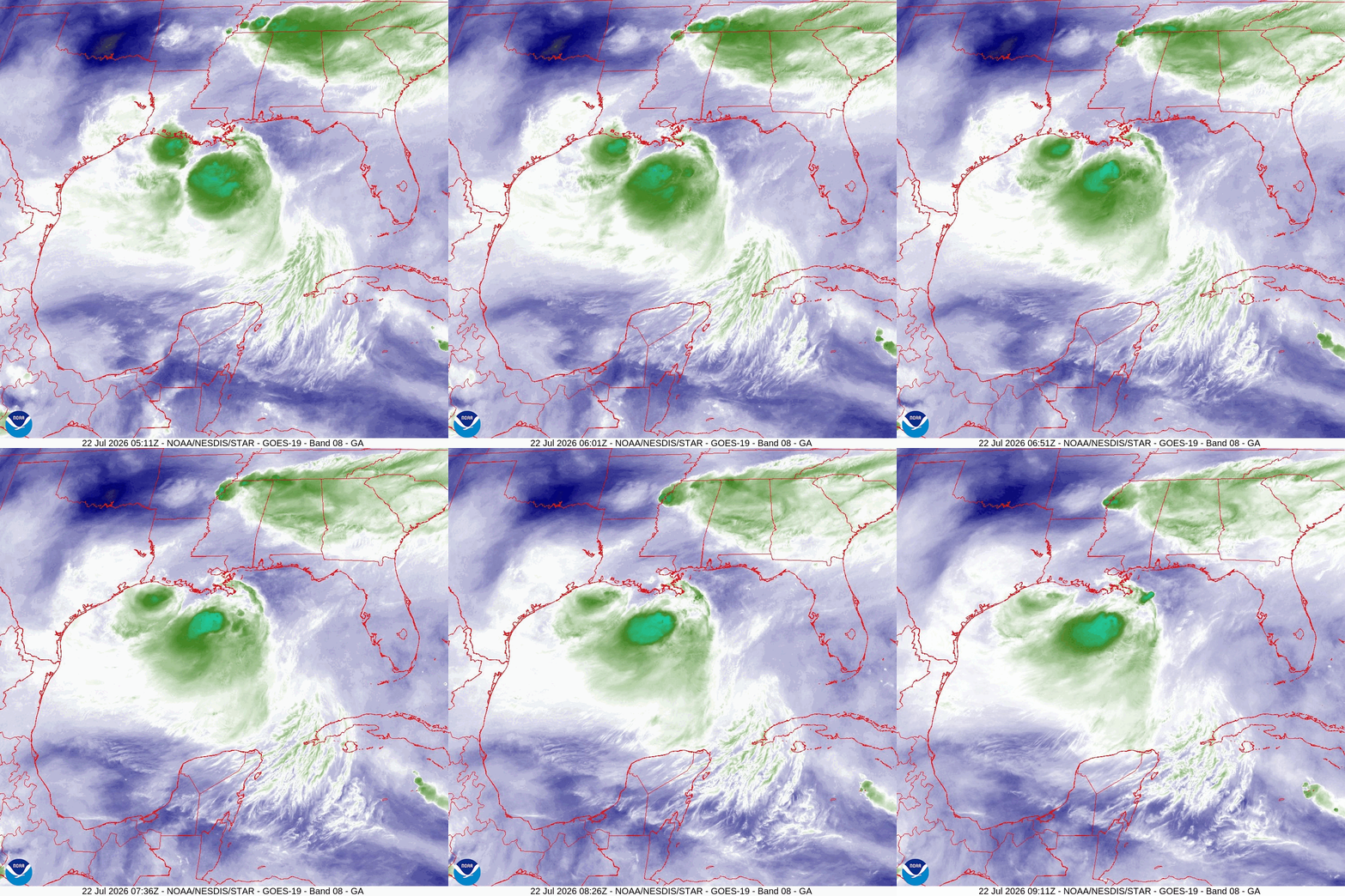
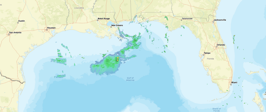
At 5 am this morning TS Bertha REMAINS an extremely poorly organized storm. Its center is currently headed towards New Orleans and in fact may pass over it however they will experience little associated weather. Due to 25 to 30 knots of NE shear Bertha is an uncoupled system. This means that most of its associated weather is displaced far from the center. The core of tropical systems are located about 1600 feet above the surface. For weak systems, which Bertha is, winds are brought to the surface by rain bands. If you look at the radar image bottom diagram you will see that there is little rain near the center of Bertha. Most is located well SW of the center in the Gulf, that is where the peak winds will be. I anticipate little rain or winds, ? 30s peak?, for Louisiana. Bertha will likely continue to weaken today. With land interactions today and the displaced convection to the SW we may see the current center dissipate and a new center could form closer to the area of deep convection to the SW. That is the only scenario that could strengthen Bertha, a little. The only area at risk of any weather is Southern Texas where if the area of convection persists, may see localized heavy rainfall. That would not be near the current track.
Best wishes to all.
Until next time,
Matt.
I wasn't going to write about Bertha because it poses little threat to anyone, however yesterday afternoon I was watching one of the news stations on TV and the headline read,
" 116 million people may be affected by huge Tropical Storm Bertha."
What a bunch of hooey !
At 5 am this morning TS Bertha REMAINS an extremely poorly organized storm. Its center is currently headed towards New Orleans and in fact may pass over it however they will experience little associated weather. Due to 25 to 30 knots of NE shear Bertha is an uncoupled system. This means that most of its associated weather is displaced far from the center. The core of tropical systems are located about 1600 feet above the surface. For weak systems, which Bertha is, winds are brought to the surface by rain bands. If you look at the radar image bottom diagram you will see that there is little rain near the center of Bertha. Most is located well SW of the center in the Gulf, that is where the peak winds will be. I anticipate little rain or winds, ? 30s peak?, for Louisiana. Bertha will likely continue to weaken today. With land interactions today and the displaced convection to the SW we may see the current center dissipate and a new center could form closer to the area of deep convection to the SW. That is the only scenario that could strengthen Bertha, a little. The only area at risk of any weather is Southern Texas where if the area of convection persists, may see localized heavy rainfall. That would not be near the current track.
Best wishes to all.
Until next time,
Matt.