Good morning.
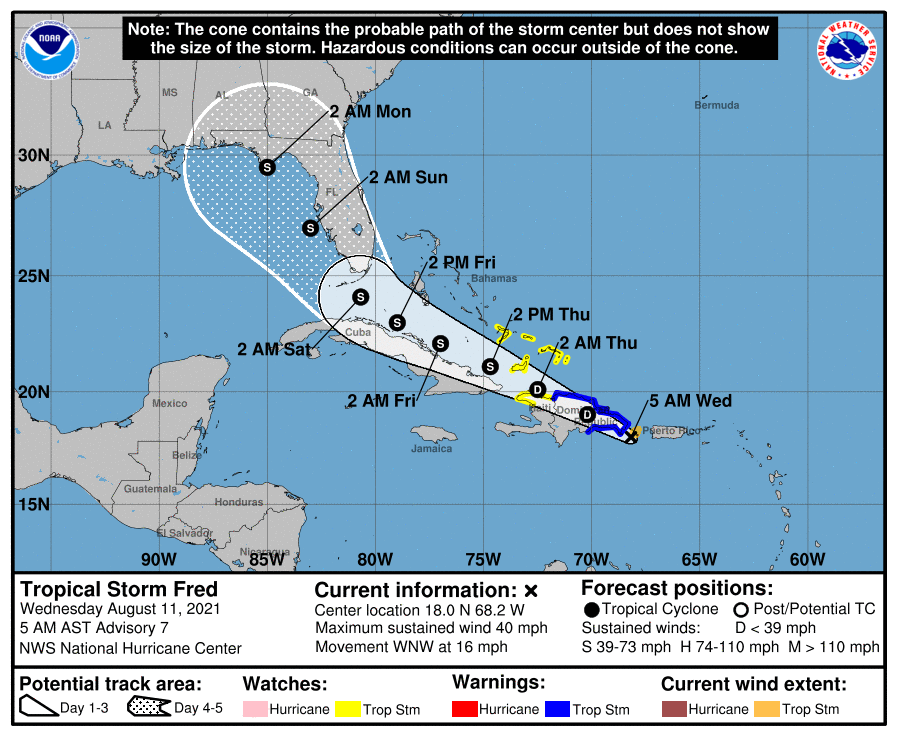
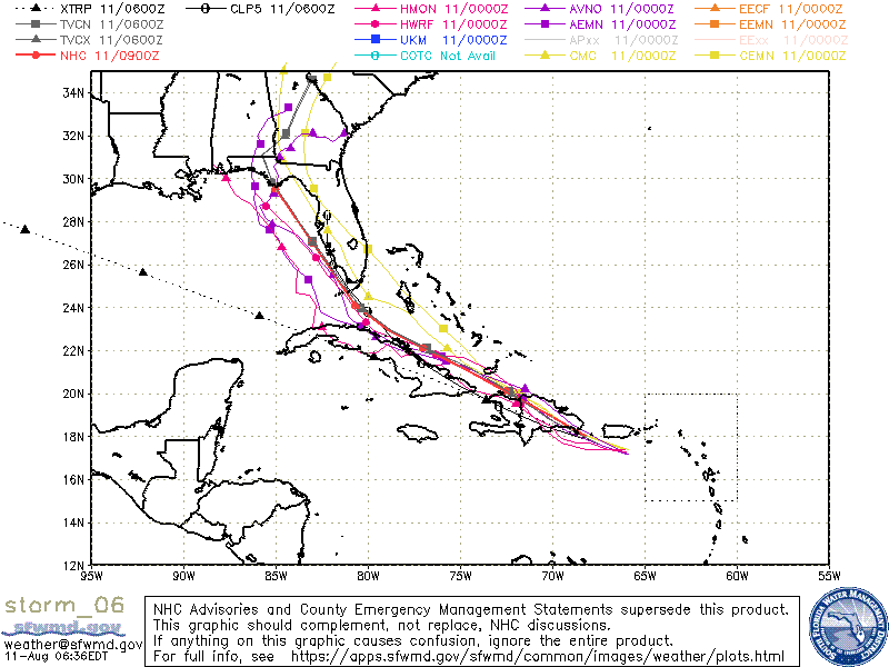
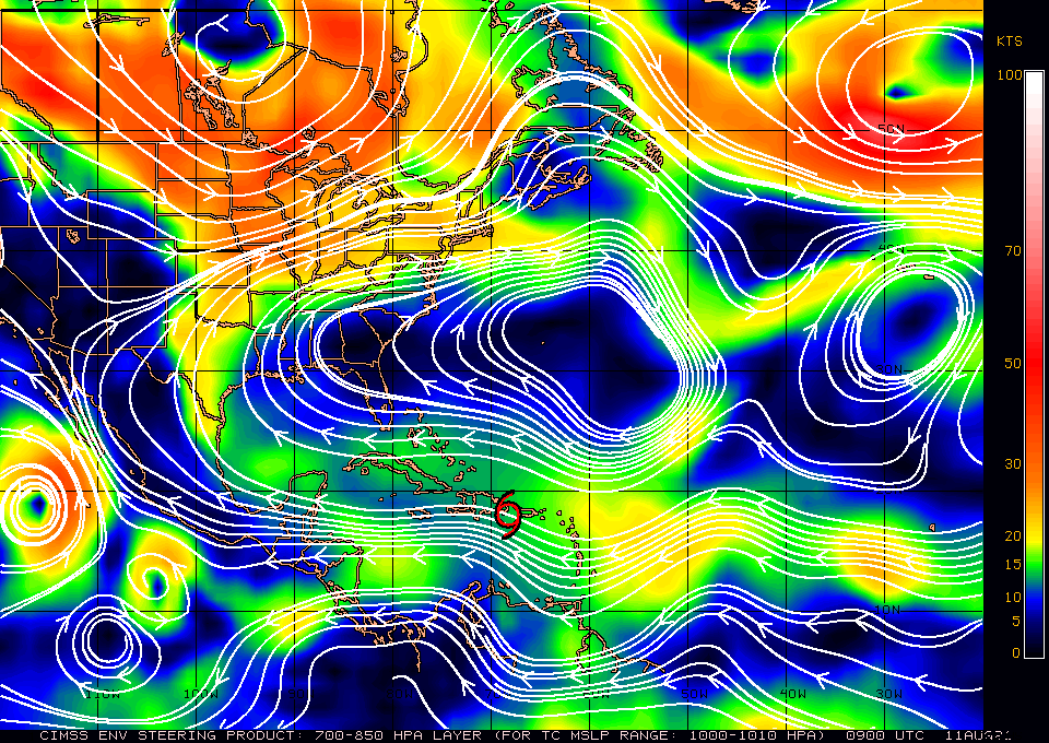
Yesterday evening a closed circulation center was found by Hurricane Hunters and TS Fred was officially named. Fred is currently just off the SE coast of Hispaniola as a minimal tropical storm. Of particular note is that Fred is a very small storm with storm force winds extending only 40 miles to the NE and NW of the center. Fred should be crossing Hispaniola today and its mountainous terrain. Of note small storms are particularly vulnerable to land and wind shear interactions. If you look at the Wind Shear Analysis below you will see that once Fred crosses Hispaniola and approaches Cuba it will be entering a high shear environment (everything in red). There is a distinct possibility that Fred will significantly weaken or even dissipate when in the region of Cuba. Even if it survives it is unlikely to more than a minimal tropical storm when at its closest approach to South Florida. After it enters the Gulf of Mexico shear will lessen and intensification may then be possible.
On the present NHC track it would pass over 100 miles to the SW of Southeast Florida at its closest approach. At that time the tropical storm wind field is expected to only extend 50-60 miles to the NE. Storm conditions are currently NOT anticipated for mainland SE FL. My current track is 20-30 miles west of theirs. If it proceeds on the NHC track mainland SE Florida would be expected to have winds in the 20s and maybe some showers Friday night and Saturday. Too early say right now.
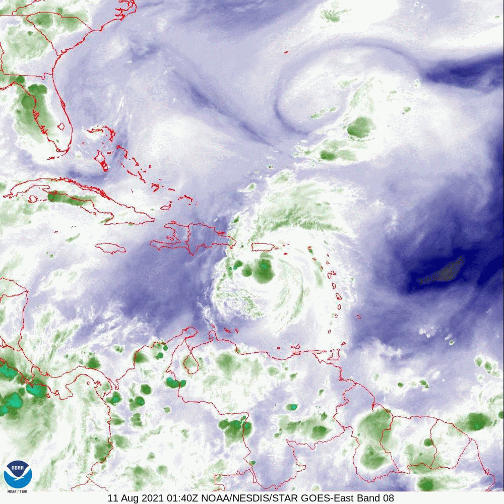
If you look at the water vapor loop below you will notice that the upper level low south of Bermuda appears to have stalled (and will likely not have any influence on Fred) and the upper level low that was over Andros Island yesterday is now just off the SE coast of FL and is slowly moving westward. Just where it is on Friday could have a significant affect on Fred, we'll have to see.
Until next time,
Matt.
Yesterday evening a closed circulation center was found by Hurricane Hunters and TS Fred was officially named. Fred is currently just off the SE coast of Hispaniola as a minimal tropical storm. Of particular note is that Fred is a very small storm with storm force winds extending only 40 miles to the NE and NW of the center. Fred should be crossing Hispaniola today and its mountainous terrain. Of note small storms are particularly vulnerable to land and wind shear interactions. If you look at the Wind Shear Analysis below you will see that once Fred crosses Hispaniola and approaches Cuba it will be entering a high shear environment (everything in red). There is a distinct possibility that Fred will significantly weaken or even dissipate when in the region of Cuba. Even if it survives it is unlikely to more than a minimal tropical storm when at its closest approach to South Florida. After it enters the Gulf of Mexico shear will lessen and intensification may then be possible.
On the present NHC track it would pass over 100 miles to the SW of Southeast Florida at its closest approach. At that time the tropical storm wind field is expected to only extend 50-60 miles to the NE. Storm conditions are currently NOT anticipated for mainland SE FL. My current track is 20-30 miles west of theirs. If it proceeds on the NHC track mainland SE Florida would be expected to have winds in the 20s and maybe some showers Friday night and Saturday. Too early say right now.
If you look at the water vapor loop below you will notice that the upper level low south of Bermuda appears to have stalled (and will likely not have any influence on Fred) and the upper level low that was over Andros Island yesterday is now just off the SE coast of FL and is slowly moving westward. Just where it is on Friday could have a significant affect on Fred, we'll have to see.
Until next time,
Matt.