Good morning.
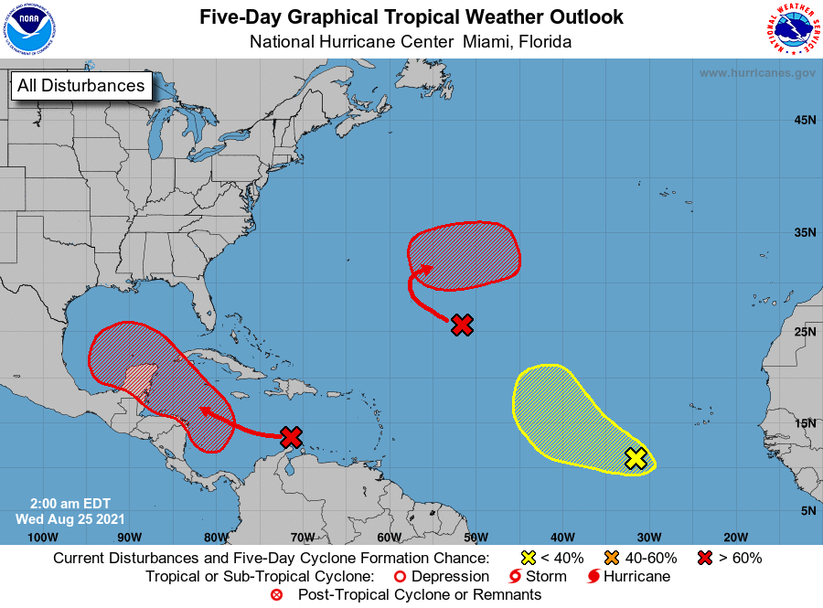
I'm writing today about a few systems out there but would like to start by saying that none are currently forecast to affect the US. Texas will need to keep an eye on the one in the Caribbean however it is currently expected to turn west into Mexico.
I just would like to point out a few things. First if you look at the SAL Analysis below you can see that dry Saharan air and dust are still being pumped SW deep into the Tropical Atlantic. This is good and has led to relatively little activity so far in July and August of this year. You can also see the dust currently over South Florida, and some larger gaps in it are starting to form. This has been due to erosion of the dust by the various weather systems in the Atlantic, you can actually see the effects of each of them.
Next if you look at the IR of Africa below you can see a weather system over central Africa centered around 10 degrees latitude. This will become the next system for us to watch. It should come off the African coast in around 4 days and is around 14 days away from potentially affecting the US. Hopefully it will move out to sea, however it may be coming off the coast in the "sweet spot" (between 10 and 12 degrees) and climatologically at a time of high risk for development.
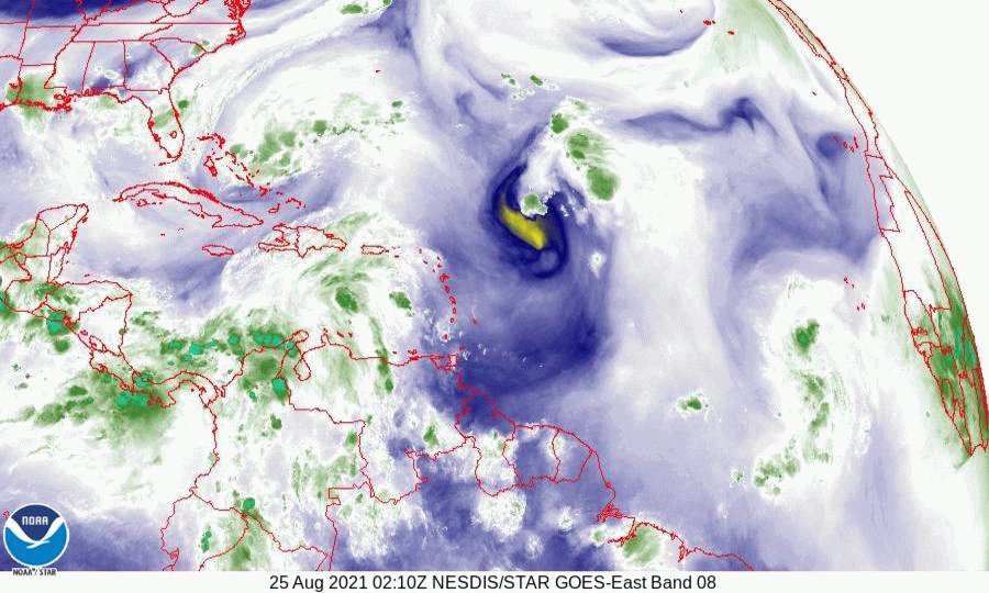
Next if you look at the water vapor loop, last image, you can see an upper level low over the Bahamas moving west towards South Florida. This will lead increased rain chances across South Florida for the next several days.
So far so good.
Until next time,
Matt.
I'm writing today about a few systems out there but would like to start by saying that none are currently forecast to affect the US. Texas will need to keep an eye on the one in the Caribbean however it is currently expected to turn west into Mexico.
I just would like to point out a few things. First if you look at the SAL Analysis below you can see that dry Saharan air and dust are still being pumped SW deep into the Tropical Atlantic. This is good and has led to relatively little activity so far in July and August of this year. You can also see the dust currently over South Florida, and some larger gaps in it are starting to form. This has been due to erosion of the dust by the various weather systems in the Atlantic, you can actually see the effects of each of them.
Next if you look at the IR of Africa below you can see a weather system over central Africa centered around 10 degrees latitude. This will become the next system for us to watch. It should come off the African coast in around 4 days and is around 14 days away from potentially affecting the US. Hopefully it will move out to sea, however it may be coming off the coast in the "sweet spot" (between 10 and 12 degrees) and climatologically at a time of high risk for development.
Next if you look at the water vapor loop, last image, you can see an upper level low over the Bahamas moving west towards South Florida. This will lead increased rain chances across South Florida for the next several days.
So far so good.
Until next time,
Matt.