Good morning.
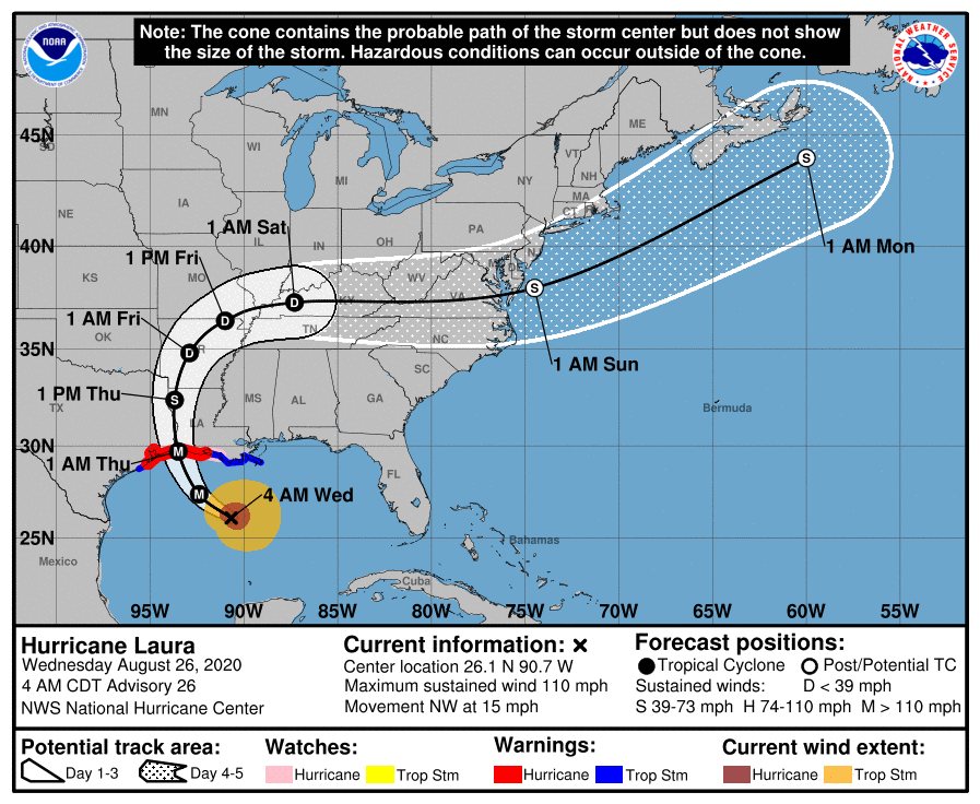
Hurricane Laura is currently spinning in the central Gulf of Mexico. The NHC is currently forecasting it to become a 130 mph Cat 4 hurricane later today and to make land fall as a 120 mph Cat 3 at around 1 am tonight. The NHC has not changed its track, nor have I. My forecast from yesterday still holds. The upper level low which I talked about yesterday is now south of Cuba, and contributing to its NW motion.
Galveston is currently under a mandatory evacuation. If you'd like to read an amazing story about the deadliest hurricane in US history, read "Isaac's Storm", a true story about the meteorologist in Galveston in 1900, who forecast the coming hurricane with only rudimentary information at the time and his description of the devastation that followed that 150 mph hurricane. Storms were not named at that time, it is known as the Great Galveston Hurricane of 1900. It came ashore on September 8th, 1900.
Until next time,
Matt.