Good morning.
There have been a few significant changes since yesterday.
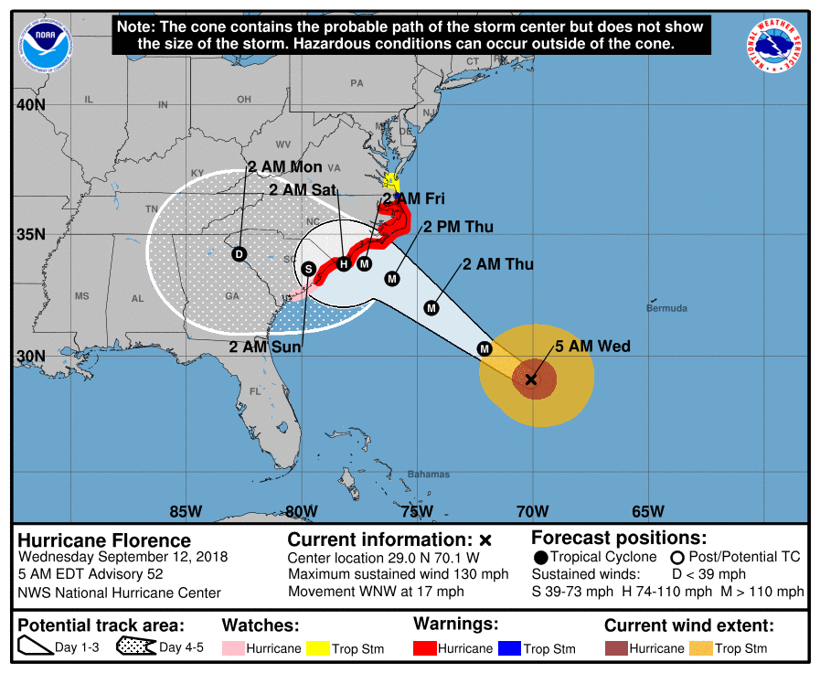
First with regards to Florence the NHC and most of the models are now in agreement that Florence will stall off the central coast of North Carolina Thursday night and Friday. This will lead to a few things. Most important will be how far off shore it stalls. It will certainly enhance rainfall totals and if close to shore prolong the wind and surge event. It will also cause it to weaken. Both due to increasing shear as it approaches the coast but also due to upwelling of colder water under the eye when it moves too slowly.
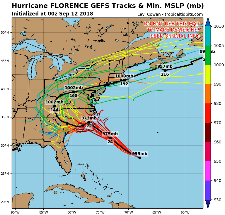
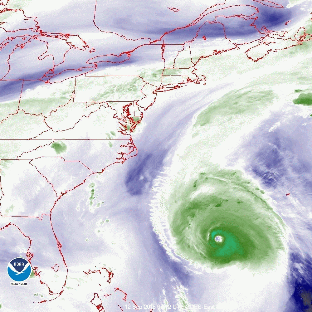
After it stalls its forecast will become very difficult. In general once a tropical cyclone stalls its course inherently becomes very hard to predict. Of note is that the small upper level low that was between the NC coast and Florence yesterday has moved SW. You can see it on the satellite water vapor loop below just off the coast of Georgia. Its not very large or strong however once it is stalled it may be one of the few things to influence it. If you look at the flow along the SC coast it is towards the SW. This is may be why the models are now trending to the SW after it stalls. The NHC is currently calling for a landfall near the NC/SC border as a Cat 2 storm, however the track is likely to continue to change. If the upper level low persists and doesn't move out of the area I would not be surprised by a track further south.
Time will tell.
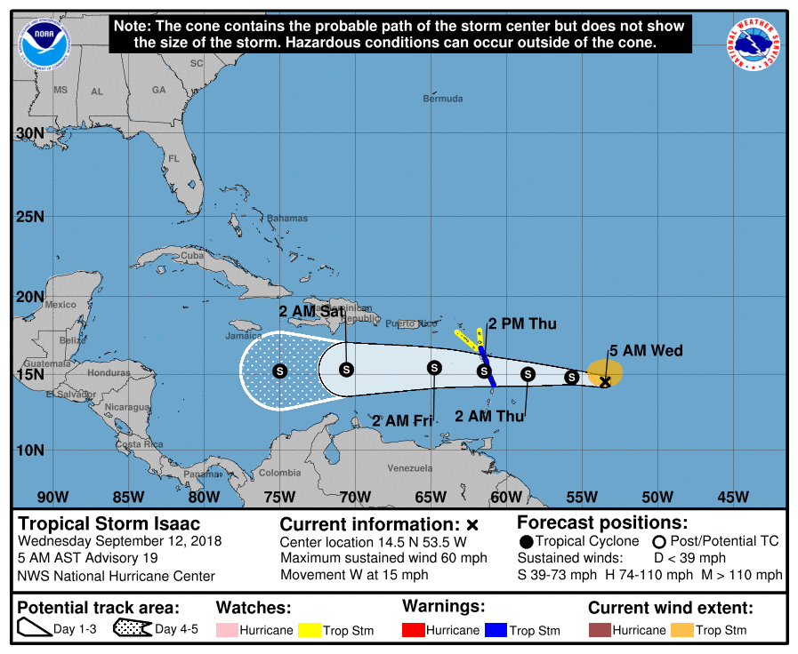
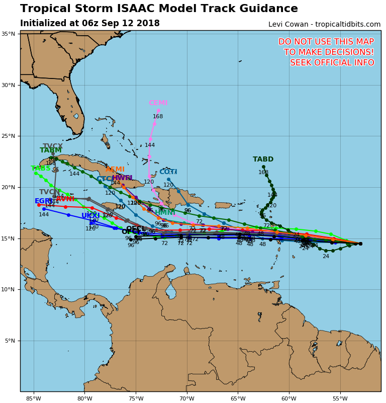
Second with regards to Isaac note that the models have shifted northward and are no longer pointing at Central America. Fortunately as previously discussed it has weakened due to shear and the projections are for it to remain a tropical storm in the Caribbean however once it leaves the Caribbean things may change.
We're just going to have to wait on that one too. Currently it does not appear to pose a significant threat to South Florida but as I stated earlier, until it is north of us we'll have to continue to keep an eye on it.
I'll probably write next tomorrow afternoon.
Until next time, Matt.
PS. As a general rule the worst part of a major hurricane is the eye wall. It is where the strongest winds and surge occur. The eye wall usually is around 5 miles thick. Florence's eye is currently 20 miles wide therefore the swath of ocean below it that is experiencing major hurricane conditions is around 30 miles wide. I usually add 5-10 miles to account for the wobbling motion of the storms, thus conservatively 40 miles wide. Outside of the eye wall one usually does not experience sustained winds over Cat 1, though it can vary with the size and intensity of the storm. Therefore unless the center of the eye were to pass within 20 miles of you (at its current eye size) you would not likely experience major hurricane conditions. Note the eye could expand significantly after it stalls, ie. pay close attention to the size of the eye.
There have been a few significant changes since yesterday.
First with regards to Florence the NHC and most of the models are now in agreement that Florence will stall off the central coast of North Carolina Thursday night and Friday. This will lead to a few things. Most important will be how far off shore it stalls. It will certainly enhance rainfall totals and if close to shore prolong the wind and surge event. It will also cause it to weaken. Both due to increasing shear as it approaches the coast but also due to upwelling of colder water under the eye when it moves too slowly.
After it stalls its forecast will become very difficult. In general once a tropical cyclone stalls its course inherently becomes very hard to predict. Of note is that the small upper level low that was between the NC coast and Florence yesterday has moved SW. You can see it on the satellite water vapor loop below just off the coast of Georgia. Its not very large or strong however once it is stalled it may be one of the few things to influence it. If you look at the flow along the SC coast it is towards the SW. This is may be why the models are now trending to the SW after it stalls. The NHC is currently calling for a landfall near the NC/SC border as a Cat 2 storm, however the track is likely to continue to change. If the upper level low persists and doesn't move out of the area I would not be surprised by a track further south.
Time will tell.
Second with regards to Isaac note that the models have shifted northward and are no longer pointing at Central America. Fortunately as previously discussed it has weakened due to shear and the projections are for it to remain a tropical storm in the Caribbean however once it leaves the Caribbean things may change.
We're just going to have to wait on that one too. Currently it does not appear to pose a significant threat to South Florida but as I stated earlier, until it is north of us we'll have to continue to keep an eye on it.
I'll probably write next tomorrow afternoon.
Until next time, Matt.
PS. As a general rule the worst part of a major hurricane is the eye wall. It is where the strongest winds and surge occur. The eye wall usually is around 5 miles thick. Florence's eye is currently 20 miles wide therefore the swath of ocean below it that is experiencing major hurricane conditions is around 30 miles wide. I usually add 5-10 miles to account for the wobbling motion of the storms, thus conservatively 40 miles wide. Outside of the eye wall one usually does not experience sustained winds over Cat 1, though it can vary with the size and intensity of the storm. Therefore unless the center of the eye were to pass within 20 miles of you (at its current eye size) you would not likely experience major hurricane conditions. Note the eye could expand significantly after it stalls, ie. pay close attention to the size of the eye.
 |  |
 |  |