Good morning.
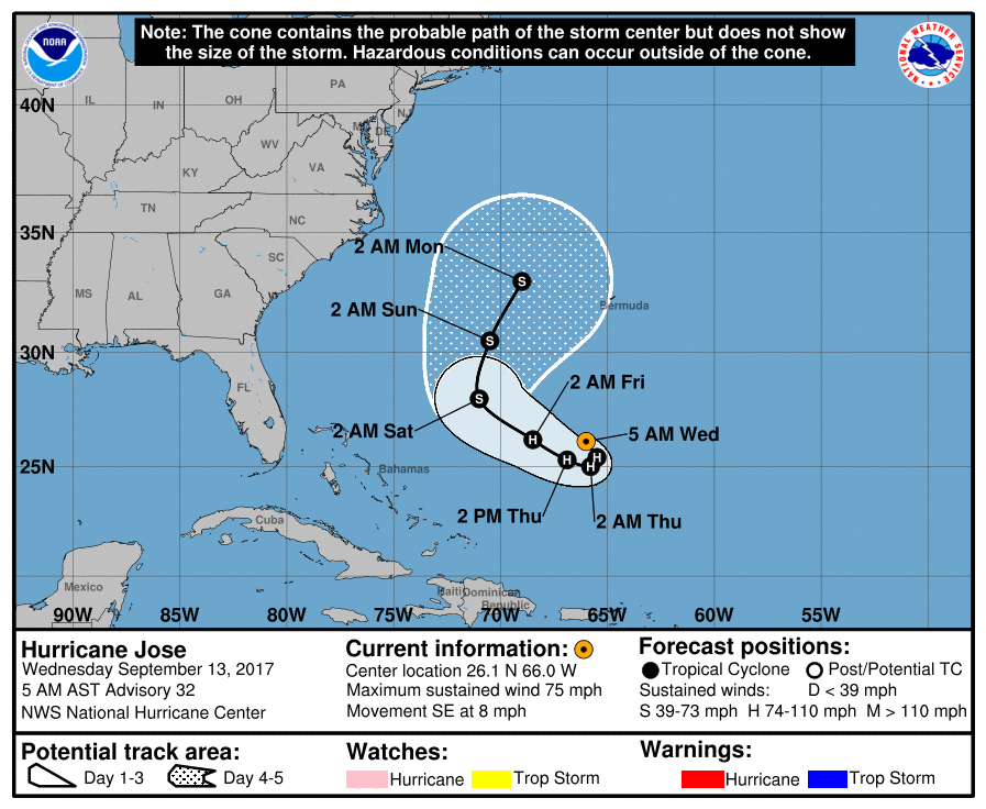
At 5 am Hurricane Jose was located at 26.1 N and 66.0 W and was moving SE @ 8 mph. Jose has weakened and should make a small loop and then turn NE out to sea. It remains primarily a threat to Bermuda however it will probably miss them as well. Unless things change I do not anticipate the need to write further about him.
Elsewhere there is not much else out there, fortunately !
Irma has caused extensive damage across the entire state of Florida with the worst damage in the Florida Keys. It will take a very long time for them to recover. I wish our friends on Big Pine Key my best.
Until the next time, Matt.
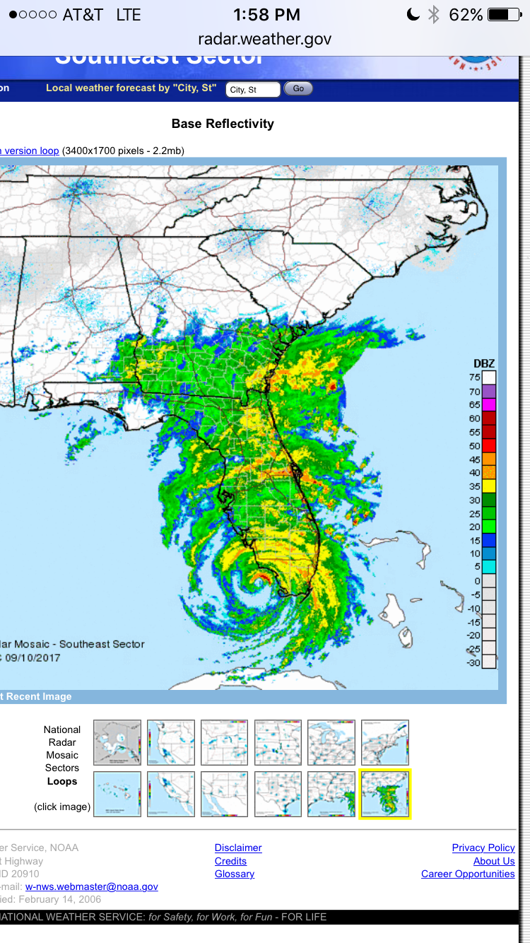
Above is SE US radar of Irma just prior to second Florida landfall on Marco Island / Naples.