Good morning.
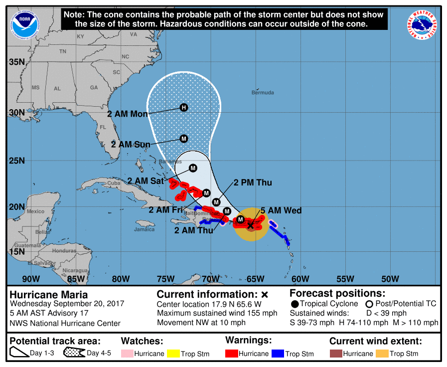
At 7 am Hurricane Maria was located over the extreme SE coast of Puerto Rico. At 11 pm Maria was moving NW towards the extreme eastern tip of Puerto Rico with a 5 nm wide eye and its eye wall was about 25 miles wide and peak winds were 175 mph. On that trajectory it would have just brushed the extreme eastern portion of Puerto Rico. However, at around 2-3 am it underwent an eye wall replacement cycle with expansion of the eye to 30 miles wide associated with weakening of peak winds to 155 mph. At around 4-5 am it took a decided westward wobble (see Satellite Loop below) which brought it to just offshore of the SE coast of Puerto Rico. The subsequent expanded eyewall now spans approximately 50 miles and Puerto Rico is currently receiving a direct hit. Due to land interactions it is weakening and peak winds are probably around 140 mph currently. This will be a major hurricane for a large portion of Puerto Rico. Hopefully its mountainous terrain will defect the worst of its winds over a lot of structures however the damage will be extensive.
The NHC's and my track once north of Puerto Rico have not changed and it should pass well to the east of Florida. The remnants of Lee may regenerate however they do not pose a threat to land at this time.
The bottom radar image is of Puerto Rico at 06:20 EDT just before Puerto Rican radar went out. Maria appeared to be undergoing another eye wall replacement cycle with shrinkage of her eye, however with crossing land it will probably re-expand to 30 miles soon.
Wishing my best for our friends in Puerto Rico,
Matt.