Good morning.
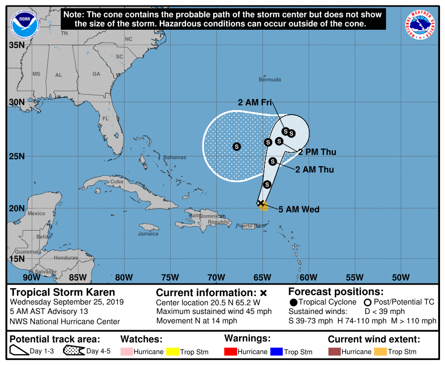
With regards to TS Karen not much has changed overall. The NHC is forecasting it to stall on Friday and then meander for a few days while a ridge builds to its east and north. The models are still all over the place and the confidence in ANY track right now is very low. Of the approximately 50 models in the diagram below very few approach Florida. We currently have dry air and high pressure over Florida which is protecting the state. The variable of time with it stalling will be the wild card. It's just way too early to make a prediction however we are approaching October and frontal systems will be marching across the country and in all likelihood, if it meanders long enough, one will pick it up and whisk it off to the NE out to sea. It's just going to be a matter of timing.
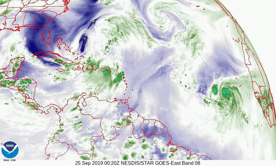
Below you will see the Surface Map which shows where Karen and Jerry are heading. If you look at the Water Vapor Loop, bottom diagram you will notice an upper level low just north of the SE Bahamas. This could become a significant factor in a few days. If it stays between Karen and South- Central Florida it could protect parts or all of the state.
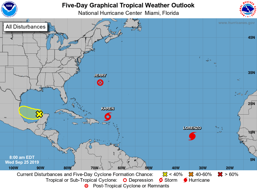
Jerry and Lorenzo are both moving out to sea. A wave over the Yucatan Peninsula will move into the Bay of Campeche and will be moving into Central Mexico in a few days.
Until next time,
Matt.
With regards to TS Karen not much has changed overall. The NHC is forecasting it to stall on Friday and then meander for a few days while a ridge builds to its east and north. The models are still all over the place and the confidence in ANY track right now is very low. Of the approximately 50 models in the diagram below very few approach Florida. We currently have dry air and high pressure over Florida which is protecting the state. The variable of time with it stalling will be the wild card. It's just way too early to make a prediction however we are approaching October and frontal systems will be marching across the country and in all likelihood, if it meanders long enough, one will pick it up and whisk it off to the NE out to sea. It's just going to be a matter of timing.
Below you will see the Surface Map which shows where Karen and Jerry are heading. If you look at the Water Vapor Loop, bottom diagram you will notice an upper level low just north of the SE Bahamas. This could become a significant factor in a few days. If it stays between Karen and South- Central Florida it could protect parts or all of the state.
Jerry and Lorenzo are both moving out to sea. A wave over the Yucatan Peninsula will move into the Bay of Campeche and will be moving into Central Mexico in a few days.
Until next time,
Matt.