Good morning.
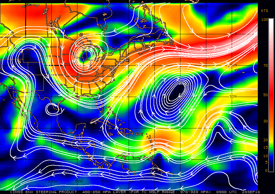
Since Monday a few things have changed with Invest 97L. Most significantly it has moved about 3 degrees north and is currently centered around 12 degrees N latitude. This is probably good new for us in South Florida. The NHC expects it to become a Tropical Depression or Tropical Storm Matthew later today. It is presently about 150 miles east of Barbados and should enter the Caribbean Sea later today. If you look at the water vapor loops of the Western Atlantic this morning, http://www.ssd.noaa.gov/goes/east/tatl/flash-wv.html , you will notice several features. First an upper level low north of Hispaniola, an upper level low in the central Atlantic moving SW, A trough just to our east starting from a small upper level low south of Cuba and a frontal boundary pushing SE across the lower SE US. The southern extension of the trough to our east to south of Cuba along with the more northern position of Invest 97L makes a move to our N and east more likely. It is currently moving W to WNW at 15-20 mph and is building a dome of high pressure over it which is mitigating the affects of significant shear to its north and west. It should move around the periphery of high pressure centered just east of Bermuda (see below) and hopefully pass far enough east of us for us to avoid significant weather.
Due to the complexity of the weather around it, it is still too early to write it off though things look encouraging this am.
I will be writing more as things develop and will post some of the latest computer models later this am after they become available.
Until later, Matt.
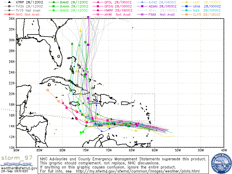
Above are the latest models from 8 this am, note some still bring the system S and west of South Florida. We'll need to keep a close eye on it. The key will be how far west it is when the NW to N turn starts to occur. This should be Friday night or Saturday depending on forward speed.

