Good morning.
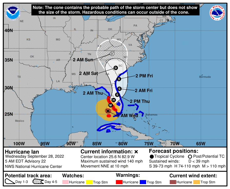
Early this morning Ian has taken a decided western wobble and effectively has moved almost due north overnight. The net effect of this is that it is unlikely to hit Ft Myers. Western wobbles are usually followed by eastern wobbles. The NHC's track has not changed. Ian should make landfall this evening along the Florida West Coast. The area between Venice and Sarasota currently appear to be at greatest risk due to this wobble.
If you look at the NHC track below you will see the size of the storm force and hurricane force wind fields. The eye is currently around 20 miles wide and should remain about that size thru landfall. The center would need to pass within 15 miles of you to receive eye wall, the eye wall is where the major hurricane force winds are.
I'll write again this evening as it approaches the coast.
Best wishes to everyone along the West Coast who may be affected by this storm. Please look in the Weather Trivia section of this website and read "What to do during a hurricane".
Be safe.
Until next time,
Matt.